
Ballydargan
This article relies largely or entirely on a single source. (April 2007) |
Ballydargan
| |
|---|---|
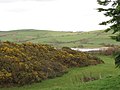
 Ballydargan Hill from the Glen Road | |
 Location within County Down | |
| County | |
| Country | Northern Ireland |
| Sovereign state | United Kingdom |
Ballydargan is a townland eight kilometres south of Downpatrick, County Down, Northern Ireland.[1] Ballydargan is in the parish of Bright.
The townland's name is recorded as Balidergan as early as 1194 and appears as Balydergan in 1333.[2] The given name Deargán, meaning 'little red (-haired) one', forms the basis of the surname Ó Deargáin, which Woulfe (1923, 495) describes as an old surname found in Westmeath, Offaly, and Cork, and can be anglicized to Dargan, Dergan, Dorgan, and Dorrigan. It is possible that the final element of Ballydargan is derived from the surname Ó Deargáin, though this surname is relatively uncommon in northern Ireland, making this less likely. Historically, the townland was divided into Upper and Lower sections.
Gallery
[edit]-
 Ballydargan Lake from the Ballylucas Road (2012)
 -
 The Ballydargan Lake partly hidden by the Haar (2011)
 -
 Glen Road climbing towards the summit ridge of Ballydargan Hill (2012)
 -
 Bogland in the Ballydargan River valley (2012)
 -
 Farm track leading down to the Ballydargan Valley (2012)


See also
[edit]- List of townlands in County Down
- Zoom in to Ballydargan on map at PlacenamesNI.org[3]
- Ballylucas to the west
- Ballynagallagh to the south
- Ballynewport to the west
- Carrowbane to the east
- Legamaddy to the north
- Rathmullan Lower to the south
- Rathmullan Upper to the west
- Whigamstown to the east
References
[edit]- ^ "Ballydargan Townland, Co. Down". townlands.ie. Retrieved 16 August 2023.
- ^ Orpen, Goddard H. (1914). "The Earldom of Ulster. Part III. Inquisitions Touching Down and Newtownards (Continued)". The Journal of the Royal Society of Antiquaries of Ireland. Sixth Series, Vol. 4 (1): 51–66. Retrieved 20 March 2025.
- ^ "PlacenamesNI.org - Ballydargan, County Down (Northern Ireland Place-Name Project, Tionscadal Logainmneacha, Thuaisceart Eirann)". ArcGIS Experience. Retrieved 21 March 2025.
- ^ "Down civil parishes (map of Bright townlands)". John Grenham. John Grenham. Retrieved 17 March 2025.

This article related to the geography of County Down, Northern Ireland is a stub. You can help Wikipedia by expanding it. |