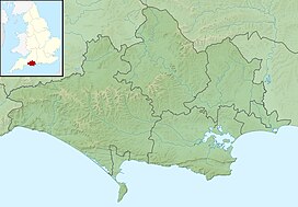
Ball Hill, Dorset
| Ball Hill | |
|---|---|
 | |
| Highest point | |
| Elevation | 251 m (823 ft)[1] |
| Prominence | 74 m (243 ft)[1] |
| Parent peak | Lewesdon Hill[1] |
| Listing | Hills of Dorset |
| Coordinates | 50°49′48″N 2°23′49″W / 50.830°N 2.397°W |
| Geography | |
Dorset, England | |
| Parent range | Dorset Downs |
| OS grid | ST721034 |
| Topo map | OS Landranger 194 |
At 251 metres, Ball Hill is one of the highest hills in the county of Dorset, England, and is on the Wessex Ridgeway.
Location
[edit]The summit of Ball Hill lies at the eastern end of a short ridge running from east to west. Its lower, western end is known as Church Hill. To the south a short spur drops steeply to the hamlet of Plush in Watcombe Bottom. To the north the land descends more gradually to the vale of Lydden. The hill is about 4 kilometres southeast of Buckland Newton, 6 kilometres west-northwest of Cerne Abbas and 9 kilometres west of Milton Abbas. Other prominent hills in the vicinity include Lyscombe Hill (261 m) to the southeast on the other side of the hamlet of Folly.[2]
History
[edit]There is evidence of prehistoric settlement on almost every hill in the vicinity, with a hill fort on Nettlecombe Tout (a spur of Lyscombe Hill) to the east, cross dykes and tumuli on the flanks of Lyscombe Hill to the southeast and a tumulus and field system on Church Hill to the west.[2]
References
[edit]- ^ a b c Summit Listings by Relative Height by Jonathan de Ferranti. Accessed on 27 Mar 2013.
- ^ a b Ordnance Survey 1:50,000 Landranger series, no. 194


