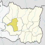
Bahunidanda
Appearance
Bahunidanda
बाहुनीडाँडा | |
|---|---|
| Coordinates: 27°10′N 86°28′E / 27.16°N 86.46°E | |
| Country | |
| Province | Pradesh Ek |
| District | Khotang District |
| Municipal area | Halesi Tuwachung |
| Ward | Ward No. 1 |
| Population (1991) | |
• Total | 2,365 |
| Time zone | UTC+5:45 (Nepal Time) |
Bahunidanda is a town (previously a village development committee) in Halesi Tuwachung municipal area in Khotang District of Province No. 1 of eastern Nepal. At the time of the 1991 Nepal census it had a population of 2,365 persons living in 401 individual households.[1]
Bahunidanda was incorporated with Halesi Tuwachung in 2017 when the government of Nepal decided to restructure to the old local level body.[2]
References
[edit]- ^ "Nepal Census 2001". Nepal's Village Development Committees. Digital Himalaya. Archived from the original on 12 October 2008. Retrieved 30 September 2008.
- ^ "New local level units come into existence". www.kathmandupost.ekantipur.com. 11 March 2017. Retrieved 18 July 2018.
External links
[edit]


