Baguia Administrative Post
Appearance
(Redirected from Baguia)
You can help expand this article with text translated from the corresponding article in German. (July 2010) Click [show] for important translation instructions.
|
Baguia | |
|---|---|
| |
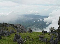
 Landscape in Matebian | |
 Official map | |
| Coordinates: 8°38′S 126°40′E / 8.633°S 126.667°E | |
| Country | |
| Municipality | Baucau |
| Seat | Alawa Leten |
| Sucos | |
| Area | |
• Total | 212.2 km2 (81.9 sq mi) |
| Population (2015 census) | |
• Total | 12,962 |
| • Density | 61/km2 (160/sq mi) |
| Households (2015 census) | |
| • Total | 2,642 |
| Time zone | UTC+09:00 (TLT) |
Baguia, officially Baguia Administrative Post (Portuguese: Posto Administrativo de Baguia, Tetum: Postu administrativu Bagia), is an administrative post (and was formerly a subdistrict) in Baucau municipality, East Timor.[1][2] Its seat or administrative centre is Alawa Leten,[2] and it has ten sucos.
Taur Matan Ruak, president of East Timor between 2012 and 2017, was born in Suco Osso Huna, Baguia Administrative Post, in 1956.
Sucos
[edit]- Afaloicai
- Alawa Craik (Alaua-Craik, Alaua Craic)
- Alawa Leten (Alaua-Leten)
- Defawasi (Defawase, Defa-Uasse)
- Hae Coni (Hae-Coni, Haeconi)
- Larisula (Lari Sula)
- Lavateri
- Osso Huna (Osso-Huna)
- Samalari
- Uacala
See also
[edit]References
[edit]- ^ "Subdistricts of Timor-Leste". www.statoids.com. 4 May 2010. Retrieved 21 September 2022.
- ^ a b "Diploma Ministerial n.o 24/2014 de 24 de Julho Orgânica dos Postos Administrativos Preâmbulo" [Ministerial Diploma No. 24/2014 of 24 July Organic of Administrative Posts Preamble]. Jornal da República (in Portuguese). Government of East Timor. 24 July 2014. Archived from the original on 4 March 2016. Retrieved 21 September 2022.
External links
[edit]![]() Media related to Baguia Administrative Post at Wikimedia Commons
Media related to Baguia Administrative Post at Wikimedia Commons
- Baguia Administrative Post – information page on Ministry of State Administration site (in Portuguese)
- Joanna Barrkman (2021). "Digital return of an ethnographic museum collection and value creation by an originating community in Baguia, Timor-Leste". In Howard Morphy; Robyn McKenzie (eds.). Museums, Societies and the Creation of Value. Routledge. doi:10.4324/9781003139324-14. ISBN 9781000515541.

