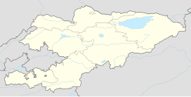
Arpa Valley
| Arpa Valley | |
|---|---|
| Floor elevation | 2,600–3,600 m (8,500–11,800 ft) |
| Length | 60 km (37 mi) NW-SE |
| Width | 32 km (20 mi) SW-NE |
| Geography | |
| Coordinates | 40°42′N 74°52′E / 40.70°N 74.87°E |
| Rivers | Arpa |
The Arpa Valley (Kyrgyz: Арпа өрөөнү) is a high-altitude valley in the southwestern part of the inner Tien Shan. It is bordered by the Fergana Range to the southwest, the Torugart Range to the south, the At-Bashy Range to the east, Ortok Too to the northeast, and Jaman-Too to the north. The valley is approximately 60 km (37 mi) long and up to 32 km (20 mi) wide at its broadest point.[1]
The valley is drained by the Arpa River, a tributary of the Ala-Buga.[2] Its elevation ranges between 2,600 m (8,500 ft) and 3,600 m (11,800 ft) above sea level.
The highway of international significance, ЭМ-11, as designated by the national road classification,[3] connects Bishkek, Torugart, and the Kyrgyzstan-China border. The road passes through the eastern part of the Arpa Valley and is part of the European route E125 and Asian Highway 61 network in Kyrgyzstan.
"From the top of the Sur-tash pass, on the Ferghana range, a most instructive view was obtained over the plateau world to the east. Below was the Arpa "Pamir," a broad, undulating, grassy valley, with the Arpa river flowing through its centre. The Jaman Davan range, which borders the Arpa plateau on the north-east, on the north closes in and joins with the Ferghana range, thus enclosing the plateau. The Arpa river cuts through this range by a deep-cut gorge, the course of which is still dotted on the map, by an imaginary line."[4]
Footnotes
[edit]- ^ "Арпа өрөөнү" [Arpa Valley] (PDF). Кыргызстандын Географиясы (Geography of Kyrgyzstan) (in Kyrgyz). Bishkek: Кыргызстан. 2004. pp. 94–95.
- ^ "Арпа" [Arpa] (PDF). Кыргызстандын Географиясы (Geography of Kyrgyzstan) (in Kyrgyz). Bishkek: Кыргызстан. 2004. p. 182.
- ^ Order of classification and numeration of public roads in the Kyrgyz Republic [Кыргыз Республикасынын аймагында жалпы пайдалануудагы автомобиль жолдорун классификациялоо жана номерлештирүү Тартиби] (Decree of the Government of the Kyrgyz Republic 512) (in Kyrgyz). 18 August 2017.
- ^ Carruthers (1910), p. 565.
References
[edit]- Douglas Carruthers "Notes on the Journey to the Arpa and Ak-Sai Plateaus in Russian Turkestan." The Geographical Journal, Vol. 36, No. 5 (Nov., 1910), pp. 563-570.

