Arorangi
Appearance

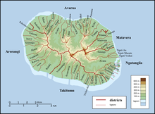
Arorangi is one of the five districts that make up the island of Rarotonga in the Cook Islands.[1] It is located in the west of the island, to the northwest of the district of Titikaveka, and southwest of the district of Avarua.
References
[edit]- ^ "Official Map of Rarotonga". Cook Islands Ministry of Justice. Retrieved 10 August 2020.
21°13′17″S 159°49′37″W / 21.221381°S 159.82687°W
