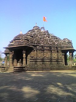
Ambarnath
Appearance
This article needs additional citations for verification. (July 2021) |
Ambernath | |
|---|---|
 | |
Location of Ambernath in Maharashtra, India | |
| Coordinates: 19°12′32″N 73°11′10″E / 19.209°N 73.186°E | |
| Country | India |
| State | Maharashtra |
| District | Thane |
| Region | Mumbai |
| Named for | God of sky |
| Government | |
| • Type | Municipal Council |
| • Body | Ambernath Municipal Council |
| • President | Manisha Walekar (National Democratic Alliance) |
| Area | |
• Total | 38 km2 (15 sq mi) |
| Elevation | 35 m (115 ft) |
| Population (2011) | |
• Total | 253,475 |
• Estimate (2024) | 358,000 |
| • Rank | 29th (as of 2011) |
| • Density | 6,700/km2 (17,000/sq mi) |
| Time zone | UTC+5:30 (IST) |
| PIN | 421501, 421502, 421505, 421506. |
| Telephone code | 0251 |
| Vehicle registration | MH-05 |
| Lok Sabha constituency | Kalyan |
| Member of Parliament | Shrikant Shinde (National Democratic Alliance) |
| Member of Legislative Assembly | Dr. Balaji Kinikar (National Democratic Alliance) |
| Vidhan Sabha constituency | Ambernath |
Ambernath (Marathi pronunciation: [əmbəɾnaːt̪ʰ]) is an eastern suburban city in Thane district of Maharashtra and is a part of the Mumbai Metropolitan Region.[1]
Demographics
[edit]| Year | Pop. | ±% |
|---|---|---|
| 1951 | 21,498 | — |
| 1961 | 34,509 | +60.5% |
| 1971 | 56,276 | +63.1% |
| 1981 | 96,347 | +71.2% |
| 2001 | 203,804 | +111.5% |
| 2011 | 253,475 | +24.4% |
| Source: Government of India[2] | ||
In 2011, Ambarnath had a population of 253,475, with 132,582 Males and 120,893 Females. Its population grew by 24.4% from 2001, when it had a population of 203,804. It is overwhelmingly Hindu, with about eighty percent of the population being Hindu.
Notable people
[edit]- Merwyn Fernandes, former Indian hockey player[4]
- Farukh Choudhary, Indian footballer
- Puranik Yogendra, politician.
- Kay Kay Menon, actor.
References
[edit]Wikimedia Commons has media related to Ambarnath.
- ^ "Mumbai Metropolitan Region Development Authority - Ambernath, Kulgaon-Badlapur and Surrounding Notified Area". Mmrda.maharashtra.gov.in. Retrieved 20 January 2016.
- ^ "Census Tables". censusindia.gov.in. Retrieved 6 January 2024.
- ^ "Ambarnath Population 2011". Census 2011.
- ^ "Arjuna Awards in Hockey - Sanabung Manipur". Arjuna Awards in Hockey - Sanabung Manipur. Sanabung Manipur. Retrieved 8 October 2011.

