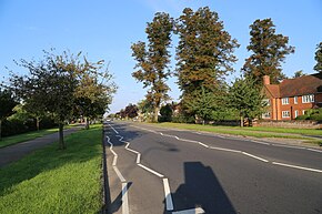
A1214 road
Appearance
| A1214 | |
|---|---|
 | |
| Route information | |
| Length | 9.4 mi (15.1 km) |
| Major junctions | |
| Southwest end | A12/A14 |
| East end | A12 |
| Location | |
| Country | United Kingdom |
| Constituent country | England |
| Primary destinations | Ipswich, Ipswich Hospital, Kesgrave, Martlesham |
| Road network | |
The A1214 is a 9.4 mile long 'A' road in the English county of Suffolk.[1] It links Central Ipswich to the A12 and A14 and passes Ipswich Hospital. Its midsection forms an outer ring road around the west and north of Ipswich.
Route
[edit]From west to east the road passes through the following settlements:
References
[edit]52°04′05″N 1°11′06″E / 52.06801°N 1.18487°E

