
File:OSCEmap 2005.png
Size of this preview: 800 × 370 pixels. Other resolutions: 320 × 148 pixels | 640 × 296 pixels | 1,357 × 628 pixels.
Original file (1,357 × 628 pixels, file size: 35 KB, MIME type: image/png)
| This is a file from the Wikimedia Commons. Information from its description page there is shown below. Commons is a freely licensed media file repository. You can help. |
Summary
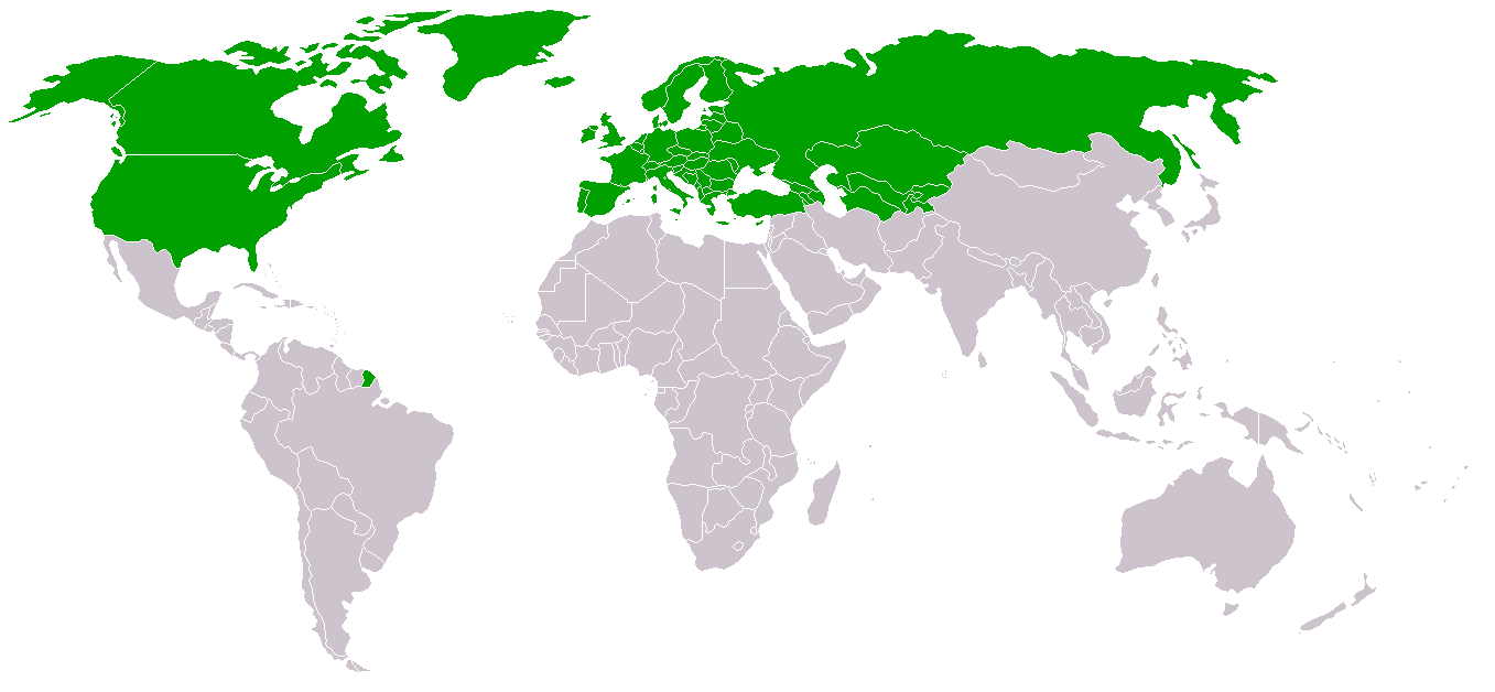
World map: w:en:Organization for Security and Co-operation in Europe (OSCE) membership (2005)
fromw:en:Image:OSCEmap_2005.png
Licensing

|
Permission is granted to copy, distribute and/or modify this document under the terms of the GNU Free Documentation License, Version 1.2 or any later version published by the Free Software Foundation; with no Invariant Sections, no Front-Cover Texts, and no Back-Cover Texts. A copy of the license is included in the section entitled GNU Free Documentation License. |
| This file is licensed under the Creative Commons Attribution-Share Alike 3.0 Unported license. | ||
| ||
| This licensing tag was added to this file as part of the GFDL licensing update. |
File history
Click on a date/time to view the file as it appeared at that time.
| Date/Time | Thumbnail | Dimensions | User | Comment | |
|---|---|---|---|---|---|
| current | 16:54, 29 December 2017 | | 1,357 × 628 (35 KB) | 42800141 | Added French Guiana |
| 20:43, 25 July 2006 |  | 1,357 × 628 (45 KB) | Kseferovic | This is an updated version of the map. Montenegro and Serbia are divided. | |
| 08:14, 4 December 2005 |  | 1,357 × 628 (27 KB) | Peka~commonswiki | World map: Organization for Security and Co-operation in Europe (OSCE) membership (2005) fromw:en:Image:OSCEmap_2005.png |
File usage
The following pages on the English Wikipedia use this file (pages on other projects are not listed):
Global file usage
The following other wikis use this file:
- Usage on an.wikipedia.org
- Usage on be.wikipedia.org
- Usage on cy.wikipedia.org
- Usage on de.wikipedia.org
- Usage on fr.wikinews.org
- Usage on id.wikipedia.org
- Usage on nn.wikipedia.org
- Usage on outreach.wikimedia.org
- Usage on pl.wikipedia.org
- Usage on pl.wikinews.org
- Usage on ro.wikipedia.org
- Usage on ru.wikipedia.org
- Usage on uk.wikipedia.org