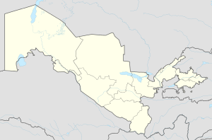
Yangiyer
40°16′N 68°49′E / 40.267°N 68.817°E
Yangiyer
Uzbek: Yangiyer | |
|---|---|
City | |
 | |
| Coordinates: 40°16′N 68°49′E / 40.267°N 68.817°E | |
| Country | |
| Region | Sirdaryo Region |
| Area | |
| • Metro | 30.0 km2 (11.6 sq mi) |
| Population (2021)[1] | |
• City | 44,200 |
| 121000 | 121001 |
Yangiyer (Uzbek: Yangiyer — new land) — is a city in Sirdaryo Region, Eastern Uzbekistan. It is a district-level city.[2] Its population is 44,200 (2021).[1]
Etymology
[edit]The name of the city is translated from Uzbek as "new land".
History
[edit]It was established in 1957 as part of the grand Soviet project to cultivate the naturally saline virgin lands of Mirzachoʻl, a vast area of about 10,000 square kilometres in Eastern Uzbekistan. The shortage of irrigation water was the main problem hindering the development of agriculture in the area.
Economy
[edit]The city has several plants including a plant of building materials, pipe plant, asphalt plant.
Yangier also has a branch of Tashkent Institute of Agriculture and Irrigation Engineering, a college of civil engineering and a museum dedicated to cultivation of virgin lands of Mirzachoʻl
Climate
[edit]Yangiyer has a cold semi-arid climate (Köppen climate classification BSk).
| Climate data for Yangiyer (1991–2020) | |||||||||||||
|---|---|---|---|---|---|---|---|---|---|---|---|---|---|
| Month | Jan | Feb | Mar | Apr | May | Jun | Jul | Aug | Sep | Oct | Nov | Dec | Year |
| Mean daily maximum °C (°F) | 6.1 (43.0) |
8.8 (47.8) |
16.0 (60.8) |
23.0 (73.4) |
29.3 (84.7) |
35.0 (95.0) |
36.4 (97.5) |
34.7 (94.5) |
29.6 (85.3) |
22.4 (72.3) |
13.8 (56.8) |
7.5 (45.5) |
21.9 (71.4) |
| Daily mean °C (°F) | 2.3 (36.1) |
4.2 (39.6) |
10.4 (50.7) |
16.5 (61.7) |
22.2 (72.0) |
27.3 (81.1) |
28.8 (83.8) |
26.8 (80.2) |
21.3 (70.3) |
14.8 (58.6) |
8.2 (46.8) |
3.6 (38.5) |
15.5 (59.9) |
| Mean daily minimum °C (°F) | −0.5 (31.1) |
0.8 (33.4) |
6.2 (43.2) |
11.3 (52.3) |
15.7 (60.3) |
19.9 (67.8) |
21.5 (70.7) |
19.3 (66.7) |
14.1 (57.4) |
8.8 (47.8) |
3.8 (38.8) |
0.6 (33.1) |
10.1 (50.2) |
| Average precipitation mm (inches) | 34.2 (1.35) |
46.2 (1.82) |
59.2 (2.33) |
60.4 (2.38) |
36.8 (1.45) |
10.2 (0.40) |
3.7 (0.15) |
2.1 (0.08) |
4.4 (0.17) |
18.1 (0.71) |
38.8 (1.53) |
37.1 (1.46) |
351.2 (13.83) |
| Average precipitation days (≥ 1.0 mm) | 9 | 10 | 11 | 10 | 8 | 4 | 2 | 1 | 2 | 5 | 8 | 10 | 80 |
| Source: NOAA[3] | |||||||||||||
References
[edit]- ^ a b "Urban and rural population by district" (PDF) (in Uzbek). Sirdaryo regional department of statistics.
- ^ "Classification system of territorial units of the Republic of Uzbekistan" (in Uzbek and Russian). The State Committee of the Republic of Uzbekistan on statistics. July 2020.
- ^ "World Meteorological Organization Climate Normals for 1991-2020 — Yangiyer". National Oceanic and Atmospheric Administration. Retrieved January 20, 2024.


