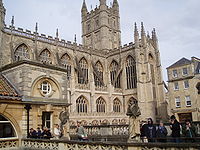
Walcot, Bath
| Walcot | |
|---|---|
 Walcot Street | |
Location within Somerset | |
| Population | 5,920 (2011; ward)[1] |
| OS grid reference | ST753659 |
| Unitary authority | |
| Ceremonial county | |
| Region | |
| Country | England |
| Sovereign state | United Kingdom |
| Post town | BATH |
| Postcode district | BA1 |
| Dialling code | 01225 |
| Police | Avon and Somerset |
| Fire | Avon |
| Ambulance | South Western |
| UK Parliament | |
Walcot is a suburb of the city of Bath, in the Bath and North East Somerset district, in the ceremonial county of Somerset, England. It lies to the north-north-east of the city centre, and is an electoral ward of the city.[2]
The Paragon and, continuing out of the city, London Road are part of the A4 road. The other main thoroughfare is Walcot Street, which adjoins the city centre and is well known for its artisan shops.[3][4]
Walcot Street and London Road are believed to be a Roman road, leading north from the Roman town of Aquae Sulis and linking with the Fosse Way. Walcot originally grew as a residential area (a vicus) in the 1st to 3rd centuries, located between the walled town, the Fosse Way and the possible Roman fort sited across the river in the Bathwick area.[5]
The parish church of St Swithin, on The Paragon was built in 1779-90 by John Palmer.[6] The 18th-century poet Christopher Anstey is buried at the church.[7][8] Walcot was the birthplace of Richard Debaufre Guyon, who would become, in succession, an Austrian officer, a Hungarian rebel and an Ottoman Pasha.[9][10]
Governance
[edit]The electoral ward returns two councillors to Bath and North East Somerset Council. The wards surrounding Walcot ward are: Lansdown to the north-west, Lambridge to the north-east, Bathwick to the south-east, and Kingsmead to the south-west. The River Avon forms the boundary with Bathwick and is crossed here by the Cleveland Bridge. The Grosvenor area of the city falls within the ward.[2]
In 1891 the civil parish had a population of 24,899.[11] On 26 March 1900 the parish was abolished to form Bath.[12]
Notable residents
[edit]- Richard Guyon (1813–1856), British-born Hungarian soldier, general in the Hungarian Revolutionary Army.
- Sir William Herschel (1738–1822), astronomer, musician.
- Benjamin Plim Bellamy (1782–1847), actor and proprietor of the Bath Assembly Rooms.[13]
- Arnold Ridley (1896-1984), actor and playwright.
- Margaret Graham (balloonist) (1804-1864) first British woman to make a solo balloon flight, which she accomplished in 1826.
References
[edit]- ^ "Ward population 2011". Retrieved 7 April 2015.
- ^ a b Bath and North East Somerset Council District Council Elections
- ^ "Artisan Quarter". Visit Bath. Retrieved 22 January 2017.
- ^ "Walcot Street Artworks" (PDF). Bath and North East Somerset Council. 2010. Retrieved 22 January 2017.
- ^ Pevsner Architectural Guides: Bath (2007) Forsyth, M
- ^ "Church of St Swithin, Walcot". Images of England. Archived from the original on 22 October 2012. Retrieved 18 January 2008.
- ^ "Christopher Anstey". Westminster Abbey. Retrieved 24 April 2015.
- ^ "Christopher Anstey: A life in 18th century Bath". Bath Royal Literary and Scientific Institution. Retrieved 24 April 2015.
- ^ "General Richard Guyon". Bath Heritage. Retrieved 24 April 2015.
- ^ "Guyon, Richard Debaufre (1813-1856), army officer". Oxford Index. Retrieved 24 April 2015.
- ^ "Population statistics Walcot AP/CP through time". A Vision of Britain through Time. Retrieved 30 March 2024.
- ^ "Relationships and changes Walcot AP/CP through time". A Vision of Britain through Time. Retrieved 30 March 2024.
- ^ "Plim Bellamy Tomb". Historic England. Historic England. Retrieved 1 October 2021.
External links
[edit]- St Swithin's Church
- Walcot Street Artworks Trail leaflet
- Explore Walcot Street
- History of Walcot Street


