Wakpala, South Dakota
Wakpala, South Dakota | |
|---|---|
| Coordinates: 45°39′34″N 100°32′08″W / 45.65944°N 100.53556°W | |
| Country | |
| State | |
| County | Corson |
| Area | |
• Total | 0.44 sq mi (1.13 km2) |
| • Land | 0.44 sq mi (1.13 km2) |
| • Water | 0.00 sq mi (0.00 km2) |
| Elevation | 1,637 ft (499 m) |
| Population | |
• Total | 267 |
| • Density | 609.59/sq mi (235.33/km2) |
| Time zone | UTC-7 (Mountain (MST)) |
| • Summer (DST) | UTC-6 (MDT) |
| ZIP code | 57658 |
| Area code | 605 |
| FIPS code | 46-68180[4] |
| GNIS feature ID | 2813013[2] |
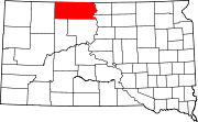
Wakpala is an unincorporated community in Corson County, South Dakota, United States, on the west side of the Missouri River, north-northwest of Mobridge. Wakpala is within the boundaries of the Standing Rock Indian Reservation, and its name loosely translates to "creek" in the Lakota language,[5] with Oak Creek running south on its eastern edge.
Chief Gall (Piji, Phizí) is buried at Saint Elizabeth Episcopal Cemetery here and Chief Sitting Bull (Tȟatȟáŋka Íyotake) is possibly buried under a concrete bust bearing his name a few miles south of town in the Mobridge area. Sitting Bull was originally buried at Fort Yates, North Dakota, but an effort was made to exhume his bones and rebury him at the present site.[citation needed]
The annual Wakpala Wacipi (dance or powwow) is held on the last weekend in August.
Demographics
[edit]| Census | Pop. | Note | %± |
|---|---|---|---|
| 2020 | 267 | — | |
| U.S. Decennial Census[6] | |||
References
[edit]- ^ "ArcGIS REST Services Directory". United States Census Bureau. Retrieved October 15, 2022.
- ^ a b U.S. Geological Survey Geographic Names Information System: Wakpala, South Dakota
- ^ "Census Population API". United States Census Bureau. Retrieved October 15, 2022.
- ^ "U.S. Census website". United States Census Bureau. Retrieved January 31, 2008.
- ^ Federal Writers' Project (1940). South Dakota place-names, v.1-3. University of South Dakota. p. 66.
- ^ "Census of Population and Housing". Census.gov. Retrieved June 4, 2016.


