Val de Fontenay station
Val de Fontenay | |||||||||||||||||||||||||||||||
|---|---|---|---|---|---|---|---|---|---|---|---|---|---|---|---|---|---|---|---|---|---|---|---|---|---|---|---|---|---|---|---|
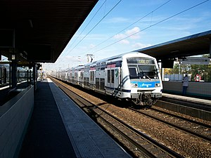
 RER E train entering station en route to Villiers-sur-Marne | |||||||||||||||||||||||||||||||
| General information | |||||||||||||||||||||||||||||||
| Location | 10 Avenue du Val de Fontenay Fontenay-sous-Bois France | ||||||||||||||||||||||||||||||
| Coordinates | 48°51′16″N 2°29′21″E / 48.85431°N 2.48914°E | ||||||||||||||||||||||||||||||
| Operated by |
| ||||||||||||||||||||||||||||||
| Line(s) | Paris-Est–Mulhouse-Ville railway | ||||||||||||||||||||||||||||||
| Platforms |
| ||||||||||||||||||||||||||||||
| Tracks |
| ||||||||||||||||||||||||||||||
| Connections | |||||||||||||||||||||||||||||||
| Construction | |||||||||||||||||||||||||||||||
| Platform levels | 2 | ||||||||||||||||||||||||||||||
| Accessible |
| ||||||||||||||||||||||||||||||
| Other information | |||||||||||||||||||||||||||||||
| Station code | 87113712 | ||||||||||||||||||||||||||||||
| Fare zone | 3 | ||||||||||||||||||||||||||||||
| History | |||||||||||||||||||||||||||||||
| Opened | 8 December 1977 | ||||||||||||||||||||||||||||||
| Passengers | |||||||||||||||||||||||||||||||
| 2019 | 14,295,323 (according to RATP) 17,693,555 (according to SNCF) | ||||||||||||||||||||||||||||||
| Services | |||||||||||||||||||||||||||||||
| |||||||||||||||||||||||||||||||
Val de Fontenay station (French pronunciation: [val də fɔ̃tnɛ]) is a Réseau Express Régional station in the Paris suburb Fontenay-sous-Bois. It is on the Paris-Est–Mulhouse-Ville railway and provides an interchange between the RER lines A and E.
The station
[edit]The station is named for a neighborhood of Fontenay-sous-Bois. It is served by line A (branch A4) and line E (branch E4).
Traffic
[edit]As of 2019[update], the estimated annual attendance was 14,295,323 passengers according the RATP Group[2] and 17,693,555 passengers according the SNCF.[3] This attendance makes this station the second busiest station in the Val-de-Marne department.[4]
RER A
[edit]On the RER A, the line towards the east of Paris divides into two branches after Vincennes station. Val de Fontenay is the first station on branch A4 which leads to Marne-la-Vallée–Chessy and is the busier of the two branches. Val de Fontenay (like Noisy-le-Grand-Mont d'Est) is served by every train running on this branch, while others are skipped at certain times of day (such as Bry-sur-Marne and Lognes). The station was opened by RATP on 8 December 1977, the opening date of RER A.
RER E
[edit]The SNCF opened its station the day after the opening of RER A. It lies on the railway line from Paris-Est to Mulhouse-Ville, and was initially served by suburban trains between Paris-Est and Nogent - Le Perreux. Since 30 August 1999, the station is instead served by the RER E on its branch E4, going between Haussmann–Saint-Lazare and Tournan. Train service on the E line consists of 6 trains per hour during the week in both directions. Towards Tournan, there are 4 trains per hour to Villiers-sur-Marne–Le Plessis-Trévise and 2 trains per hour to Tournan. Towards Haussmann–Saint-Lazare, trains coming from Villiers-sur-Marne stop at all stations, while trains coming from Tournan stop only at Noisy-le-Sec, Pantin, Rosa Parks and Magenta. In the evening, there are 4 trains per hour, alternating between Villiers-sur-Marne and Tournan and stopping at all stations.
Bus connections
[edit]The station is served by several buses:[5][6]
Gallery
[edit]-
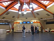
Station concourse
(with view on access to RER A platforms). -
Bus interchange station
(View from the main access) -
RER A platform – East end (towards Paris)
-
RER A platform (towards Paris)
(with view of a service indicator sign) -
RER E platform (towards Paris)
(View to the North) -
Main access to the bus interchange station
-
RER A platforms in July 2022
-
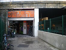
Access ZA Péripôle – Bois Galon
-
Access Quartier des Alouettes
References
[edit]- ^ "Plan pour les voyageurs en fauteuil roulant" [Map for travelers in wheelchairs] (PDF). Île-de-France Mobilités. 2023. Retrieved 27 December 2023.
- ^ "Trafic annuel entrant par station du réseau ferré 2019". Open Data RATP (Data.Ratp.fr) (in French). RATP Group. Retrieved 7 August 2021.
- ^ "Fréquentation en gares en 2019 – Val de Fontenay". SNCF Open data (in French). SNCF – Gares & Connexions. Retrieved 7 August 2021.
- ^ Bao Nguyen. "La fréquentation des gares en France". Datavisualisation SNCF (in French). Cf. Val-de-Marne department on map of France. Retrieved 7 August 2021.
- ^ "Plan du réseau de bus à l'Est de Paris (Secteur n°10)" [Map of the RATP bus network to the east of Paris (Sector n° 10).] (PDF). Ratp.fr (Color map showing the names of bus stops and main streets.) (in French). RATP Group. May 2020. Retrieved 19 August 2020.
- ^ "Plan du réseau Noctilien (2017) – (Secteur : Paris & Sud-Est)" [Map of the night bus (Noctilien) network (2017) – (Sector: Paris and its south-eastern suburbs).] (PDF). Ratp.fr (Color map showing the names of the bus stops and the cities served.) (in French). RATP Group. April 2017. Retrieved 19 August 2020.
External links
[edit]![]() Media related to Gare du Val de Fontenay at Wikimedia Commons
Media related to Gare du Val de Fontenay at Wikimedia Commons
- Val de Fontenay station at Transilien, the official website of SNCF (in French)


