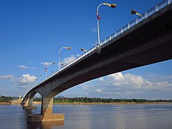
Third Thai–Lao Friendship Bridge
Appearance
(Redirected from Third Thai-Lao Friendship Bridge)
Third Thai–Lao Friendship Bridge สะพานมิตรภาพ ไทย-ลาว แห่งที่ ๓ ຂົວມິດຕະພາບ ລາວ-ໄທ ແຫ່ງທີສາມ | |
|---|---|
 | |
| Coordinates | 17°29′33″N 104°43′42″E / 17.4925°N 104.7283°E |
| Carries | Motor vehicles |
| Crosses | Mekong River |
| Locale | At Samat, Nakhon Phanom Province, Thailand Thakhek, Khammouane Province, Laos |
| Official name | Third Thai–Lao Friendship Bridge |
| Characteristics | |
| Design | Box girder bridge |
| Total length | 1423 m |
| Width | 13 m |
| History | |
| Opened | 11 November 2011 |
| Location | |
 | |
The Third Thai–Lao Friendship Bridge[a] over the Mekong is a bridge that connects Nakhon Phanom Province in Thailand with Thakhek, Khammouane Province in Laos. The bridge's foundation stone was laid on 6 March 2009, and it opened for traffic on 11 November 2011.[1][2] The bridge is 1,423 metres long and 13 metres wide.[3]
The name "Third Thai-Lao Friendship Bridge" was previously also used to refer to the planned bridge from Chiang Khong, Thailand to Houayxay, Laos, but this bridge is now known as the Fourth Thai-Lao Friendship Bridge.
Traffic on the bridge drives on the left, as in Thailand, while traffic in Laos drives on the right; the lane-change is on the Laos side.
See also
[edit]- First Thai-Lao Friendship Bridge
- Second Thai-Lao Friendship Bridge
- Fourth Thai–Lao Friendship Bridge
- Fifth Thai-Lao Friendship Bridge
- Transportation in Laos
- Transport in Thailand
17°29′33″N 104°43′42″E / 17.49250°N 104.72833°E
Notes
[edit]- ^ * Thai: สะพานมิตรภาพ ไทย-ลาว แห่งที่ 3, pronounced [sā.pʰāːn mít.trā.pʰâːp tʰāj lāːw hɛ̀ŋ tʰîː sǎːm]
- Lao: ຂົວມິດຕະພາບ ລາວ-ໄທ ແຫ່ງທີສາມ, pronounced [kʰǔa̯ mīt.tā.pʰâːp láːw tʰáj hɛ̄ŋ tʰīː sǎːm]
References
[edit]- ^ "Archived copy". Archived from the original on 15 June 2009. Retrieved 15 June 2009.
{{cite web}}: CS1 maint: archived copy as title (link) - ^ "Thailand, Laos Open New Friendship Bridge « VOA Breaking News".
- ^ "Third Mekong Bridge opens : TTRweekly". Archived from the original on 23 November 2011. Retrieved 15 October 2017.
External links
[edit]Wikimedia Commons has media related to Third Thai-Lao Friendship Bridge.
