Nebi Safa
Nebi Safa
Nabi Safa, An Nabi Safa', En Nabi Safa, Mazraet Selsata, Thelthatha | |
|---|---|
Village | |
 The temple ruins at Nebi Safa, ca 1851, by van de Velde | |
 | |
| Country | Lebanon |
| Governorate | Beqaa Governorate |
| District | Rashaya District |
| Alternative name | Nabi Safa, An Nabi Safa', En Nabi Safa, Thelthatha |
|---|---|
| Location | 13 kilometres (8.1 mi) west of Rashaya |
| History | |
| Cultures | Roman |
| Site notes | |
| Condition | Ruins |
| Public access | Yes |
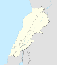
Nebi Safa, Nabi Safa, Neby Sufa, An Nabi Safa, An Nabi Safa' or En Nabi Safa also known as Mazraet Selsata or Thelthatha is a village in the Kfar Mishki municipality situated 13 kilometres (8.1 mi) west of Rashaya in the Rashaya District of the Beqaa Governorate in Lebanon.[1][2][3]
The village is situated in a gap in a ridge overlooking the Wadi Al-Taym between the Merj Shemiseh and is predominantly occupied by Druze.[4] It was visited by Edward Robinson in 1852, who noted two sarcophagi (roman temples) in the area.[5]
Roman temple
[edit]There are the ruins of a Roman temple in the village that is included in a group of Temples of Mount Hermon. It is larger than the one at Hebbariye, measuring 72 feet (22 m) long (from east to west) and 35 feet (11 m) wide (from north to south). It faces east with a commanding aspect towards Mount Hermon.[5] It was noted that the view "of Hermon from this point is imposing beyond the power of language to express".[6] George Taylor noted that the doorway of the temple was at least thirty degrees offset from the peak.[7] The stone blocks used to make the temple were around 3 feet (0.91 m) thick, not as large as those at Hebbariye and with a lighter entablature of 4.5 feet (1.4 m). It feature an elegant pediment with graceful architecture. Only the northern wall remains standing with pilasters in the northeast corner. The east entrance featured 3 feet (0.91 m) thick columns that possibly formed a portico.[5] At the west end of the temple is an altar with stairs leading down to an underground chamber or crypt that runs for the length of the temple.[7] Thirteen courses of stones were recorded by Robinson to a height of 43.5 feet (13.3 m).[5]
The site was suggested to have been used by the Druze as a shrine to a prophet called Safa, who was descended from Jacob and whose people lived towards Hebron and Jerusalem. Little record of the prophet Safa remains, although it was said that "The honourable body is there, and the spirit is always to be found there. Any day that a man seeks him he will find him, it depends on his faith."[4]
References
[edit]- ^ Brown, J.; Meyers, E.; Talbert, R.; Elliott, T.; Gillies, S. "Places: 678302 (Nebi Safa)". Pleiades. Retrieved September 19, 2012.
- ^ Daniel M. Krencker; Willy Zschietzschmann (1938). Römische Tempel in Syrien: nach Aufnahmen und Untersuchungen von Mitgliedern der Deutschen Baalbekexpedition 1901–1904, Otto Puchstein, Bruno Schulz, Daniel Krencker. W. de Gruyter & Co. Retrieved 17 September 2012.
- ^ Ted Kaizer (2008). The Variety of Local Religious Life in the Near East in the Hellenistic and Roman Periods. BRILL. pp. 78–. ISBN 978-90-04-16735-3. Retrieved 19 September 2012.
- ^ a b Samuel Curtiss (30 January 2005). Primitive Semitic Religion Today. Kessinger Publishing. pp. 83–. ISBN 978-1-4179-7346-0. Retrieved 19 September 2012.
- ^ a b c d E. ROBINSON (1856). Biblical Researches in Palestine and the adjacent regions: a journal of Travels in the years 1838 and 1852. Murray. pp. 426–. Retrieved 19 September 2012.
- ^ Charles Wilson (3 June 2010). Picturesque Palestine, Sinai and Egypt. Sophia Perennis et Universalis. ISBN 978-1-59731-459-6. Retrieved 19 September 2012.
- ^ a b George Taylor (1971). The Roman temples of Lebanon: a pictorial guide. Les temples romains au Liban; guide illustré. Dar el-Machreq Publishers. Retrieved 19 September 2012.
Bibliography
[edit]- Warren, C.; Conder, C.R. (1884). The Survey of Western Palestine: Jerusalem. London: Committee of the Palestine Exploration Fund. (p. 491 ff)
External links
[edit]- Nebi Safa on sattelliteviews.net
- Nebi Safa on middleeast.com
- Nebi Safa on geographic.org
- Roman Temples on discoverlebanon.com
- Hiking to Kfar Mechki on lebivity.com
- 3D Google Earth map of En Nebi Safa on www.gmap3d.com
- Nabi Safa (Mazraet Selsata) on wikimapia
- Nabi Safa on www.localiban.org
- Full text of Picturesque Palestine, Sinai and Egypt. Edited by Charles Wilson, 1881.


