Jump to content

Template:Infobox NRHP/testcases

Coordinates: 38°46′33″N 90°28′41″W / 38.77583°N 90.47806°W / 38.77583; -90.47806
From Wikipedia, the free encyclopedia

These all use the {{sandbox version}} of the {{Infobox NRHP}} code; please ensure that all of them look correct here before saving sandbox tests to the live template.

Basic tests

[edit]

Manzanar, with long_direction omitted

[edit]
Side by side comparison
{{Infobox NRHP}}{{Infobox NRHP/sandbox}}
Manzanar War Relocation Center
L.A. Historic-Cultural Monument
Small buildings in rows in a dusty flat area. A tattered U.S. flag flies from a pole in the foreground, and tall mountains dominate the background below a sky with clouds.
A hot windstorm brings dust from the surrounding desert July 3, 1942
Located in California, close to the midpoint of the diagonal border between California and Nevada
Nearest cityIndependence, California
Coordinates36°43′42″N 118°09′16″W / 36.72833°N 118.15444°W / 36.72833; -118.15444
Area814 acres (329 ha)
Built1942
Visitation81,344 (2007)[5][6]
NRHP reference No.76000484
LAHCM No.160
Significant dates
Added to NRHPJuly 30, 1976[1]
Designated NHLFebruary 4, 1985[2]
Designated NHSMarch 3, 1992
Designated CHISL1972[3]
Designated LAHCMSeptember 15, 1976[4]

References

  1. ^ "Manzanar National Historic Site: Park Statistics (U.S. National Park Service)". National Park Service. Retrieved 2008-06-02.
  2. ^ "Manzanar War Relocation Center". National Historic Landmark Summary Listing. National Park Service. Retrieved 2008-05-29.
  3. ^ Manzanar Committee. Reflections: Three Self-Guided Tours Of Manzanar. p. 19.
  4. ^ "Historic - Cultural Monuments (HCM) Listing: City Declared Monuments" (PDF). City of Los Angeles, Department of City Planning. 2007-09-07. Retrieved 2008-05-28.
  5. ^ "Park Visitation Report: Manzanar". National Park Service, United States Department of the Interior. 2007. Retrieved 2008-02-27.
  6. ^ "Manzanar National Historic Site: Public Use Counting and Reporting Instructions" (PDF). National Park Service, United States Department of the Interior. 2000-01-01. Retrieved 2008-02-27.

Manzanar, with dec style coordinates

[edit]
Side by side comparison
{{Infobox NRHP}}{{Infobox NRHP/sandbox}}
Manzanar War Relocation Center
L.A. Historic-Cultural Monument
Small buildings in rows in a dusty flat area. A tattered U.S. flag flies from a pole in the foreground, and tall mountains dominate the background below a sky with clouds.
A hot windstorm brings dust from the surrounding desert July 3, 1942
Located in California, close to the midpoint of the diagonal border between California and Nevada
Nearest cityIndependence, California
Coordinates36°43′42″N 118°09′16″W / 36.72833°N 118.15444°W / 36.72833; -118.15444
Area814 acres (329 ha)
Built1942
Visitation81,344 (2007)[5][6]
NRHP reference No.76000484
LAHCM No.160
Significant dates
Added to NRHPJuly 30, 1976[1]
Designated NHLFebruary 4, 1985[2]
Designated NHSMarch 3, 1992
Designated CHISL1972[3]
Designated LAHCMSeptember 15, 1976[4]
Manzanar War Relocation Center
L.A. Historic-Cultural Monument
Small buildings in rows in a dusty flat area. A tattered U.S. flag flies from a pole in the foreground, and tall mountains dominate the background below a sky with clouds.
A hot windstorm brings dust from the surrounding desert July 3, 1942
Located in California, close to the midpoint of the diagonal border between California and Nevada
Nearest cityIndependence, California
Coordinates36°43′42″N 118°09′16″W / 36.72833°N 118.15444°W / 36.72833; -118.15444
Area814 acres (329 ha)
Built1942
Visitation81,344 (2007)[5][6]
NRHP reference No.76000484
LAHCM No.160
Significant dates
Added to NRHPJuly 30, 1976[1]
Designated NHLFebruary 4, 1985[2]
Designated NHSMarch 3, 1992
Designated CHISL1972[3]
Designated LAHCMSeptember 15, 1976[4]

References

  1. ^ "Manzanar National Historic Site: Park Statistics (U.S. National Park Service)". National Park Service. Retrieved 2008-06-02.
  2. ^ "Manzanar War Relocation Center". National Historic Landmark Summary Listing. National Park Service. Retrieved 2008-05-29.
  3. ^ Manzanar Committee. Reflections: Three Self-Guided Tours Of Manzanar. p. 19.
  4. ^ "Historic - Cultural Monuments (HCM) Listing: City Declared Monuments" (PDF). City of Los Angeles, Department of City Planning. 2007-09-07. Retrieved 2008-05-28.
  5. ^ "Park Visitation Report: Manzanar". National Park Service, United States Department of the Interior. 2007. Retrieved 2008-02-27.
  6. ^ "Manzanar National Historic Site: Public Use Counting and Reporting Instructions" (PDF). National Park Service, United States Department of the Interior. 2000-01-01. Retrieved 2008-02-27.

Manzanar, with long_direction left blank

[edit]
Side by side comparison
{{Infobox NRHP}}{{Infobox NRHP/sandbox}}
Manzanar War Relocation Center
L.A. Historic-Cultural Monument
Small buildings in rows in a dusty flat area. A tattered U.S. flag flies from a pole in the foreground, and tall mountains dominate the background below a sky with clouds.
A hot windstorm brings dust from the surrounding desert July 3, 1942
Located in California, close to the midpoint of the diagonal border between California and Nevada
Nearest cityIndependence, California
Coordinates36°43′42″N 118°09′16″W / 36.72833°N 118.15444°W / 36.72833; -118.15444
Area814 acres (329 ha)
Built1942
Visitation81,344 (2007)[5][6]
NRHP reference No.76000484
LAHCM No.160
Significant dates
Added to NRHPJuly 30, 1976[1]
Designated NHLFebruary 4, 1985[2]
Designated NHSMarch 3, 1992
Designated CHISL1972[3]
Designated LAHCMSeptember 15, 1976[4]
Manzanar War Relocation Center
L.A. Historic-Cultural Monument
Small buildings in rows in a dusty flat area. A tattered U.S. flag flies from a pole in the foreground, and tall mountains dominate the background below a sky with clouds.
A hot windstorm brings dust from the surrounding desert July 3, 1942
Located in California, close to the midpoint of the diagonal border between California and Nevada
Nearest cityIndependence, California
Coordinates36°43′42″N 118°09′16″W / 36.72833°N 118.15444°W / 36.72833; -118.15444
Area814 acres (329 ha)
Built1942
Visitation81,344 (2007)[5][6]
NRHP reference No.76000484
LAHCM No.160
Significant dates
Added to NRHPJuly 30, 1976[1]
Designated NHLFebruary 4, 1985[2]
Designated NHSMarch 3, 1992
Designated CHISL1972[3]
Designated LAHCMSeptember 15, 1976[4]

References

  1. ^ "Manzanar National Historic Site: Park Statistics (U.S. National Park Service)". National Park Service. Retrieved 2008-06-02.
  2. ^ "Manzanar War Relocation Center". National Historic Landmark Summary Listing. National Park Service. Retrieved 2008-05-29.
  3. ^ Manzanar Committee. Reflections: Three Self-Guided Tours Of Manzanar. p. 19.
  4. ^ "Historic - Cultural Monuments (HCM) Listing: City Declared Monuments" (PDF). City of Los Angeles, Department of City Planning. 2007-09-07. Retrieved 2008-05-28.
  5. ^ "Park Visitation Report: Manzanar". National Park Service, United States Department of the Interior. 2007. Retrieved 2008-02-27.
  6. ^ "Manzanar National Historic Site: Public Use Counting and Reporting Instructions" (PDF). National Park Service, United States Department of the Interior. 2000-01-01. Retrieved 2008-02-27.

Manzanar, with long_direction specified

[edit]
Side by side comparison
{{Infobox NRHP}}{{Infobox NRHP/sandbox}}
Manzanar War Relocation Center
L.A. Historic-Cultural Monument
Small buildings in rows in a dusty flat area. A tattered U.S. flag flies from a pole in the foreground, and tall mountains dominate the background below a sky with clouds.
A hot windstorm brings dust from the surrounding desert July 3, 1942
Located in California, close to the midpoint of the diagonal border between California and Nevada
Nearest cityIndependence, California
Coordinates36°43′42″N 118°09′16″W / 36.72833°N 118.15444°W / 36.72833; -118.15444
Area814 acres (329 ha)
Built1942
Visitation81,344 (2007)[5][6]
NRHP reference No.76000484
LAHCM No.160
Significant dates
Added to NRHPJuly 30, 1976[1]
Designated NHLFebruary 4, 1985[2]
Designated NHSMarch 3, 1992
Designated CHISL1972[3]
Designated LAHCMSeptember 15, 1976[4]
Manzanar War Relocation Center
L.A. Historic-Cultural Monument
Small buildings in rows in a dusty flat area. A tattered U.S. flag flies from a pole in the foreground, and tall mountains dominate the background below a sky with clouds.
A hot windstorm brings dust from the surrounding desert July 3, 1942
Located in California, close to the midpoint of the diagonal border between California and Nevada
Nearest cityIndependence, California
Coordinates36°43′42″N 118°09′16″W / 36.72833°N 118.15444°W / 36.72833; -118.15444
Area814 acres (329 ha)
Built1942
Visitation81,344 (2007)[5][6]
NRHP reference No.76000484
LAHCM No.160
Significant dates
Added to NRHPJuly 30, 1976[1]
Designated NHLFebruary 4, 1985[2]
Designated NHSMarch 3, 1992
Designated CHISL1972[3]
Designated LAHCMSeptember 15, 1976[4]

References

  1. ^ "Manzanar National Historic Site: Park Statistics (U.S. National Park Service)". National Park Service. Retrieved 2008-06-02.
  2. ^ "Manzanar War Relocation Center". National Historic Landmark Summary Listing. National Park Service. Retrieved 2008-05-29.
  3. ^ Manzanar Committee. Reflections: Three Self-Guided Tours Of Manzanar. p. 19.
  4. ^ "Historic - Cultural Monuments (HCM) Listing: City Declared Monuments" (PDF). City of Los Angeles, Department of City Planning. 2007-09-07. Retrieved 2008-05-28.
  5. ^ "Park Visitation Report: Manzanar". National Park Service, United States Department of the Interior. 2007. Retrieved 2008-02-27.
  6. ^ "Manzanar National Historic Site: Public Use Counting and Reporting Instructions" (PDF). National Park Service, United States Department of the Interior. 2000-01-01. Retrieved 2008-02-27.

ref with refnum parameter

[edit]
Side by side comparison
{{Infobox NRHP}}{{Infobox NRHP/sandbox}}
Colonial Inn
Infobox NRHP/testcases is located in Maine
Infobox NRHP/testcases
Location145 Shore Rd., Ogunquit, Maine
Coordinates43°14′41″N 70°35′48″W / 43.24472°N 70.59667°W / 43.24472; -70.59667
Area1.5 acres (0.61 ha)
Built1897 (1897)
Architectural styleQueen Anne
NRHP reference No.12000454[1]
Added to NRHPJuly 31, 2012

References

Contributing Property

[edit]
Side by side comparison
{{Infobox NRHP}}{{Infobox NRHP/sandbox}}
St. Agatha's Episcopal Church
Small white clapboard church. The entrance is on the left, under another story just above the entrance, which gives the church a lopsided appearance.
St. Agatha's Episcopal Church, 2008
Location144 Circle Drive
DeFuniak Springs, Florida,
Coordinates30°42′58.57″N 86°6′57″W / 30.7162694°N 86.11583°W / 30.7162694; -86.11583
Built1896
Architectural styleCarpenter Gothic
Part ofDeFuniak Springs Historic District (ID92001048)
Added to NRHPAugust 28, 1992[1]

References

  1. ^ "National Register Information System". National Register of Historic Places. National Park Service. 2009-03-13.

Individually listed Contributing property

[edit]
Side by side comparison
{{Infobox NRHP}}{{Infobox NRHP/sandbox}}
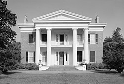
Melrose
Two-story building fronted with a portico with four Greek columns
Melrose in 1975
LocationMelrose Avenue, Natchez, Mississippi
Area80 acres (32 ha)
Built1845
Architectural styleGreek Revival
Part ofNatchez National Historical Park (ID01000276)
NRHP reference No.74002253
Significant dates
Added to NRHPMay 30, 1974[2]
Designated NHLMay 30, 1974[1]
Designated CPOctober 7, 1988

References

  1. ^ "Melrose". National Historic Landmark summary listing. National Park Service. Retrieved 2007-10-13.
  2. ^ "National Register Information System". National Register of Historic Places. National Park Service. 2007-01-23.

Locmapin that isn't the name of a U.S. state

[edit]
Side by side comparison
{{Infobox NRHP}}{{Infobox NRHP/sandbox}}
Elliott Coues House
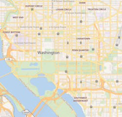
Infobox NRHP/testcases is located in Central Washington, D.C.
Infobox NRHP/testcases
Location1726 N Street, NW, Washington, D.C.
Coordinates38°54′25″N 77°2′24″W / 38.90694°N 77.04000°W / 38.90694; -77.04000
Built1887
NRHP reference No.75002049
Elliott Coues House
Infobox NRHP/testcases is located in Central Washington, D.C.
Infobox NRHP/testcases
Location1726 N Street, NW, Washington, D.C.
Coordinates38°54′25″N 77°2′24″W / 38.90694°N 77.04000°W / 38.90694; -77.04000
Built1887
NRHP reference No.75002049

References

NRHP infobox included within other infoboxes

[edit]

Included in a ship infobox

[edit]
Sandbox version Actual template
USS Pampanito, with SS Jeremiah O'Brien moored astern
USS Pampanito, with SS Jeremiah O'Brien moored astern
History
BuilderPortsmouth Naval Shipyard, Kittery, Maine[1]
Laid down15 March 1943[1]
Launched12 July 1943[1]
Commissioned6 November 1943[1]
Decommissioned15 December 1945[1]
Stricken20 December 1971[1]
StatusMuseum ship in San Francisco, California since 21 November 1975[2]
General characteristics
Class and typeBalao-class diesel-electric submarine[2]
Displacement
  • 1,526 tons (1550 t) surfaced[2]
  • 2,391 tons (2429 t) submerged[2]
Length311 ft 6 in (95.0 m)[2]
Beam27 ft 3 in (8.31 m)[2]
Draft16 ft 10 in (5.13 m) maximum[2]
Propulsion
Speed
  • 20.25 knots (37 km/h) surfaced[6]
  • 8.75 knots (16 km/h) submerged[6]
Range11,000 nm (20,000 km) surfaced at 10 knots (19 km/h)[6]
Endurance
  • 48 hours at 2 knots (4 km/h) submerged[6]
  • 75 days on patrol
Test depth400 ft (120 m)[6]
Complement10 officers, 70–71 enlisted[6]
Armament
USS PAMPANITO (submarine)
LocationFisherman's Wharf-Pier 45, San Francisco, California
NRHP reference No.86000089
Significant dates
Added to NRHPJanuary 14, 1986[7]
Designated NHLJanuary 14, 1986[8]

References

  1. ^ a b c d e f g h i j k l Friedman, Norman (1995). U.S. Submarines Through 1945: An Illustrated Design History. Annapolis, Maryland: United States Naval Institute. pp. 285–304. ISBN 1-55750-263-3. {{cite book}}: Cite has empty unknown parameter: |coauthors= (help)
  2. ^ a b c d e f g h i j k l m n Bauer, K. Jack (1991). Register of Ships of the U.S. Navy, 1775-1990: Major Combatants. Westport, Connecticut: Greenwood Press. pp. 275–280. ISBN 0-313-26202-0. {{cite book}}: Unknown parameter |coauthors= ignored (|author= suggested) (help)
  3. ^ a b c d e f g h i j Bauer, K. Jack; Roberts, Stephen S. (1991). Register of Ships of the U.S. Navy, 1775–1990: Major Combatants. Westport, Connecticut: Greenwood Press. pp. 275–280. ISBN 978-0-313-26202-9.
  4. ^ a b U.S. Submarines Through 1945 pp. 261–263
  5. ^ a b U.S. Submarines Through 1945 pp. 305–311
  6. ^ a b c d e f g h i j k l U.S. Submarines Through 1945 pp. 305-311
  7. ^ a b "National Register Information System". National Register of Historic Places. National Park Service. 2007-01-23.
  8. ^ a b "USS PAMPANITO (submarine)". National Historic Landmark summary listing. National Park Service. Retrieved 2008-03-12.

included in a train station infobox

[edit]
Sandbox version Actual template
Sea Cliff
Close-up view of the historic Sea Cliff Station in Glen Cove, New York, from the northbound platform. An open shelter on the southbound platform can be seen in the distance.
General information
LocationSea Cliff Avenue & Glen Keith Road
Glen Cove, NY
Owned byMTA
Line(s)
Platforms2
Tracks3(including one storage track)
ConnectionsMTA Long Island Bus
Mid Island Taxi
Construction
ParkingYes
Bicycle facilitiesYes; Bike Rack
AccessibleYes
Other information
Fare zone7
History
Opened1867
Rebuilt1888, 1997
Services
Preceding station Long Island Rail Road Following station
Glen Head Oyster Bay Branch Glen Street
toward Oyster Bay
Sea Cliff Railroad Station
Brick wall with door next to small brass plaque
NRHP landmark, rebuilt in 1888.
LocationSea Cliff, New York, USA
Built1888
Architectural styleLate-Victorian
NRHP reference No.88000021[1]
Added to NRHPFebruary 18, 1988

References

included in a lighthouse infobox

[edit]
Sandbox version Actual template
Point Reyes Lighthouse
Map
LocationPoint Reyes, Marin County, United States Edit this at Wikidata
Coordinates37°59′51″N 123°00′59″W / 37.9975°N 123.016389°W / 37.9975; -123.016389
Tower
Constructed1870 Edit this on Wikidata
Constructioncast iron Edit this on Wikidata
Height11 m (36 ft) Edit this on Wikidata
HeritageNational Register of Historic Places listed place Edit this on Wikidata
Light
Focal height31 m (102 ft) Edit this on Wikidata
Lensfirst order Fresnel lens Edit this on Wikidata
Range21 nmi (39 km; 24 mi) Edit this on Wikidata
CharacteristicFl W 5s Edit this on Wikidata
Point Reyes Light Station
Located on the California coast, just north of San Francisco Bay
Nearest cityPoint Reyes, California
Coordinates37°59′51″N 123°0′59″W / 37.99750°N 123.01639°W / 37.99750; -123.01639
Built1870
ArchitectMarston, Phineas F.
MPSLight Stations of California MPS
NRHP reference No.91001100
Added to NRHPSeptember 3, 1991[1]

References

  1. ^ a b "National Register Information System". National Register of Historic Places. National Park Service. 2008-04-15.

included in a Windmill infobox

[edit]
Sandbox version Actual template
Boyd's Windmill
Origin
Mill nameBoyd's Mill
Mill locationMiddletown, RI
41°30′03″N 17°16′09″W / 41.50083°N 17.26917°W / 41.50083; -17.26917
Operator(s)Middletown Historical Society
Year built1810
Information
PurposeCorn mill
TypeSmock mill
StoreysThree storey smock
Base storeysA few courses of brick
Smock sidesEight sides
No. of sailsEight sails
Type of sailsCommon sails
Other informationOne of only eight sailed windmills in the United States
Boyd's Windmill
Located in east Rhode Island, very near the Atlantic coast
Coordinates41°30′3″N 71°16′9″W / 41.50083°N 71.26917°W / 41.50083; -71.26917
NRHP reference No.01000018
Added to NRHPJanuary 26, 2001[1]
Boyd's Windmill
Origin
Mill nameBoyd's Mill
Mill locationMiddletown, RI
41°30′03″N 17°16′09″W / 41.50083°N 17.26917°W / 41.50083; -17.26917
Operator(s)Middletown Historical Society
Year built1810
Information
PurposeCorn mill
TypeSmock mill
StoreysThree storey smock
Base storeysA few courses of brick
Smock sidesEight sides
No. of sailsEight sails
Type of sailsCommon sails
Other informationOne of only eight sailed windmills in the United States
Boyd's Windmill
Located in east Rhode Island, very near the Atlantic coast
Coordinates41°30′3″N 71°16′9″W / 41.50083°N 71.26917°W / 41.50083; -71.26917
NRHP reference No.01000018
Added to NRHPJanuary 26, 2001[1]

References

  1. ^ a b "National Register Information System". National Register of Historic Places. National Park Service. 2008-04-15.

include in "increase4=" coding

[edit]

Use modified St. Charles Historic District information (which has 3 increases already), adding a fictitious increase of 999.9 acres on April 99, 9999, with refnum 999999999:

Side by side comparison
{{Infobox NRHP}}{{Infobox NRHP/sandbox}}
St. Charles Historic District
Infobox NRHP/testcases is located in Missouri
Infobox NRHP/testcases
Infobox NRHP/testcases is located in the United States
Infobox NRHP/testcases
LocationRoughly bounded by the Missouri River and Madison, Chauncey, and 2nd Sts.; also 1000 S. Main St.; also bounded by Madison, 2nd, Jefferson, and the alley behind the 100 block of S. Main St.; also the 100, 200, and 300 blocks of N. Main St., St. Charles, Missouri
Coordinates38°46′33″N 90°28′41″W / 38.77583°N 90.47806°W / 38.77583; -90.47806
Area47 acres (19 ha), 1.3 acres (0.53 ha), 3.1 acres (1.3 ha), 9 acres (3.6 ha), 999.9 acres (404.6 ha)
ArchitectMultiple
Architectural styleGreek Revival, Italianate, Late Victorian architecture
NRHP reference No.70000856 (original)
87000903 (increase 1)
91000504 (increase 2)
96001087 (increase 3)
999999999[1] (increase 4)
Significant dates
Added to NRHPSeptember 22, 1970
Boundary increasesJune 4, 1987
May 1, 1991
October 10, 1996
April 99, 9999

References

further test "decrease4=" coding

[edit]

Use modified St. Charles Historic District information (which actually has 3 increases), changing those (falsely) to decreases instead and adding a fictitious decrease of 999.9 acres on April 99, 9999, with refnum 999999999:

Side by side comparison
{{Infobox NRHP}}{{Infobox NRHP/sandbox}}
St. Charles Historic District
Infobox NRHP/testcases is located in Missouri
Infobox NRHP/testcases
Infobox NRHP/testcases is located in the United States
Infobox NRHP/testcases
LocationRoughly bounded by the Missouri River and Madison, Chauncey, and 2nd Sts.; also 1000 S. Main St.; also bounded by Madison, 2nd, Jefferson, and the alley behind the 100 block of S. Main St.; also the 100, 200, and 300 blocks of N. Main St., St. Charles, Missouri
Coordinates38°46′33″N 90°28′41″W / 38.77583°N 90.47806°W / 38.77583; -90.47806
Area47 acres (19 ha), 1.3 acres (0.53 ha), 3.1 acres (1.3 ha), 9 acres (3.6 ha), 999.9 acres (404.6 ha)
ArchitectMultiple
Architectural styleGreek Revival, Italianate, Late Victorian architecture
NRHP reference No.70000856
87000903 (decrease 1)
91000504 (decrease 2)
96001087 (decrease 3)
999999999[1] (decrease 4)
Significant dates
Added to NRHPSeptember 22, 1970
Boundary decreasesJune 4, 1987
May 1, 1991
October 10, 1996
April 99, 9999

References

See also

[edit]