Jump to content

Template:Infobox station/testcases

Coordinates: 35°49′53″N 128°37′24″E / 35.8313°N 128.6232°E / 35.8313; 128.6232
From Wikipedia, the free encyclopedia
Side by side comparison
{{Infobox station}}{{Infobox station/sandbox}}
{{{name}}}

{{{native_name}}}
Bus interchange
Trolleybus
Mainline rail interchange
Express train
Airport interchange
Handicapped/disabled access
{{{type}}}
[[File:{{{image}}}|frameless|alt={{{alt}}}|upright={{{image_upright}}}]]
{{{caption}}}
{{{mlanguage}}}
General information
Other names{{{other_name}}}
Location{{{address}}}
{{{borough}}}
{{{country}}}
Coordinates0°N 0°E / 0°N 0°E / 0; 0
Elevation{{{elevation}}}
Owned by{{{owned}}}
Operated by{{{operator}}}
Transit authority{{{transit_authority}}}
Line(s){{{lines}}}
Distance{{{distance}}}
Platforms{{{platforms}}}
Tracks{{{tracks}}}
Train operators{{{train_operators}}}
Bus routes{{{bus_routes}}}
Bus stands{{{bus_stands}}}
Bus operators{{{bus_operators}}}
Connections{{{connections}}}
Construction
Structure type{{{structure}}}
Depth{{{depth}}}
Platform levels{{{levels}}}
Parking{{{parking}}}
Bicycle facilities{{{bicycle}}}
Accessible{{{disabled}}}
Architect{{{architect}}}
Architectural style{{{architectural_style}}}
Other information
Status{{{status}}}
Station code{{{code}}}
IATA code{{{iata}}}
Fare zone{{{zone}}}
Classification{{{classification}}}
Website{{{website}}}
History
Opened{{{opened}}}
Opening{{{opening}}}
Closed{{{closed}}}
Rebuilt{{{rebuilt}}}
Electrified{{{electrified}}}
Previous names{{{former}}}
Original company{{{original}}}
Pre-grouping{{{pregroup}}}
Post-grouping{{{postgroup}}}
Pre-nationalisation{{{prenational}}}
Key dates
{{{years}}}{{{events}}}
{{{years1}}}{{{events1}}}
{{{years11}}}{{{events11}}}
Passengers
{{{pass_year}}}{{{passengers}}} Steady 0% ({{{pass_system}}})
Rank{{{pass_rank}}}
{{{mpassengers}}}
Services
  {{{services}}}  
Other services
  {{{other_services}}}  
{{{embedded}}}
{{{nrhp}}}
{{{map_name}}}
{{{route_map}}}
Location
{{{map_alt}}}
{{{map_alt}}}
{{{map_dot_label}}}
{{{map_caption}}}

August 2019 tests

[edit]
Former
Side by side comparison
{{Infobox station}}{{Infobox station/sandbox}}
Islamabad Station

اسلام آباد اسٹیشن
General information
Other namesMargalla Railway Station
LocationKhayaban-e-Johar, Sector I-9
Islamabad, Capital Territory. 55000
Pakistan
Coordinates33°39′49″N 73°02′53″E / 33.663653°N 73.048182°E / 33.663653; 73.048182
Owned byMinistry of Railways
Line(s)Islamabad–Muzaffarabad Branch Line
Other information
Station codeMGLA[1]
History
Opened
Previous namesMargalla Station
Services
Preceding station Pakistan Railways Following station
Nur (Rawalpindi)
Terminus
Islamabad–Muzaffarabad Branch Line Terminus
Location
Islamabad Station is located in Pakistan
Islamabad Station
Islamabad Station
Location within Pakistan
Islamabad Station

اسلام آباد اسٹیشن
General information
Other namesMargalla Railway Station
LocationKhayaban-e-Johar, Sector I-9
Islamabad, Capital Territory. 55000
Pakistan
Coordinates33°39′49″N 73°02′53″E / 33.663653°N 73.048182°E / 33.663653; 73.048182
Owned byMinistry of Railways
Line(s)Islamabad–Muzaffarabad Branch Line
Other information
Station codeMGLA[1]
History
Opened
Previous namesMargalla Station
Services
Preceding station Pakistan Railways Following station
Nur (Rawalpindi)
Terminus
Islamabad–Muzaffarabad Branch Line Terminus
Location
Islamabad Station is located in Pakistan
Islamabad Station
Islamabad Station
Location within Pakistan
Former names
Side by side comparison
{{Infobox station}}{{Infobox station/sandbox}}
Islamabad Station

اسلام آباد اسٹیشن
General information
Other namesMargalla Railway Station
LocationKhayaban-e-Johar, Sector I-9
Islamabad, Capital Territory. 55000
Pakistan
Coordinates33°39′49″N 73°02′53″E / 33.663653°N 73.048182°E / 33.663653; 73.048182
Owned byMinistry of Railways
Line(s)Islamabad–Muzaffarabad Branch Line
Other information
Station codeMGLA[3]
History
Opened
Services
Preceding station Pakistan Railways Following station
Nur (Rawalpindi)
Terminus
Islamabad–Muzaffarabad Branch Line Terminus
Location
Islamabad Station is located in Pakistan
Islamabad Station
Islamabad Station
Location within Pakistan
Islamabad Station

اسلام آباد اسٹیشن
General information
Other namesMargalla Railway Station
LocationKhayaban-e-Johar, Sector I-9
Islamabad, Capital Territory. 55000
Pakistan
Coordinates33°39′49″N 73°02′53″E / 33.663653°N 73.048182°E / 33.663653; 73.048182
Owned byMinistry of Railways
Line(s)Islamabad–Muzaffarabad Branch Line
Other information
Station codeMGLA[3]
History
Opened
Services
Preceding station Pakistan Railways Following station
Nur (Rawalpindi)
Terminus
Islamabad–Muzaffarabad Branch Line Terminus
Location
Islamabad Station is located in Pakistan
Islamabad Station
Islamabad Station
Location within Pakistan

March 2019 tests

[edit]
Gradients (data page)
Side by side comparison
{{Infobox station}}{{Infobox station/sandbox}}
40th Street
SEPTA rapid transit station
General information
Location40th & Market Streets
Philadelphia
Coordinates39°57′25″N 75°12′07″W / 39.9570°N 75.2020°W / 39.9570; -75.2020
Owned bySEPTA
Platforms2 side platforms
Tracks2
Connections SEPTA Trolleys: 10, 11, 13, 33, 36 (night and diverted service only)
City Transit SEPTA City Bus: 30, 40, LUCY
Construction
Structure typeUnderground
History
RebuiltMarch 1, 2017
Electrified700 volts DC
Services
Preceding station SEPTA Following station
46th Street Market–Frankford Line 34th Street
When tunnel is closed
41st and Lancaster Route 10 Terminus
42nd and Woodland
toward Darby T.C.
Route 11
42nd and Chester Route 13
42nd and Baltimore Route 34
42nd and Woodland Route 36
Former services
Preceding station Philadelphia Transportation Company Following station
46th Street Market Elevated 36th Street
Closed 1955
toward Frankford
34th Street
toward Frankford
Location
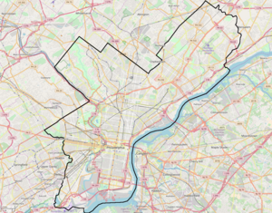
40th Street is located in Philadelphia
40th Street
40th Street
Location within Philadelphia
40th Street
SEPTA rapid transit station
General information
Location40th & Market Streets
Philadelphia
Coordinates39°57′25″N 75°12′07″W / 39.9570°N 75.2020°W / 39.9570; -75.2020
Owned bySEPTA
Platforms2 side platforms
Tracks2
Connections SEPTA Trolleys: 10, 11, 13, 33, 36 (night and diverted service only)
City Transit SEPTA City Bus: 30, 40, LUCY
Construction
Structure typeUnderground
History
RebuiltMarch 1, 2017
Electrified700 volts DC
Services
Preceding station SEPTA Following station
46th Street Market–Frankford Line 34th Street
When tunnel is closed
41st and Lancaster Route 10 Terminus
42nd and Woodland
toward Darby T.C.
Route 11
42nd and Chester Route 13
42nd and Baltimore Route 34
42nd and Woodland Route 36
Former services
Preceding station Philadelphia Transportation Company Following station
46th Street Market Elevated 36th Street
Closed 1955
toward Frankford
34th Street
toward Frankford
Location
40th Street is located in Philadelphia
40th Street
40th Street
Location within Philadelphia

January 2019 tests

[edit]
Non-Lua (data page)
Side by side comparison
{{Infobox station}}{{Infobox station/sandbox}}
Hsinchu

新竹
Taiwan High Speed Rail
THSR railway station
Station exterior
Chinese name
Traditional Chinese新竹
Transcriptions
Standard Mandarin
Hanyu PinyinXīnzhú
Bopomofoㄒㄧㄣ ㄓㄨˊ
Hakka
RomanizationXín-zùg (Sixian dialect)
Sìn-zhug (Hailu dialect)
Southern Min
Tâi-lôSin-tik
General information
Location6 Gaotie 7th Rd
Zhubei, Hsinchu County
Taiwan
Coordinates24°48′30″N 121°02′25″E / 24.8082°N 121.0403°E / 24.8082; 121.0403
Line(s)
  THSR
Distance72.1 km
Connections
Lua (data page)
Side by side comparison
{{Infobox station}}{{Infobox station/sandbox}}
Paso Robles
General information
Location800 Pine Street
Paso Robles, California 93446
Owned byCity of Paso Robles
Line(s)Coast Line
Platforms1 side platform
Tracks1
Services
Preceding station Amtrak Following station
Salinas
toward Seattle
Coast Starlight San Luis Obispo
Paso Robles
General information
Location800 Pine Street
Paso Robles, California 93446
Owned byCity of Paso Robles
Line(s)Coast Line
Platforms1 side platform
Tracks1
Services
Preceding station Amtrak Following station
Salinas
toward Seattle
Coast Starlight San Luis Obispo
Nested style (data page)
Side by side comparison
{{Infobox station}}{{Infobox station/sandbox}}
Paso Robles
General information
Location800 Pine Street
Paso Robles, California 93446
Owned byCity of Paso Robles
Line(s)Coast Line
Platforms1 side platform
Tracks1
Services
Preceding station Amtrak Following station
Salinas
toward Seattle
Coast Starlight San Luis Obispo
Paso Robles
General information
Location800 Pine Street
Paso Robles, California 93446
Owned byCity of Paso Robles
Line(s)Coast Line
Platforms1 side platform
Tracks1
Services
Preceding station Amtrak Following station
Salinas
toward Seattle
Coast Starlight San Luis Obispo

95th/Dan Ryan (data page)

[edit]
Side by side comparison
{{Infobox station}}{{Infobox station/sandbox}}
95th/Dan Ryan
 
9500S
0E/0W
Chicago 'L' rapid transit station
General information
Location15 West 95th Street
Chicago, Illinois 60620
Coordinates41°43′21″N 87°37′28″W / 41.722596°N 87.624391°W / 41.722596; -87.624391
Owned byChicago Transit Authority
Line(s)Dan Ryan branch
Platforms1 Island platform
Tracks2
ConnectionsCTA Buses

Pace Buses

Greyhound Bus
Construction
Structure typeExpressway median
ParkingNo
Bicycle facilitiesYes
AccessibleYes
History
OpenedSeptember 28, 1969
Rebuilt2000–01 (elevator added, minor renovations), 2003 (bus terminal renovations), 2014–19 (station expansion and reconstruction)
Previous names95th, 95th/State (station sign)
Passengers
20173,261,146[4]Decrease 6%
Rank12 out of 143
Services
Preceding station Chicago "L" Following station
87th
toward Howard
Red Line Terminus
Proposed services
Preceding station Chicago "L" Following station
87th
toward Howard
Red Line 103rd
toward 130th
Track layout
Red Line
north to Howard
Bus lane
95th St.
Side by side comparison
{{Infobox station}}{{Infobox station/sandbox}}
Infobox station/testcases
General information
Owned byDPTI
Operated byAdelaide Metro
Distance8.5
Platforms2 Side
Tracks2
Construction
Structure typeGround
ParkingYes
AccessibleYes
History
Opened1883
Infobox station/testcases
General information
Owned byDPTI
Operated byAdelaide Metro
Distance8.5
Platforms2 Side
Tracks2
Construction
Structure typeGround
ParkingYes
AccessibleYes
History
Opened1883
Side by side comparison
{{Infobox station}}{{Infobox station/sandbox}}
Infobox station/testcases
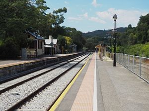
Goodwood Station with the Glenelg Tram overpass.
General information
Coordinates34°57′06″S 138°35′06″E / 34.9515825°S 138.5849102°E / -34.9515825; 138.5849102
Owned byDPTI
Operated byAdelaide Metro
Distance5
Platforms3 (2 Centre)
Tracks4
Construction
Structure typeGround
ParkingYes
AccessibleNo
History
Opened5 March 1883
Rebuilt1929

References

  1. ^ Official Web Site of Pakistan Railways
  2. ^ a b c d Azam Khan (31 January 2011). "Islamabad Railway Station may be off-track soon - The Express Tribune". Islamabad. Retrieved 6 September 2016.
  3. ^ Official Web Site of Pakistan Railways
  4. ^ "Annual Ridership Report – Calendar Year 2017" (PDF). Chicago Transit Authority, Ridership Analysis and Reporting. January 31, 2018. Retrieved July 29, 2018. {{cite web}}: Cite has empty unknown parameter: |coauthors= (help)

Pittsburgh Union Station

[edit]
Side by side comparison
{{Infobox station}}{{Infobox station/sandbox}}
Pittsburgh Union Station
Amtrak inter-city rail station
Services
Preceding station Amtrak Following station
Alliance
toward Chicago
Capitol Limited Connellsville
Terminus Pennsylvanian Greensburg
toward New York
Former services
Lua error in Module:Adjacent_stations at line 237: Unknown line "Panhandle".

Grand Trunk station (Richmond)

[edit]
Side by side comparison
{{Infobox station}}{{Infobox station/sandbox}}
Richmond
Postcard view of the GTR station in 1915
General information
Location739, Rue Principale Nord
Richmond, Quebec
Canada.
Coordinates45°39′54″N 72°08′54″W / 45.66500°N 72.14833°W / 45.66500; -72.14833
Owned byprivate
Construction
Structure typebrick station building
History
Opened1853[1]
Closed1994[2]
Rebuilt1999 restaurant[3]
Previous namesGrand Trunk Railway
Official nameCanadian National Railway Station, Richmond, Quebec
Designated1991
Reference no.6719
Side by side comparison
{{Infobox station}}{{Infobox station/sandbox}}
Richmond
Postcard view of the GTR station in 1915
General information
Location739, Rue Principale Nord
Richmond, Quebec
Canada
Coordinates45°39′54″N 72°08′54″W / 45.66500°N 72.14833°W / 45.66500; -72.14833
Owned byprivate
Construction
Structure typebrick station building
History
Opened1853[1]
Closed1994[2]
Rebuilt1999 restaurant[3]
Previous namesGrand Trunk Railway
Official nameCanadian National Railway Station, Richmond, Quebec
Designated1991
Reference no.6719

Suseongmot station

[edit]
Korean language names
Side by side comparison
{{Infobox station}}{{Infobox station/sandbox}}
338
Suseongmot Station
The station platform in April 2015
Korean name
Hangul
수성못역
Revised RomanizationSuseongmot yeok
McCune–ReischauerSusŏngmot yŏk
General information
LocationJisan-dong, Suseong District, Daegu
South Korea
Coordinates35°49′53″N 128°37′24″E / 35.8313°N 128.6232°E / 35.8313; 128.6232
Operated byDTRO
Line(s)Daegu Metro Line 3
Platforms2
Tracks2
Construction
Structure typeOverground
Other information
Station code338
History
OpenedApril 23, 2015
Services
Preceding station Daegu Metro Following station
Hwanggeum Line 3 Jisan
towards Yongji
  1. ^ a b "Saint Lawrence and Atlantic Railway Land Agreement: Memorandum of an Agreement, 1848, Between Betsey Clark and the Saint Lawrence and Atlantic Rail-Road Company". The Identity of English-speaking Quebec in 100 Objects. Quebec Anglophone Heritage Network (QAHN). 1848. Retrieved April 8, 2015. In 1853, Richmond became a junction for the Quebec and Richmond Railway line positioned on the east side of the railroad station and the newly named Grand Trunk Railway on the west side of the station.
  2. ^ a b Matthew Farfan. "Railway Stations of the Eastern Townships" (PDF). Townships Heritage WebMagazine. Retrieved April 8, 2015. Via Rail service to Richmond and Sherbrooke finally ceased in 1994
  3. ^ a b "La Vieille Gare de Richmond". Retrieved April 8, 2015.