Spokane River: Difference between revisions
m robot Modifying: fr:Spokane (rivière) |
No edit summary |
||
| Line 1: | Line 1: | ||
{{Geobox | |
{{Geobox | Riversuck a dick |
||
_hide = 1 |
|||
<!-- *** Name section *** --> |
|||
| name = Spokane River |
|||
| category = River |
|||
| category_hide = 1 |
|||
<!-- *** Image *** ---> |
<!-- *** Image *** ---> |
||
| image = Spokane river 1909.jpg |
| image = Spokane river 1909.jpg |
||
Revision as of 16:52, 7 December 2010
The Spokane River is a tributary of the Columbia River, approximately 111 miles (179 km) long, in northern Idaho and eastern Washington in the United States. It drains a low mountainous area east of the Columbia, passing through the city of Spokane, which shares its name with the river. Heavily used for irrigation and drinking water, its watershed comprises a region of extensive farming and timber production. The lowered water levels in the river have resulted in an ongoing pollution crisis and a political struggle over its resolution.
The Spokane River's entire drainage basin is about 6,240 square miles (16,200 km2) large, of which 3,840 square miles (9,900 km2) are above Post Falls Dam at the outlet of Coeur d'Alene Lake.[1] Its mean annual discharge is 7,946 cubic feet per second (225 m3/s).[2]
Description
The Spokane River rises out of Lake Coeur d'Alene in the Idaho Panhandle, draining from the northwest corner of the lake near the city of Coeur d'Alene. It flows west approximately 25 mi (40 km) into east central Washington through the suburban Spokane Valley to Spokane. The Spokane Falls are located in the heart of Downtown Spokane, about a mile before the river receives Latah Creek from the south.
From there it flows northwest along the western edge of Spokane, receiving the Little Spokane River from the east approximately 10 mi northwest of the city center. It flows in a zigzag course along the southern edge of the Selkirk Mountains, forming the southern boundary of the Spokane Indian Reservation, where it is impounded by the Little Falls Dam to form Long Lake, a 15 mi (24 km) reservoir. It joins Franklin D. Roosevelt Lake on the Columbia from the east at Miles. The site of historic Fort Spokane is located at the mouth of the river on the Columbia.
Crisis
Much of the river's water, particularly during the summer, comes from underground springs fed by the Spokane-Rathdrum Aquifer. The aquifer provides drinking water for 400,000 people in the Spokane area, as well as extensive irrigation water along its course. The use of the aquifer water is so extensive that Spokane Falls, the signature natural feature of the city of Spokane, runs dry during many summers, with all the water being diverted to the Upper Falls and Lower Falls hydroelectric power plants. The lowered water levels have raised the toxicity of the stream, resulting in low concentrations of dissolved oxygen and algae blooms along much of the river's lower course.
In 2002 the Environmental Protection Agency issued a Superfund cleanup plan for the Spokane River-Lake Coeur d'Alene basin. In a controversial move, the Bush administration transferred control of the Idaho portion to the state of Idaho, which opposes the Superfund designation and the cleanup, partly based on its high cost and possible effect on real estate prices.
It has also been confirmed that there is heavy metal pollution in the Spokane River, resulting from pollution coming from Lake Coeur D'Alene (a large lake East of Spokane in Idaho) and traveling from the Bunker Hill Superfund Site (BHSS).[3]
The Spokane River has also suffered heavily from phosphorus pollution, mostly from dishwashing detergent entering the river. In 2007, an average of 1,769 pounds of phosphorus entered the Spokane wastewater treatment plant every day.
Fish habitat

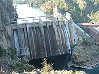
The Spokane River supports populations of rainbow trout, northern pikeminnow, and bridgelip suckers (see Catostomidae), as well as several non-native species. It supported several species of salmon until the construction of Long Lake Dam in 1915 by Washington Water Power blocked upstream passage.[4]
See also
- List of Idaho rivers
- List of Washington rivers
- Spokane River Centennial Trail
- North Idaho Centennial Trail
- Harker Canyon
References
- ^ Spokane Subbasin Plan, Northwest Power and Conservation Council; and Intermountain Subbasin Plan, Coeur d'Alene, Northwest Power and Conservation Council
- ^ Cite error: The named reference
Benkewas invoked but never defined (see the help page). - ^ Rosen, J.F., Science of the Total Environment, Volume: 303 Issue: 1-2, Pages: 15–23, Published: February 15, 2003
- ^ John Fahey, "Power Plays: The Enigma of Little Falls," Pacific Northwest Quarterly 82, no.4 (October 1991), 122–131.
