Simrishamn
Simrishamn | |
|---|---|
| Coordinates: 55°33′N 14°21′E / 55.550°N 14.350°E | |
| Country | Sweden |
| Province | Skåne |
| County | Skåne County |
| Municipality | Simrishamn Municipality |
| Area | |
• Total | 4.49 km2 (1.73 sq mi) |
| Population (31 December 2010)[1] | |
• Total | 6,527 |
| • Density | 1,453/km2 (3,760/sq mi) |
| Time zone | UTC+01:00 (CET) |
| • Summer (DST) | UTC+02:00 (CEST) |
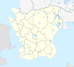
Simrishamn is a locality and the seat of Simrishamn Municipality, Skåne County, Sweden with 6,527 inhabitants in 2010.[1] Despite its small population, Simrishamn is, for historical reasons, usually still referred to as a city.
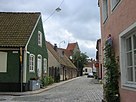
Simrishamn is a picturesque coastal town, built around the main street (Storgatan), that passes the market square, itself being the centre of the town. The climate of Simrishamn is mild, because it is warmed by the Gulf Stream and the Baltic Sea, and the hardiness zone of Simrishamn is 8a, comparable to Paris, France.
History
[edit]Simrishamn is first mentioned (as Symbrishafn) in 1161 and as a town in 1361. Simris has been interpreted as "at the mouth of the slow-flowing (river)" and hamn as "port or harbour",[2] meaning present-day Tommarpsån. It has been speculated that the name has something to do with the Cimbri, a Germanic tribe, as the name also has been "Cimbrishavn". In 1658, when Scania under the Treaty of Roskilde was permanently transferred from Denmark to Sweden, the town had a population of about 200 people. The growth was relatively small until about 1810 when it reached 700 inhabitants, growing to 1,365 in 1850 and 1,966 in 1890.[3] The local government reform of 1971 made Simrishamn the seat of Simrishamn Municipality with about 20,000 inhabitants.
Climate
[edit]The nearest station to Simrishamn is in Skillinge 10 kilometres (6.2 mi) further down the coastline, also on the open sea. Skillinge has a maritime climate with a moderated coastline and a slightly warmer interior during summers. Österlen has a drier climate than elsewhere in Southern Sweden, although it has no active weather station measuring sunshine. Even so, the cool temperatures of the Baltic Sea keeps the immediate coastline on average a couple of degrees cooler during July days than in places further north in the country or the western part of Skåne. This is due to the dominance of water in the surroundings, whereas the Mälar valley around Stockholm is surrounded by more land.
Especially during summer, seasonal lag is strong on the local coastline. This means that August averages the warmest summer nights and that September is a lot warmer than May as the sea water gradually warms. During winter, this maritime proximity of Österlen reverses the climate patterns and leads to average highs above 3 °C (37 °F) on the coastline and frosts usually being weak even while frequent. Records for Skillinge began in 1995 and as such do not contain likely historical extremes. Simrishamn had an active weather station from 1951 that closed in 1996.[4]
| Climate data for Skillinge; 10 kilometres (6.2 mi) south of Simrishamn (2002–2021 averages, extremes since 1995) | |||||||||||||
|---|---|---|---|---|---|---|---|---|---|---|---|---|---|
| Month | Jan | Feb | Mar | Apr | May | Jun | Jul | Aug | Sep | Oct | Nov | Dec | Year |
| Record high °C (°F) | 11.2 (52.2) |
13.4 (56.1) |
19.5 (67.1) |
21.9 (71.4) |
25.6 (78.1) |
31.1 (88.0) |
30.5 (86.9) |
32.0 (89.6) |
26.9 (80.4) |
20.9 (69.6) |
16.8 (62.2) |
12.0 (53.6) |
32.0 (89.6) |
| Mean maximum °C (°F) | 7.7 (45.9) |
8.0 (46.4) |
12.3 (54.1) |
16.7 (62.1) |
21.4 (70.5) |
25.7 (78.3) |
26.4 (79.5) |
25.8 (78.4) |
22.6 (72.7) |
16.9 (62.4) |
12.4 (54.3) |
9.0 (48.2) |
28.3 (82.9) |
| Mean daily maximum °C (°F) | 3.3 (37.9) |
3.3 (37.9) |
5.8 (42.4) |
9.7 (49.5) |
14.3 (57.7) |
19.1 (66.4) |
21.5 (70.7) |
21.0 (69.8) |
17.6 (63.7) |
12.4 (54.3) |
8.3 (46.9) |
5.1 (41.2) |
11.8 (53.2) |
| Daily mean °C (°F) | 1.3 (34.3) |
1.2 (34.2) |
3.1 (37.6) |
6.4 (43.5) |
10.6 (51.1) |
15.0 (59.0) |
17.5 (63.5) |
17.5 (63.5) |
14.4 (57.9) |
9.9 (49.8) |
6.3 (43.3) |
3.1 (37.6) |
8.9 (47.9) |
| Mean daily minimum °C (°F) | −0.8 (30.6) |
−0.9 (30.4) |
0.3 (32.5) |
3.0 (37.4) |
6.9 (44.4) |
10.9 (51.6) |
13.5 (56.3) |
14.0 (57.2) |
11.1 (52.0) |
7.3 (45.1) |
4.2 (39.6) |
1.0 (33.8) |
5.9 (42.6) |
| Mean minimum °C (°F) | −9.6 (14.7) |
−7.1 (19.2) |
−5.7 (21.7) |
−2.0 (28.4) |
0.9 (33.6) |
5.7 (42.3) |
9.0 (48.2) |
8.5 (47.3) |
5.4 (41.7) |
0.3 (32.5) |
−3.0 (26.6) |
−6.3 (20.7) |
−11.1 (12.0) |
| Record low °C (°F) | −16.8 (1.8) |
−14.6 (5.7) |
−16.1 (3.0) |
−4.8 (23.4) |
−1.5 (29.3) |
2.1 (35.8) |
7.0 (44.6) |
6.0 (42.8) |
2.9 (37.2) |
−5.9 (21.4) |
−7.1 (19.2) |
−17.7 (0.1) |
−17.7 (0.1) |
| Average precipitation mm (inches) | 52.4 (2.06) |
33.5 (1.32) |
31.2 (1.23) |
22.8 (0.90) |
36.0 (1.42) |
43.8 (1.72) |
57.1 (2.25) |
61.0 (2.40) |
42.3 (1.67) |
67.1 (2.64) |
59.3 (2.33) |
52.9 (2.08) |
559.4 (22.02) |
| Source 1: SMHI Open Data for Skillinge A, precipitation[5] | |||||||||||||
| Source 2: SMHI Open Data for Skillinge A, temperature[6] | |||||||||||||
Gallery
[edit]-
Street plan, before 1917
-
Saint Nicolai Church, a medieval church in central Simrishamn
-
Harbour
-
Old town hall
-
New town hall
-
Railway station
See also
[edit]References
[edit]- ^ a b c "Tätorternas landareal, folkmängd och invånare per km2 2005 och 2010" (in Swedish). Statistics Sweden. 14 December 2011. Archived from the original on 27 January 2012. Retrieved 10 January 2012.
- ^ Svenskt ortnamnslexikon 2003
- ^ Cyber City Archived 2006-10-01 at the Wayback Machine
- ^ "Open Data for Simrishamn" (in Swedish). Swedish Meteorological and Hydrological Institute. Retrieved 28 April 2022.
- ^ "Open Data for Skillinge A" (in Swedish). Swedish Meteorological and Hydrological Institute. Retrieved 28 April 2022.
- ^ "Open Data for Skillinge A" (in Swedish). Swedish Meteorological and Hydrological Institute. Retrieved 28 April 2022.
External links
[edit]![]() Media related to Simrishamn at Wikimedia Commons
Media related to Simrishamn at Wikimedia Commons
- Simrishamn - Official site
- Österlen - Official site
- Österlen & Ystad - Official site


