Siege of Montevideo (1812–1814)
Appearance
(Redirected from Siege of Montevideo (1812-1814))
| Siege of Montevideo (1812–1814) | |||||||
|---|---|---|---|---|---|---|---|
| Part of the Second Banda Oriental campaign | |||||||
 Map of Montevideo with besieging lines, 1813. | |||||||
| |||||||
| Belligerents | |||||||
|
|
| ||||||
| Commanders and leaders | |||||||
| Strength | |||||||
| 4,000 | 7,000 | ||||||

You can help expand this article with text translated from the corresponding article in Spanish. (April 2013) Click [show] for important translation instructions.
|
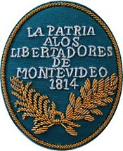
The event known as Second Siege of Montevideo (Spanish: Segundo Sitio de Montevideo) took place between 1812 and 1814, when the patriotic troops led by José Rondeau besieged the city of Montevideo, still held by Spanish loyalists under the leadership of Gaspar de Vigodet, governor of Montevideo. The siege was successful and marked the end of the Spanish presence in present-day Uruguay.
During this whole period and just like in the failed first siege of Montevideo, supplied from over the sea, the city held out, until 17 May 1814. Then, the naval victories of Admiral William Brown, cut off the supply route and the city faced starvation. By the end of June, Vigodet was forced to surrender Montevideo to General Carlos María de Alvear.
See also
[edit]- Battle of Cerrito
- Dissolution of the Viceroyalty of the Río de la Plata
- Gaspar de Vigodet
- José Rondeau
References
[edit]This article includes a list of references, related reading, or external links, but its sources remain unclear because it lacks inline citations. (May 2016) |
