
Road of Malezas
 | |
|---|---|
| Road of Malezas | |
| Santa Clara–Encrucijada Road 4–311 | |
 Kilometer 16 in San Francisco, Encrucijada | |
| Major junctions | |
| South end | Avenida Eduardo Chibás (Santa Clara) |
| Santa Clara Beltway Original Road to Santa Clara Airport Road to Santa Clara Airport | |
| North end | Calzada de Maceo (Encrucijada) |
| Location | |
| Country | Cuba |
| Provinces | Villa Clara |
| Municipalities | Santa Clara, Encrucijada |
| Highway system | |
The Road of Malezas (Spanish: Carretera de Malezas), also spelled Road of Maleza (Spanish: Carretera de Maleza), is a north–south Cuban state highway connecting the municipalities of Santa Clara to Encrucijada in Villa Clara Province.
History
[edit]In April 2022, villages along the road have been without public transportation for over a month, with an estimate of 30,000 residents in the towns of Jardin, Padagogico, Las Flores, and El Sopapo, due to a fuel crisis in Cuba so bad that it's being compared to the Special Period.[1]
In June 2024, at 2:00am, a tourist bus hit a lose cow on the road, killing it. This type of accident is apparently common on this road, especially late at night and early in the morning.[2]
Route
[edit]-
 4-311 about when entering Encrucijada Sur
 -
 4-311 seen when entering the exit to the Road to Santa Clara Airport
 -
 Junction with the Road to Calabazar with a school in Dos Hermanas on the right

.jpg)

The road starts in the city of Santa Clara from Calle Pazos and the junction with the Avenida Eduardo Chibas, which later goes into the Road to Sagua. It has a redlight at the junction with the Santa Clara Beltway, and after goes above the railway lines north of Santa Clara, where its known as the El Elevado Bridge. It goes through several villages, then has two junctions to get the Abel Santamaría Airport, then continues across two more villages, and then enters the municipality of Encrucijada, where it continues across three more villages until the town of Dos Hermanas, where it has a junction going to Calabazar de Sagua, and the road continues until Encrucijada, going under the newly made Encrucijada Beltway (part of the Circuito Norte), the road to Abel Santamaria, and finally ends at the Calzada de Maceo as the 6ta Avenida Sur.[3]
-
 Art of Encrucijada seen on the junction with the Encrucijada Beltway (CN)
 -
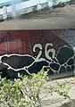
 Mural seen under the Encrucijada Beltway (CN) bridge on northbound
 -
 Mural seen under the Encrucijada Beltway (CN) bridge on southbound
 -
 6ta del Sur street sign seen when its apart of the 4–311


The section going from the Santa Clara Beltway to El Elevado is known to be full of potholes and mud, causing four people traveling in a privately owned Lada to crash into a traffic sign on the road.[4]
| Municipality | Location | km | mi | Destination | Notes |
|---|---|---|---|---|---|
| Santa Clara | Santa Clara | 0 | Avenida Eduardo Chibás – Cifuentes, Sagua La Grande | ||
| 0.2 | Calle 5ta | ||||
| 0.29 | Calle C (Detour of Malezas) | ||||
| 0.83 | Calle 17 | ||||
| 0.98 | Calle 19 | ||||
| 1.17 | Callejón del Prado | ||||
| 1.50 | Santa Clara Beltway / |
||||
| 2.04 | El Elevado Bridge | ||||
| 2½[5] | Laboratorio Provincial de Sanidad Vegetal de Villa Clara | ||||
| 2½[6] | La Granjita Hotel | ||||
| 4.17 | Ciudad Escolar Ernesto Che Guevara | ||||
| 4.25 | Club of the MININT | ||||
| Ovidio Rivero | 5.47 | Calle 7ma | |||
| El Jardin | 6.08 | Calle 14 | |||
| 6.11 | Calle 8va | ||||
| 6.95 | |||||
| Parroquia | 7.32 | Calle 4ta | |||
| Las Minas | 7.68 | ||||
| Malezas | 8.73 | Calle F | |||
| 7½[7] | El Cohete | ||||
| La Guayaba | 8.99 | Calle H | |||
| 9.04 | Calle J | ||||
| 9.11 | Calle K – Los Lagos | ||||
| 9.17 | |||||
| 9.26 | |||||
| 9.40 | Los Lagos | ||||
| Oropesa | 10.33 | Calle 5ta | |||
| 11[8][9] | |||||
| Frank Pais | 10.97 | Calle 6ta | |||
| 11.05 | |||||
| 11.12 | Calle 12 | ||||
| 11.19 | Calle 14 Oeste | ||||
| 11.25 | |||||
| 11.60 | Loma La Bayoya | ||||
| 11.83 | |||||
| 12.08 | |||||
| San Miguel | 12.85 | ||||
| 12.99 | Calle A | ||||
| 13.32 | Calle 8va | ||||
| 13.77 | Camino los Cocos | ||||
| Estancia Vieja | 15.92 | Calle 6ta | |||
| 15.98 | Calle 7ma | ||||
| Encrucijada | San Francisco | 18.01 | |||
| El Chivo | 19.71 | Calle C | |||
| Marties de Angola | 21.66 | Calle 4ta | |||
| 21.85 | Calle 2da | ||||
| 22.21 | Road to Braulio Coroneaux | ||||
| Dos Hermanas | 22.88 | Road to Calabazar – Calabazar de Sagua | |||
| Encrucijada | 26.74 | Road to El Mosquito – El Mosquito | |||
| 26.90 | |||||
| 27.14 | Avenida 8va del Este – Abel Santamaria | ||||
| 27.25 | Avenida 4ta del Este | ||||
| 27.37 | Calzada de Maceo | Continues as 6ta Avenida Sur | |||
References
[edit]- ^ Hernández, Normando (2022-04-26). "Sin transporte urbano la zona de Maleza". ICLEP (in Spanish). Retrieved 2024-09-02.
- ^ "Ómnibus impacta a una vaca en carretera de Santa Clara". CiberCuba (in Spanish). 2024-07-20. Retrieved 2024-09-01.
- ^ "OpenStreetMap". OpenStreetMap. Retrieved 2024-09-02.
- ^ Hernández, Normando (2024-07-28). "Accidente en la carretera a Malezas pone en riesgo la seguridad vial". ICLEP (in Spanish). Retrieved 2024-09-02.
- ^ "Composición química del fruto de dos especies del Bosque Seco Tropical en la región costera del Ecuador como fuente de alimento para los rumiantes". cagricola.uclv.edu.cu. Retrieved 2024-09-02.
- ^ "Hotels in Cuba: Advice & Booking - NovelaCuba.com". novelacuba.com. Retrieved 2024-09-02.
- ^ "Comercio". Portal del Ciudadano Mi Santa Clara (in Spanish). Oct 20, 2021.
- ^ "Santa Clara Airport SNU | Contact Info". www.airportcuba.net. Retrieved 2024-09-02.
- ^ "Airports serving Cayo Santa Maria, Cuba". www.cayosantamaria.info. Retrieved 2024-09-02.