Sant Vicenç de Montalt
Appearance
(Redirected from Sant Vicenc de Montalt)
Sant Vicenç de Montalt | |
|---|---|
 | |
| Coordinates: 41°34′49″N 2°30′31″E / 41.58028°N 2.50861°E | |
| Country | |
| Community | |
| Province | Barcelona |
| Comarca | Maresme |
| Government | |
| • Mayor | Miquel Àngel Martínez Camarasa (2015)[1] (CiU) |
| Area | |
• Total | 8.0 km2 (3.1 sq mi) |
| Elevation | 143 m (469 ft) |
| Population (2018)[3] | |
• Total | 6,372 |
| • Density | 800/km2 (2,100/sq mi) |
| Demonym(s) | Santvicentí, Xurraví, santvicentina, Xurravina |
| Website | svmontalt |
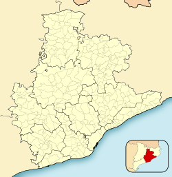
Sant Vicenç de Montalt (Catalan pronunciation: [ˈsam biˈsɛnz ðə munˈtal]), is a municipality in the comarca of the Maresme in Catalonia, Spain. It is situated on the coast between Sant Andreu de Llavaneres and Arenys de Mar, below the el Corredor range, with the main settlement slightly inland. The main N-II road along the coast passes through the municipality, linked to the town by a local road. There are also roads to Arenys de Munt and to Mataró, and a station on the RENFE railway line at Caldes d'Estrac.
Demography
[edit]| 1900 | 1930 | 1950 | 1970 | 1986 | 2007 |
|---|---|---|---|---|---|
| 658 | 823 | 802 | 939 | 1516 | 5267 |
References
[edit]- ^ "Ajuntament de Sant Vicenç de Montalt". Generalitat of Catalonia. Retrieved 2015-11-13.
- ^ "El municipi en xifres: Sant Vicenç de Montalt". Statistical Institute of Catalonia. Retrieved 2015-11-23.
- ^ Municipal Register of Spain 2018. National Statistics Institute.
- Panareda Clopés, Josep Maria; Rios Calvet, Jaume; Rabella Vives, Josep Maria (1989). Guia de Catalunya, Barcelona: Caixa de Catalunya. ISBN 84-87135-01-3 (Spanish). ISBN 84-87135-02-1 (Catalan).
External links
[edit]Wikimedia Commons has media related to Sant Vicenç de Montalt.
- Official website (in Catalan)
- Government data pages (in Catalan)
- Historic heritage in Sant Vicenç de Montalt


