Costilla, New Mexico
Costilla, New Mexico | |
|---|---|
Census-designated place | |
 La Plaza de Arriba in Costilla. | |
| Coordinates: 36°58′43″N 105°32′07″W / 36.97861°N 105.53528°W | |
| Country | United States |
| State | New Mexico |
| County | Taos |
| Area | |
• Total | 3.03 sq mi (7.84 km2) |
| • Land | 3.03 sq mi (7.84 km2) |
| • Water | 0.00 sq mi (0.00 km2) |
| Elevation | 7,805 ft (2,379 m) |
| Population | |
• Total | 177 |
| • Density | 58.49/sq mi (22.59/km2) |
| Time zone | UTC-7 (Mountain (MST)) |
| • Summer (DST) | UTC-6 (MDT) |
| ZIP code | 87524 |
| Area code | 575 |
| GNIS feature ID | 2629108[2] |
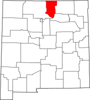
Costilla is a census-designated place in Taos County, New Mexico, United States. Its population was 205 as of the 2010 census.[4] Costilla has a post office with ZIP code 87524.[5][6] State roads 196 and 522 intersect in the community.
History
[edit]
The village of Costilla was originally known as San Miguel, named after its church. On November 1, 1861, the Territory of Colorado created 17 original counties, with San Miguel as the original seat of Costilla County, Colorado Territory. When its post office opened on November 13, 1862, the village selected the new name Costilla, perhaps in recognition of its new status.[7] In 1863, county voters decided to move the county seat 17 miles (27 km) north to San Luis. In 1869, a U.S. government survey determined that Costilla was actually located in the Taos County, New Mexico Territory.[8] It wasn't until October 21, 1872, that the village post office was officially renamed Costilla, New Mexico Territory.[7]
Geography
[edit]According to the U.S. Census Bureau, the community has an area of 3.056 square miles (7.92 km2), all land.[9]
Demographics
[edit]| Census | Pop. | Note | %± |
|---|---|---|---|
| 2020 | 177 | — | |
| U.S. Decennial Census[10][3] | |||
Education
[edit]It is in the Questa Independent Schools school district.[11]
See also
[edit]References
[edit]- ^ "ArcGIS REST Services Directory". United States Census Bureau. Retrieved October 12, 2022.
- ^ a b U.S. Geological Survey Geographic Names Information System: Costilla, New Mexico
- ^ a b "Census Population API". United States Census Bureau. Retrieved October 12, 2022.
- ^ "U.S. Census website". United States Census Bureau. Retrieved May 14, 2011.
- ^ "Postmaster Finder - Post Offices by ZIP Code". United States Postal Service. Archived from the original on April 28, 2019. Retrieved July 11, 2014.
- ^ United States Postal Service (2012). "USPS - Look Up a ZIP Code". Retrieved February 15, 2012.
- ^ a b Bauer, William H.; Ozment, James L.; Willard, John H. (1990). Colorado Post Offices 1859-1989. Golden, Colorado: Colorado Railroad Historical Foundation. ISBN 0-918654-42-4.
- ^ Rosso, Mike (November 1, 2010). "Lines in the sand". Colorado Central Magazine. Retrieved November 10, 2023.
- ^ "2010 Census Gazetteer Files: Places: New Mexico". U.S. Census Bureau. Archived from the original on July 14, 2014. Retrieved July 11, 2014.
- ^ "Census of Population and Housing". Census.gov. Retrieved June 4, 2016.
- ^ "2020 CENSUS - SCHOOL DISTRICT REFERENCE MAP: Taos County, NM" (PDF). U.S. Census Bureau. Retrieved September 4, 2022.
External links
[edit]![]() Media related to Costilla, New Mexico at Wikimedia Commons
Media related to Costilla, New Mexico at Wikimedia Commons


