San Carlos (Equatorial Guinea)
Appearance
(Redirected from San Carlos (volcano))
| San Carlos | |
|---|---|
| Gran Caldera de Luba | |
| Highest point | |
| Elevation | 2,261 m (7,418 ft)[1] |
| Prominence | 1,539 m (5,049 ft)[2] |
| Listing | Ultra Ribu |
| Coordinates | 03°21′39″N 08°32′21″E / 3.36083°N 8.53917°E[1] |
| Geography | |
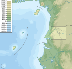
| Location | Bioko, Equatorial Guinea |
| Geology | |
| Mountain type | Shield volcano |
| Last eruption | Unknown |
San Carlos (also Gran Caldera de Luba, or simply Caldera) is a basaltic shield volcano with a broad summit caldera on the island of Bioko, Equatorial Guinea.[3] With an elevation of 2,261 metres above sea level it is the second highest peak in Equatorial Guinea.
See also
[edit]References
[edit]- ^ a b "Africa Ultra-Prominences". Peaklist.org. Retrieved 2014-05-13. Listed as "Gran Caldera de Luba"
- ^ "Gran Caldera de Luba, Equatorial Guinea". Peakbagger.com. Retrieved 2014-05-13.
- ^ "San Carlos". Global Volcanism Program. Smithsonian Institution. Retrieved 2014-05-13.

