Rohožník, Malacky District
Appearance
(Redirected from Rohoznik, Malacky District)
Rohožník
Nádasfő | |
|---|---|
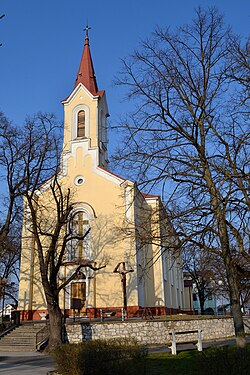
 Church of the Assumption of the Virgin Mary | |
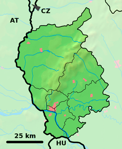
Location of Rohožník in the Bratislava Region Location of Rohožník in Slovakia | |
| Coordinates: 48°27′19″N 17°10′3″E / 48.45528°N 17.16750°E | |
| Country | |
| Region | |
| District | Malacky District |
| First mentioned | 1532 |
| Government | |
| • Mayor | Peter Švaral |
| Area | |
• Total | 27.44 km2 (10.59 sq mi) |
| Elevation | 201 m (659 ft) |
| Population (2021)[3] | |
• Total | 3,557 |
| Time zone | UTC+1 (CET) |
| • Summer (DST) | UTC+2 (CEST) |
| Postal code | 906 38[2] |
| Area code | +421 34[2] |
| Car plate | MA |
| Website | rohoznik |
Rohožník (German: Rohrbach; Hungarian: Nádasfő) is a village in Malacky District in the Bratislava Region of western Slovakia close to the town of Malacky, northwest of Slovakia's capital Bratislava.
History
[edit]First historical record about the village is from book of Hungarian historian Carolus Péterffy "Sacra concilia ecclesiae Romano-inquistitae in regno Hungariae celebrata" from year 1397.
Geography
[edit]The village lies at an altitude of 201 metres and covers an area of 27.44 km2.
References
[edit]- ^ "Hustota obyvateľstva - obce [om7014rr_ukaz: Rozloha (Štvorcový meter)]". www.statistics.sk (in Slovak). Statistical Office of the Slovak Republic. 2022-03-31. Retrieved 2022-03-31.
- ^ a b c "Základná charakteristika". www.statistics.sk (in Slovak). Statistical Office of the Slovak Republic. 2015-04-17. Retrieved 2022-03-31.
- ^ "Počet obyvateľov podľa pohlavia - obce (ročne)". www.statistics.sk (in Slovak). Statistical Office of the Slovak Republic. 2022-03-31. Retrieved 2022-03-31.
External links
[edit]- "..::Obec Rohožník::." rohoznik.sk. Retrieved 2015-11-09.
- Peterffy, C. (1742). Sacra concilia ecclesiae romano-catholicae in regno Hungariae celebrata. Typis Haeredum Royerianrum. Retrieved 2015-11-09.


