Road signs in China
A wide variety of road signs are displayed in the People's Republic of China.

China's traffic signs also closely followed those used in Europe, the US, and Japan. China is not a signatory to the Vienna Convention on Road Signs and Signals.[1] Despite the fact that Chinese is one of the six official languages of the United Nations and China is a permanent member of the UN Security Council, China itself has never signed this convention, which was issued in all six official languages of the UN, including Chinese.
The signs are specified in the Guobiao standard GB 5678-2022.
The road signs used in the special administrative regions of Hong Kong and Macau differ from those used in the rest of China.
Warning signs are triangular in shape, as in Europe, but unlike European countries, warning signs in China have a black border and a yellow background instead of a red border and a white or yellow background. This makes it one of the few countries in the world using this type of warning sign.
Gallery
[edit]Warning signs
[edit]- Warning signs
-
Crossroads
-
Offset road junctions from the left
-
Offset road junctions from the right
-
Fork road on left rear
-
Fork road on right rear
-
Fork road on left front
-
Fork road on right front
-
T-junction ahead
-
Side road junction ahead on the left
-
Side road junction ahead on the right
-
Roundabout
-
Curve to the left
-
Curve to the right
-
Double curve, with turn right first, then left
-
Double curve, with turn left first, then right
-
Multiple curves
-
Multiple curves
-
Steep ascent
-
Steep descent
-
Continued descent
-
Road narrows on both sides
-
Road narrows on right
-
Road narrows on left
-
Narrow bridge
-
Two-way traffic ahead
-
Pedestrian crossing ahead
-
Children ahead
-
Cattle area
-
Deer area
-
Panda area
-
Falling rocks or debris on left
-
Falling rocks or debris on right
-
Dangerous crosswinds
-
Slippery road surface
-
Road near mountain on left
-
Road near mountain on right
-
Riverbank on right
-
Riverbank on left
-
Cross-village road
-
Tunnel ahead
-
Ferry
-
Hump bridge
-
Bumpy road
-
Bump
-
Dip
-
Overflow road
-
Railroad ahead (with safety barriers)
-
Locomotive railroad crossing ahead (without safety barriers)
-
Level crossing (multiple tracks)
-
Cyclists
-
Wheelchairs ahead
-
Accident area
-
Slow
-
Turn left and/or right to detour
-
Turn left to detour
-
Turn right to detour
-
Be careful
-
Roadworks ahead
-
Advisory speed
-
Turn on lights for driving through tunnel
-
Lane with tidal drive
-
Keep a safe distance
-
Crossroads with a dual carriageway
-
T-junction with a dual carriageway
-
Merging traffic on left
-
Merging traffic on right
-
Escape lane
-
2km to escape lane
-
2km to escape lane
-
1km to escape lane
-
1km to escape lane
-
500m to escape lane
-
500m to escape lane
-
Escape lane on right
-
Escape lane on right
-
Snow ahead
-
Rain ahead
-
Fog ahead
-
Thunderstorm ahead
-
Traffic queues likely ahead
Prohibitory signs
[edit]- Prohibitory signs
-
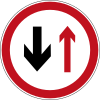
Yield to oncoming traffic
-
No entry for both vehicular traffic and pedestrians
-
Do not enter for vehicular traffic
-
No motor vehicles
-
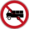
No freight vehicles
-
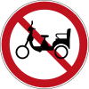
No electric tricycles
-
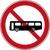
No buses
-
No small passanger vehicles
-
No small passanger vehicles (New)
-
No trailers
-
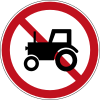
No tractors
-
No motorcycles
-
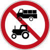
No freight vehicles and tractors
-
No bicycles
-
No horse-drawn vehicles
-
No passenger bikes
-
No freight bikes
-
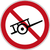
No handcarts
-
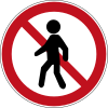
No pedestrians
-
No left turn
-
No left turn for freight vehicles
-
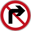
No right turn
-
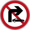
No right turn for small vehicles
-
No proceed straight
-
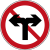
No left and right turns
-
No proceed straight and left turns
-
No proceed straight and right turns
-
No U-turns
-
No overtaking
-
End of overtaking prohibition
-
No stopping
-
No parking
-
No honking
-
Maximum width
-
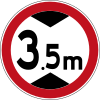
Maximum height
-
Maximum weight
-
Maximum weight per axle
-
Maximum speed limit
-
End of maximum speed limit
-
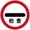
Control
-
No vehicles carrying dangerous goods
-
Customs
-
Speed limit zone
-
End of speed limit zone
-
No parking zone
-
End of no parking zone
-
No stopping zone
-
End of no stopping zone
Indicative signs
[edit]- Indicative signs
-
Proceed straight
-
Turn left
-
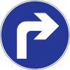
Turn right
-
Proceed straight and/or turn left
-
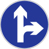
Proceed straight and/or turn right
-
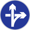
Turn left and/or right
-
Keep right side
-
Keep left side
-
Proceed straight and turn left via ramp of Cloverleaf interchange
-
Proceed straight and turn right via ramp of interchange
-
One-way street to right side
-
One-way street
-
Pedestrians only
-
Honking
-
Minimum speed limit
-
Priority at junction
-
Priority over oncoming vehicles
-
Crosswalk
-
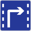
Lane for turn right
-
Lane for turn left
-
Lane for proceed straight
-
Lane for proceed straight and turn right
-
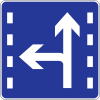
Lane for proceed straight and turn left
-
Lane for U-turn
-
Lane for U-turn and turn left
-
Lane for automobile
-
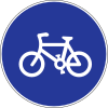
Bicycles only
-
Lane for bicycles
-
Lane for Bus rapid transit
-
Parking place
-
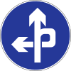
Parking place on left
-
Parking place on right
-
Parking place on roadside
-
U-turn
Informational signs
[edit]- Informational signs
-
After driving 500m (northbound), turn left to Nanjing road, proceed straight to G2, or turn right to Dongbei road on crossroads
-
After driving 500m (eastbound), turn left to Wuai street, proceed straight to Tiancun road, or turn right to Tiancun
-
Turn left and drive 500m to Yuanda road, proceed straight to Zhiquan road, or turn right and drive 500m to Linyuan road
-
Turn left and drive 500m to Erlong road, or turn right and drive 500m to Huanghe road
-
After driving 500m (westbound), turn left to Nanzhi road, proceed straight to Changjiang road, or turn right to Fucheng road on the Xueyuan road crossing
-
On northbound, turn left to Nanjing road, proceed straight to G2, or turn right to Dongbei road on crossroads
-
On westbound, turn left to Wuyi road direction of G108, proceed straight to Hongqi road, or turn right to Renmin road direction of G108 on crossroads
-
On westbound, proceed straight to Xuefu road, turn left to Gongbin road, or turn right to Huanghe road
-
On eastbound, turn left to Nanzhi road, proceed straight to Changjiang road, or turn right to Fucheng road on the Xueyuan road crossing
-
Turn left and drive 15 km to Mingshanshi, or turn right and drive 18 km to Yongtai
-
On eastbound, proceed straight to Chenglinzhuang road, or turn right to Chenglin avenue
-
On westbound of interchange, turn left via ramp to Weijin south road, or proceed straight to Hubei road
-
On westbound of interchange, proceed straight to Old street, or turn right via ramp to Third street
-
On southbound, turn left to Wenhui road, or turn right to Xuzhuang road
-
Turn left to Wangping, or turn right to Xinyu
-
On westbound of interchange, turn left via ramp to Langfang, proceed straight to Maju bridge, or turn right via ramp to Dayangfang
-
Turn left to Zhonghuan
-
Turn right to Waihuan
-
National Highway sign, in this case G105
-
Provincial Highway sign, in this case S203
-
County Highway sign, in this case X008
-
Rural Highway sign, in this case Y002
-
Xinjiekou Waidajie Street
-
Xitucheng road, this segment leading south has addresses 123-192 and the segment going north has addresses 193-220
-
Driving 2 km to Nanzhi road, 15 km to Bayi road, or 25 km to G101
-
Mt Kunlun, 2247m elevation
-
Entering Beijing
-
Hospital up ahead
-
Low-flying aircraft
-
Fuel station + car wash
-
Parking
-
Parking up ahead
-
Emergency lay-by
-
Disabled parking
-
Rest stop + park, to the right
-
Rest stop + park, to the left
-
Pedestrians / Emergency shelter
-
Rest area (left)
-
Rest area (right)
-
Alternative route to street desired
-
Alternative route to street desired
-
Alternative route for height-restricted vehicles
-
Cul-de-sac/dead end
-
3-lane road merges to 2 lanes
-
4-lane road merges to 3 lanes
-
2-lane road expands to 3 lanes
-
Traffic cameras up ahead
-
2500m remaining in tunnel
-
2500m remaining in tunnel (alt.)
-
Chevron to left
-
Chevron to right
-
Chevron left two arrow
-
Chevron left three arrow
-
T junction to left or right
-
Hazard maker or pass either side
-
Hazard maker right
-
Hazard maker left
-
Exit (left)
-
Exit (right)
-
Exit to expressway (left)
-
Exit to expressway (right)
-
National expressway sign without name below, in this case G2
-
Provincial expressway sign without name below, in this case S9
-
National expressway sign with name below, in this case G2 Jinghu
-
Freeway name (ie: FoShan 1st Ring Road)
-
Suzhou City Area (5 exits)
-
Next exit (Nanjing Road) in 4km
-
Next exit (Exit#3) in 4km
-
Next exit in 4km
-
Freeway exit (Exit#113)
-
Freeway exit (left exit) (Exit#48)
-
Name of freeway
-
G15 Freeway ends in 2km
-
G15 Freeway ends in 1km
-
G15 Freeway ends in 500m
-
Freeway ends in 2km
-
Freeway ends in 1km
-
Freeway ends in 500m
-
Freeway ends in 200m - Reduce speed
-
G15 Freeway end
-
G1511 Freeway end
-
ShuiGuan Freeway end
-
Tune to 1620kHz for traffic info
-
Danger of tailgating (ie: high traffic zone) - Keep your distance
-
Maintain a distance of 200m from the vehicle ahead
-
0 metres ahead
-
50 metres ahead
-
100 metres ahead
-
Advisory speed in fog: 60 km/h
-
Advisory speed in fog: 50 km/h
-
Emergency telephone
-
Emergency telephone from the left
-
Emergency telephone from the right
-
Emergency telephone on both sides
-
2 km to toll gate
-
1 km to toll gate
-
500 m to toll gate
-
Toll gate
-
2 km to toll gate that supports ETC
-
1 km to toll gate that supports ETC
-
500 m to toll gate that supports ETC
-
Toll gate that supports ETC
-
Gas station
-
Full Service area (TianMuHu is the name of the service area) in 2km
-
TianMuHu Service area exit
-
DongLuShan Service area exit
-
LangWang rest area
-
outdoor parking area
-
indoor parking area
-
Dedicated climbing lane for large trucks
-
Dedicated climbing lane (right lane) for large trucks
-
Northbound
-
Exit to Southbound
-
Exit to Northbound
-
Exit to Southbound
-
Exit to Northbound
-
Westbound
Tourist signs
[edit]- Tourist signs
-
Sun
-
City rock turns
-
city rock keep
-
Information
-
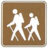
Hiking
-
Cable car
-
Camp
-
Fireplace or campsite
-
Playground
-
Equestrianism
-
Fishing
-
Golf
-
Swimming
-
Rowing
-
Snow
-
Skiing
-
Ice-skating
Additional signs
[edit]- Additional signs
-
Event time
-
Except for bus
-
Cars
-
Trucks
-
Trucks and tractors
-
Private property
-
One way (straight)
-
Two way
-
One way (right)
-
One way (left)
-
keep (left)
-
keep (right)
-
Turn right
-
Turn left
-
___ metres ahead (straight)
-
___ metres ahead (left)
-
___ metres ahead (both ways)
-
___ metres ahead (right)
-
School
-
Customs
-
Accident
-
Collapsing area
-
Training route
-
Assessment route
Vehicle-mounted signs
[edit]- Vehicle-mounted signs
-
No drink driving
-
No littering
-
Sharp bend, slow down
-
Sharp bend, slow down
-
Sharp bend and dip, slow down
-
Sharp bend and dip, slow down
-
Fasten your seatbelt
-
Heavy vehicles keep right
-
No hand-held phone while driving
-
School bus stop
Retired Signs
[edit]-
Old triangular version of stop sign
References
[edit]- ^ "Article 29". Convention on Road Signs and Signals (PDF). United Nations Treaty Series (in English, French, Chinese, Russian, and Spanish). Vol. 1091. Vienna. 8 November 1968. p. 27 – via United Nations Treaty Collection.
{{cite book}}: CS1 maint: location missing publisher (link)


