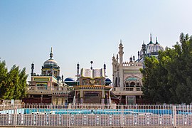
Rahim Yar Khan
Rahim Yar Khan
رحیم یار خاں | |
|---|---|
| Rahim YAR Khan | |
| Coordinates: 28°25′12″N 70°18′0″E / 28.42000°N 70.30000°E | |
| Country | |
| Province | |
| District | Rahim Yar Khan |
| Area | |
• Total | 210.2 km2 (81.2 sq mi) |
| Elevation | 83 m (272 ft) |
| Population | |
• Total | 517,000 |
| • Density | 2,500/km2 (6,400/sq mi) |
| Time zone | UTC+5 (PST) |
| Postal code | 64200 |
| Calling code | 068 |
| Number of tehsils | 4 |
| Number of Union councils | 139 |
| Website | rykhan |
Rahim Yar Khan (Urdu: رحیم یار خان, romanized: Rahīm Yār Khān; Urdu pronunciation: [ɾəɦiːm jɑːɾ xɑːn]) is a city in the Punjab, Pakistan. It is the 16th most populous city in Pakistan and is the capital of the Rahim Yar Khan District. The city's administration is divided into nine Union Councils.[2]
Famous Places
[edit]- City Pull
- City Centre
- Royal Desert Palm Hotel
- Taj Mahal Marquee
- Etihad Club
- Shaikh Zayed International Airport
- Gulberg Town
- Dari Sangi Canal
- KFUEIT
- Etihad Town
- Zam Zam Ladies Park
- Jugnoo Park
- City Park RYK
- Press Club Chok
- Town Hall
- Abbasia Under Pass
- Govt. Khawaja Fareed Graduate College
- Dua Chowk
- Bhong Mosque
- Patan Minara
- Islam Garh Fort
History
[edit]Rahim Yar Khan has been renamed several times over the last 5,000 years. The earliest recorded name was AROR or ALOR, and then it became City of Pattan, Phul Wada, Noshehra and now Rahim Yar Khan. The ancient tower of Pattan Minarah stands 13 km to the south of the city center in its original form. Umayyads led by Muhammad Bin Qasim conquered the cities of Aror, Uch and Multan after conquest of Sindh.[3]
Rahim Yar Khan region was part of Multan province of Mughal Empire.[4] In 1881, Nawab of Bahawalpur gave the city its current name by naming it after his first born son and crown prince Rahim Yar Khan.
Rahim Yar Khan has had the status of a separate district since 1943. The district derives its name from its headquarters, the city of Rahim Yar Khan, which was known as "Naushehra" until 1881. To avoid confusion with the similarly named city of Nowshera, the ruler of Bahawalpur, Nawab Sadiq Khan IV, renamed it after his first son, Rahim Yar Khan (1877–1881).[5]
Demographics
[edit]The population of the city is 517,000 during the 2023 census.[1]
Education
[edit]Universities and colleges
[edit]- Army Public School and College
- Islamia University of Bahawalpur, RYK campus
- Khawaja Fareed University of Engineering and Information Technology
- National College of Business Administration and Economics
- Punjab Colleges
- Shaikh Zayed Medical College and Hospital
Schools
[edit]Transport
[edit]
Airport
[edit]Shaikh Zayed International Airport is located in Rahim Yar Khan. It serves the people of city with domestic and international flights.[6] There are daily flight from this airport to Karachi, twice in a week to/from Lahore, and once a week to Islamabad.
Railway
[edit]
Rahim Yar Khan is connected with rest of the country by rail. The Rahim Yar Khan railway station is a major railway station of Pakistan Railways on the Karachi-Peshawar Railway Line.
Notable people
[edit]- Aima Baig, singer
- Asim Saleem Bajwa, Lieutenant general (Pakistan)
- Talha Chahour, actor
- Saima Akram Chaudhry, Pakistani screenwriter
- Abdullah Darkhawasti, Pakistani Sunni Islamic scholar
- Fida-Ur-Rehman Darkhawasti, Islamic scholar, academic person and politician
- Muniba Mazari, social activist
References
[edit]- ^ a b "Rahim Yar Khan, Pakistan Metro Area Population 1950-2024". macrotrends.net. Retrieved 5 February 2024.
- ^ "county & Unions in the District of Rahim Yar Khan". National Reconstruction Bureau, Government of Pakistan website. Archived from the original on 9 February 2012. Retrieved 16 May 2023.
- ^ Firishtah, Muḥammad Qāsim Hindū Shāh Astarābādī (1770). The History of Hindostan. T. Becket and P.A. De Hondt.
- ^ Dasti, Humaira Faiz (1998). Multan, a Province of the Mughal Empire, 1525–1751. Royal Book. ISBN 978-969-407-226-5.
- ^ "Brief History of Rahim Yar Khan". District Courts Rahim Yar Khan website. Retrieved 16 May 2023.
- ^ "Shaikh Zaid Airport– Rahim Yar Khan, Pakistan".


