Ratcliffe-on-Soar
| Ratcliffe-on-Soar | |
|---|---|
| Village and civil parish | |
 | |
 Parish map | |
Location within Nottinghamshire | |
| Area | 1.77 sq mi (4.6 km2) |
| Population | 147 (2021) |
| • Density | 83/sq mi (32/km2) |
| OS grid reference | SK 495295 |
| • London | 105 mi (169 km) SSE |
| District | |
| Shire county | |
| Region | |
| Country | England |
| Sovereign state | United Kingdom |
| Post town | NOTTINGHAM |
| Postcode district | NG11 |
| Dialling code | 01509 |
| Police | Nottinghamshire |
| Fire | Nottinghamshire |
| Ambulance | East Midlands |
| UK Parliament | |
Ratcliffe-on-Soar, sometimes written Ratcliffe-upon-Soar[1] or Radcliffe-on-Soar,[2] is a village and civil parish in Nottinghamshire on the River Soar.
Geography
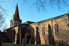
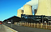
[edit]It is part of the Rushcliffe district, and is the site of Ratcliffe-on-Soar Power Station. Nearby places are Kingston on Soar, Kegworth and Trentlock. With a population measured at 141 in the 2011 Census,[3] and marginally increasing to 147 residents at the 2021 census,[4] the parish is too small to have a parish council and so has a parish meeting. Although the village does not contain any shops, it has a church and a marina which is often affected by severe flooding as it built on designated floodplain, just before the Soar joins the River Trent at Trentlock.[5]
History
[edit]Mesolithic scrapers and Neolithic flints have been found in Ratcliffe-on-Soar.[6]
Ratcliffe is one of three nearby settlements whose name preserves the Brittonic word for "ramparts" (cf. Gaelic rath ), along with Ratby and the Roman ruins at Leicester, known as Ratae Corieltauvorum.[7]
Evidence of a Roman villa and other structures has been found in the village, as well as Roman pottery.[8]
In the Domesday Book of 1086 the village is listed as Radeclive.[9] It's also thought the name comes from references to the red clay along the cliffs of the Soar.[10]
The area was a filming location for the 2010 movie Skeletons.
Economy
[edit]Ratcliffe-on-Soar Power Station was the last coal power plant in the UK, closing on 30 September 2024.
Transport
[edit]The Midland Main Line runs by the village, which is served by the East Midlands Parkway railway station. A shuttle bus service runs from the railway station to East Midlands Airport.[11]
See also
[edit]References
[edit]- ^ GENUKI. "Genuki: Ratcliffe on Soar, Nottinghamshire". www.genuki.org.uk. Retrieved 12 February 2024.
- ^ "Nottinghamshire history > Articles > Transactions of the Thoroton Society > Summer Excursion 1924: Radcliffe-on-Soar. Holy Trinity Church". www.nottshistory.org.uk. Retrieved 12 February 2024.
- ^ "Civil Parish population 2011". Neighbourhood Statistics. Office for National Statistics. Retrieved 14 April 2016.
- ^ UK Census (2021). "2021 Census Area Profile – Ratcliffe on Soar parish (E04007994)". Nomis. Office for National Statistics. Retrieved 12 February 2024.
- ^ National Rivers Authority - The Soar Valley Improvement Scheme
- ^ Archi UK
- ^ Thompson, James. The History of Leicester, from the Time of the Romans to the End of the Seventeenth Century, Appendix A: Ratæ—Roman Leicester, pp. 443 ff. J. S. Crossley (Leicester), 1849.
- ^ Archi UK
- ^ Archi UK
- ^ "Ratcliffe on Soar :: Survey of English Place-Names". epns.nottingham.ac.uk. Retrieved 12 February 2024.
- ^ Eat Midlands Airport - By Train
External links
[edit]![]() Media related to Ratcliffe on Soar at Wikimedia Commons
Media related to Ratcliffe on Soar at Wikimedia Commons


