South Papua
South Papua
Papua Selatan | |
|---|---|
| Province of South Papua Provinsi Papua Selatan | |
| Motto(s): | |
 | |
| Country | |
| Capital | Salor, Merauke |
| Largest city | Merauke, Merauke |
| Government | |
| • Body | South Papua Provincial Government |
| • Governor | Rudy Sufahriadi (acting) |
| • Vice Governor | Vacant |
| Area | |
• Total | 129,715.02 km2 (50,083.25 sq mi) |
| Population ([1]) | |
• Total | 537,973 |
| • Density | 4.1/km2 (11/sq mi) |
| Languages | |
| • Official language | Indonesian |
| • Native languages of South Papua | Asmat, Boazi, Citak, Kolopom, Korowai, Marind, Mombum, Muyu, Wambon, Yaqay, and others |
| • Also spoken | Javanese, Papuan Malay, and others |
| Demographics | |
| • Religions |
|
| • Ethnic groups | Asmat, Kombai, Korowai, Marind, Marori, Sawi, Wambon (natives), Javanese (migrant), and others |
| Time zone | UTC+9 (Indonesia Eastern Time) |
| HDI (2024) | |
| Website | papuaselatan |
South Papua, officially the South Papua Province (Indonesian: Provinsi Papua Selatan),[4] is an Indonesian province located in the southern portion of Papua, following the borders of the Papuan customary region of Anim Ha.[5][6] Formally established on 11 November 2022 and including the four most southern regencies that were previously part of the province of Papua and before 11 December 2002 had comprised a larger Merauke Regency, it covers a land area of 129,715.02 km2, about the same area as Pennsylvania (or 90% of that of England). This area had a population of 513,617 at the 2020 Census,[7] while the official estimate as at mid 2023 was 537,973,[1] making it the least populous province in Indonesia.
It shares land borders with the separate nation of Papua New Guinea to the east, as well as the Indonesian provinces of Highland Papua and Central Papua to the north and northwest, respectively. South Papua also faces the Arafura Sea in the west and south, which is a maritime border with Australia. Merauke is the economic centre of South Papua, while its administrative centre is the town of Salor located in Kurik District of Merauke Regency, around 60 km northwest of Merauke town.[8]
South Papua landscape predominantly consists of lowland areas characterized by extensive swamps and massive rivers such as the Digul and Maro. Indigenous ethnic group inhabiting this region for example Asmat, Marind, Muyu, and Korowai. They rely on sago and fish as staple dietary sources. Certain tribes like Asmat were recognized for its wood carving and boating culture. There is also massive amount of migrant like Javanese people because of transmigration program sponsored by the government to convert vast amount of swamps into rice paddy and increase this region's population. South Papua is also home to the renowned Wasur National Park, an expansive wetland area with rich biodiversity including agile wallaby, mound-building termites or musamus, and the bird of paradise.[9][10][11][12]
History
[edit]The wetland region of South Papua, before the arrival of Europeans, was home to several indigenous tribes. These tribes included the Asmat, Marind and Wambon, who still maintain their ancestral traditions in the area. The Marind tribe, also known as the Malind, lived in groups along the rivers in the Merauke region, and their way of life centered around hunting, gathering, and farming. However, the Marind tribe was also notorious for their practice of headhunting. They would travel in boats along the rivers and coasts to distant settlements, where they would behead the inhabitants. The heads of their victims would then be taken back to their villages to be preserved and celebrated.[13][14][15]

In the 19th century, European powers began to colonize the island of New Guinea. The island was divided along a straight line, with the western portion falling under the jurisdiction of the Dutch New Guinea region and the eastern portion becoming British New Guinea. Marind people often crossed the border to engage in headhunting activities. In 1902, the Dutch established a military base at the eastern tip of South Papua, near the Maro River, to strengthen the border and eliminate this tradition. This base was named Merauke, after its location. The Dutch also established a Catholic mission in Merauke to spread their religion and to further discourage the practice of headhunting. During the Dutch colonial period, the Javanese people were brought to Merauke to cultivate rice fields. This influx of laborers further contributed to the growth of the town and the development of the surrounding region. Eventually, it became the capital of Afdeeling Zuid Nieuw Guinea or the South New Guinea Province.[13][15]
In addition to the Maro River, the Dutch also became aware of another, larger river known as the Digul River. In the 1920s, the Dutch government sent an expedition to explore the interior of Papua. The idea emerged to use the remote region as a detention camp, and a suitable location was identified at the headwaters of the Digul River or Boven-Digoel. A concentration camp called Tanah Merah was established, it was a densely forested area surrounded by the harsh Digul River, making it difficult for prisoners to escape. Additionally, the region was plagued by malaria, which further discouraged escape attempts. Over the years, several notable figures were detained at the camp, including Mohammad Hatta and Sutan Sjahrir. After the Dutch left in the 1960s, Tanah Merah became more populated and eventually became the capital of the Boven Digoel Regency.[15][16][17]

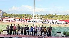
In the 1960s, Indonesian forces took control of all of Dutch New Guinea, including the former Zuid Nieuw Guinea. Following the takeover, the territory was reorganized, and the former Zuid Nieuw Guinea became the Merauke Regency, with its capital located in Merauke. On 11 December 2002, the Merauke Regency was further divided into four separate regencies: Merauke, Mappi, Asmat, and Boven Digoel. These regencies were established to better serve the needs of the local populations and provide more effective governance across the region. More recently, on 25 July 2022, the former territory of the Merauke Regency was officially re-united with other regions in southern Papua to form the new province of South Papua, following the signing of Law No. 14/2022. The name "South Papua" (Papua Selatan) was chosen instead of "Anim Ha" due to the latter term's historical origins during Dutch rule and its potential to be demeaning to other tribes in southern Papua. In contrast, "South Papua" was selected as an inclusive and unifying name that avoids any negative connotations and reflects the diverse and vibrant cultural heritage of the region.[4] The public reception towards South Papua was far more positive compared to the other new provinces of Central Papua and Highlands Papua,[18] with residents spreading a giant Indonesian flag in front of the regent office of Merauke after the province's establishment.[19]
In 2007, the Regent of Merauke, John Gebze, spearheaded the initiation of the Merauke Integrated Food and Energy Estate (MIFEE), a large-scale development project aimed at enhancing Indonesia's food security. Situated in Merauke, an area renowned for its extensive lowland and fertile terrain, the project sought to capitalize on the region's vast land for agricultural purposes. Originally dubbed the Merauke Integrated Rice Estate (MIRE), with a primary focus on rice cultivation, the initiative later broadened its scope to encompass additional crops such as sugar cane, corn, and oil palm. Officially inaugurated in 2010 during the presidency of Susilo Bambang Yudhoyono, the project garnered participation from numerous private investors. However, its progression faced significant challenges, stemming from divergent perspectives among government entities, investors, and the indigenous Marind community, who held land rights in the area. Furthermore, mounting pressure from non-governmental organizations (NGOs) decrying the project as a violation of indigenous rights and environmental degradation prompted a cessation of new land development activities by the involved companies.[20][21][22] During the time of President Joko Widodo, the Food Estate project was revived in various regions with 200,000 hectares of land designated for Papua Island. The main commodities are corn and rice and are located, among others, in Mappi, Boven Digoel and Merauke.[23]
Geography
[edit]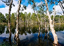
Geographically, most of the South Papua region is located in lowland area which are dominated by two ecoregions or geographical areas that include an ecosystem and biodiversity within it. These ecoregions are Southern New Guinea freshwater swamp forests and Southern New Guinea lowland rain forests. These two ecoregions are crossed by large rivers originated from New Guinea Highlands which is the highest mountainous area in Indonesia.[24] In South Papua, many sago trees are found, which are a staple food for local tribes. Sago thrives in lowland environments and exhibits robust growth even in areas prone to flooding, including swamps, coastal regions, peatlands, and along riverbanks.[25]

Additionally, there is a smaller but unique ecoregion called Trans-Fly savanna and grasslands which are part of Wasur National Park, a Ramsar wetland of international importance.[26] This ecoregion consists of swamp forest, coastal forest, and vast savanna that are flooded at various times, creating a wetland area with massive biodiversity like agile wallaby, mound-building termites or musamus, and the bird of paradise. This wetland also attracts migratory bird for example magpie goose from Australia, also known locally as Boha Wasur.[24][27]
The South Papua region was designated as a transmigration program site due to its expansive lowland areas with vast amount of water which offer ideal conditions for rice cultivation. Transmigration districts such as Semangga, Tanah Miring, and Kurik serve as primary sources of agricultural produce destined for markets in the City of Merauke. However, the influx of migrant populations into these areas has introduced non-native species, such as Javan rusa and tilapia fish, which disrupt the established ecosystem. Particularly, the adaptable tilapia fish proliferates rapidly in this environment, outcompeting indigenous fish species and consequently dominating the catches of fishermen in Merauke's rivers.[24][28][29]
Politics
[edit]Government and administrative divisions
[edit]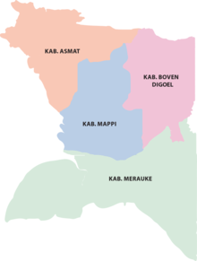
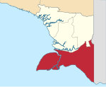
South Papua is divided into four regencies (kabupaten), the least amount compared to other Indonesian provinces. Before 11 December 2002, all four of the current regencies comprised a single Merauke Regency, which was split into the present four regencies on that date. The table below gives the areas of all the regencies,[30] together with their populations at the 2020 Census[7] and according to the official estimates as of mid-2023.[1]
| Kode Wilayah |
Name of Regency |
Seat | Regent | Area in km2 |
Pop'n Census 2020 |
Pop'n Estimate mid 2023 |
HDI[31] 2022 |
No. of districts |
No. of villages |
Coat of arms |
Location map |
|---|---|---|---|---|---|---|---|---|---|---|---|
| 93.01 | Merauke Regency | Merauke | Romanus Mbaraka | 45,013.35 | 230,932 | 243,722 | 0.712 (High) | 20 | 190 |  |
|
| 93.02 | Boven Digoel Regency | Tanah Merah | Hengky Yaluwo | 27,108.29 | 64,285 | 67,760 | 0.625 (Medium) | 20 | 112 |  |

|
| 93.03 | Mappi Regency | Kepi | Krisostomus Yohanes Agawemu |
25,609.94 | 108,295 | 110,291 | 0.596 (Medium) | 15 | 164 |  |

|
| 93.04 | Asmat Regency | Agats | Elisa Kambu | 31,983.44 | 110,105 | 116,200 | 0.522 (Low) | 19 | 221 |  |

|
Totals
|
129,715.02 | 513,617 | 537,973 | 74 | 687 | 
| |||||
The province now forms one of Indonesia's 84 national electoral districts to elect members to the People's Representative Council. The South Papua Electoral District consists of all of the 4 regencies in the province, and elects 3 members to the People's Representative Council.[32]
Demographics
[edit]| Year | Pop. | ±% |
|---|---|---|
| 1971 | 160,727 | — |
| 1980 | 172,662 | +7.4% |
| 1990 | 243,722 | +41.2% |
| 2000 | 291,680 | +19.7% |
| 2010 | 409,735 | +40.5% |
| 2020 | 513,617 | +25.4% |
| 2023 | 537,973 | +4.7% |
| Source: Statistics Indonesia 2024 and earlier. South Papua was part of Papua Province until 2022. | ||
South Papua had a population of 513,617 at the 2020 Census,[7] while the official estimate as at mid 2023 was 537,973 and making it the least populous province in Indonesia.[1]
South Papua is inhabited by local Papuan people from various ethnic group. South Papua are part of customary region of Anim Ha, a distinct region with unique culture compared to other parts of Papua owing to its geography located in lowland area with vast amount of wetland and large rivers. Some of the ethnic group living here including Marind people (with subgroups such as Kimaam) and Yei people in Merauke, Muyu and Wambon people in Boven Digoel, Awyu and Wiyagar people from Mappi, and Asmat people from Asmat. There are also isolated ethnic group found in the border near Highland Papua province like Kombai and Korowai people. Each of the ethnic groups mentioned have unique language.[33]
Religion
[edit]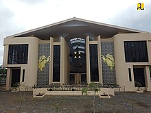
According to Ministry of Home Affairs, the percentage of religion in South Papua in 2023 is 72.57% Christianity (49.62% Catholic and 22.95% Protestant), 27.28% Islamic, 0.11% Hindu, and 0.04% Buddhist. Thus, South Papua is the only province on the island of Papua with a percentage of Catholicism that exceeds other religions. This significant number of Catholic residents supports the formation of Roman Catholic Archdiocese of Merauke and Roman Catholic Diocese of Agats which are the ecclesiastical province in the Roman Catholic Church led by either archbishop or bishop.[34][35]
Culture
[edit]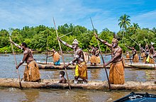
The native Papuan people have a distinct culture and traditions that cannot be found in other parts of Indonesia. Coastal Papuans are usually more willing to accept modern influence into their daily lives, which in turn diminishes their original culture and traditions. Meanwhile, most inland Papuans still preserve their original culture and traditions, although their way of life over the past century is tied to the encroachment of modernity and globalization.[36] Each Papuan tribe usually practices its traditions and culture, which may differ greatly from one tribe to another.
Hunting as practiced by Marind people usually begins with a traditionally controlled burn of peat bog and swamps, it was then left for three days to a week for new shoots to grow, which will invite game animals such as deer, pigs, saham (Notamacropus agilis). The hunting party consists of usually of 7-8 people, then go to the burned locations while bringing food and drink, ranging from tubers, sago, to drinking water, for several days. A temporary hut called bivak would be constructed from barks from Bus, a type of eucalyptus tree to form the walls and the roof made from Lontar leaves.[37] As with many coastal communities from the Moluccas to Papua, Sasi is practiced, which are markers usually constructed from wood and janur to mark the prohibition of harvesting either from land or sea for a while to preserve natural resources and for sustainable harvest.[38] To open and close sasi regions such as forests, usually the Marind-Kanume mark with two arrows shot to the west and to the east to respect three clans that inhabited the area as well as other rituals which can take up to forty days. Violators of the prohibition would be punished with payment of Wati leaves and pigs. Failure of payments will result in referral to local security officers to be put on trial.[39]
Wood carving
[edit]
Asmat people are famous internationally for their wood carving. Some of its carving can be found in various museum for example in Asmat Museum of Culture and Progress. Asmat carvings have various motifs such as nature, living creatures, and everyday life. The Asmat people consider that carvings are not only works of art but part of their religious rituals to connect with their ancestors. Asmat carvings are made from local materials such as Merbau and nutmeg wood. One of the famous Asmat carvings is the Bisj Pole which measures more than 3 meters. This pillar consists of figures arranged in tiers. This figure represents the spirits of ancestors killed by their enemies. The top of the pole is decorated like wings.[40][41][42]
Due to the swampy terrain and extensive river networks in South Papua, numerous tribes rely on boats for their daily transportation needs. These traditional vessels, known as perahu lesung, are crafted by hollowing out the center of a single tree trunk and are often embellished with intricate carvings. Typically, these boats are propelled by multiple individuals standing upright and rowing. In ancient times, the Asmat people utilized these boats not only for transportation but also as integral elements of their headhunting customs, which instilled fear in neighboring communities. Historically, Asmat residents would navigate their boats to distant villages, where they would carry out raids and massacres on the inhabitants.[43][44]
Architecture
[edit]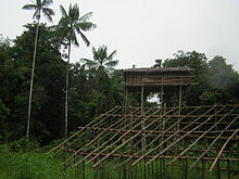
The Korowai people from the Mappi Regency in southern Papua are one of the indigenous tribes in Papua that still adhere to the traditions of their ancestors, one of which is to build houses on top of tall trees called Rumah Tinggi (lit. 'high house'). Some of the Korowai people's tree houses can even reach a height of 50 m above the ground. The Korowai people build houses on top of trees to avoid wild animals and evil spirits. The Korowai people still believe in the myth of Laleo, a cruel demon who often attacks suddenly. Laleo is depicted as an undead that roams at night. According to the Korowai people, the higher the house, the safer it will be from Laleo's attacks. The rumah tinggi is built on big and sturdy trees as the foundation for its foundation. The tops of the trees are then deforested and used as houses. All materials come from nature, logs and boards are used for the roof and floor, while the walls are made of sago bark and wide leaves. The building process for a rumah tinggi usually takes seven days and the structure then lasts up to three years.[45][46]
Cuisine
[edit]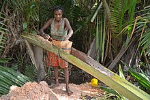
The staple food of South Papua, in general, is sago, but some tribes also have other staple foods; for example, bananas,[47] ubi (Dioscorea alata), keladi (Colocasia esculenta), sweet potato (Ipomoea batatas), and sukun (Artocarpus incisa and Artocarpus camansi).[48] Sago is either processed as a pancake or sago congee called papeda, usually eaten with yellow soup made from tuna, red snapper or other fishes spiced with turmeric, lime, and other spices. On some coasts and lowlands in Papua, sago is the main ingredient in all the foods. Sagu bakar, sagu lempeng, and sagu bola, have become dishes that are well known to all of Papua, especially in the custom folk culinary tradition of Mappi, Asmat, and Mimika. Papeda is one of the sago foods that is rarely found.[49] As Papua is considered a non-Muslim majority region, pork is readily available everywhere. In Papua, pig roast which consists of pork and yams roasted in heated stones placed in a hole dug in the ground and covered with leaves; this cooking method is called bakar batu (burning the stone), and it is an important cultural and social event among Papuan people.[50] The Marind people used this cooking method or using burning bomi thermite mound made by Macrotermes sp to cook a pizza-like dish called "Sagu Sef", which is made from dough from sago and coconut with sago grub and deer meat. Spices used can include shallot, garlic, coriander, pepper, and salt, which are then mixed and covered with banana leaves, to cook it evenly hot stones or bomi would be put on top of the dish.[51]

Common Papuan snacks are usually made out of sago. Kue bagea (also called sago cake) is a cake originating from Ternate in North Maluku, although it can also be found in Papua.[52] It has a round shape and creamy color. Bagea has a hard consistency that can be softened in tea or water, to make it easier to chew.[53] It is prepared using sago,[54] a plant-based starch derived from the sago palm or sago cycad. Sagu Lempeng is a typical Papuan snack that is made in the form of processed sago in the form of plates. Sagu Lempeng is also a favorite for travelers. But it is very difficult to find places to eat because this bread is a family consumption and is usually eaten immediately after cooking. Making sago plates is as easy as making other breads. Sago is processed by baking it by printing rectangles or rectangles with iron which is ripe like white bread. Initially tasteless, but recently it has begun to vary with sugar to get a sweet taste. It has a tough texture and can be enjoyed by mixing it or dipping it in water to make it softer.[55] Sago porridge is a type of porridge that is found in Papua. This porridge is usually eaten with yellow soup made of mackerel or tuna then seasoned with turmeric and lime. Sago porridge is sometimes also consumed with boiled tubers, such as those from cassava or sweet potato. Vegetable papaya flowers and sautéed kale are often served as side dishes to accompany the sago porridge.[56] In the inland regions, Sago worms are usually served as a type of snack dish.[57][58] Sago worms come from sago trunks which are cut and left to rot. The rotting stems cause the worms to come out. The shape of the sago worms varies, ranging from the smallest to the largest size of an adult's thumb. These sago caterpillars are usually eaten alive or cooked beforehand, such as stir-frying, cooking, frying, and then skewered. But over time, the people of Papua used to process these sago caterpillars into sago caterpillar satay. To make satay from this sago caterpillar, the method is no different from making satay in general, namely on skewers with a skewer and grilled over hot coals.[59]
Economy
[edit]Agriculture and forestry
[edit]
The vast and fertile geography of South Papua offers abundant agricultural potential. Since the Dutch colonial era, the region has seen the importation of Javanese settlers to cultivate rice fields, particularly in Merauke. This practice continued through the transmigration program post-independence. Consequently, traditional local staples such as sago and tubers have gradually been supplanted by rice and instant food options.[60]
In 2010, the government under Susilo Bambang Yudhoyono initiated the Merauke Integrated Food and Energy Estate (MIFEE) program, aimed at positioning Merauke Regency as one of Indonesia's primary food hubs. Targeted crops under this program encompass rice, corn, and oil palm. However, the project encountered setbacks due to disputes between governmental bodies, corporations, indigenous groups, and non-governmental organizations (NGOs) concerning environmental degradation and alleged human rights infringements against indigenous communities. Consequently, no further land was developed under the initiative.[20][21][22]
In South Papua, extensive oil palms plantations are established in Merauke and Boven Digoel, managed primarily by large corporations. Notably, PT Tunas Sawa Erma (TSE), a subsidiary of Korindo from South Korea, is actively involved in this sector. In addition to palm oil, Korindo is engaged in the timber industry. Under the TSE Group umbrella, operations span across Merauke and Boven Digoel, comprising several subsidiaries, including PT Tunas Sawa Erma (TSE), PT Dongin Prabawa (DP), PT Berkat Cipta Abadi (BCA), and PT Papua Agro Lestari (PAL).[61][62] The distribution of oil palm plantations in South Papua includes the Ngguti, Ulilin and Muting districts in Merauke Regency and the Jair district in Boven Digoel Regency.[63] One of the prominent forestry products in South Papua is sago, serving as the staple food for indigenous tribes residing in the region. In addition to sago, the area is abundant in agarwood or gaharu, derived from species such as Aquilaria and Gyrinops, prized for its aromatic qualities. Agarwood are notably found in Mappi and Asmat. This resource plays a significant role in the livelihoods of tribes in the interior regions due to its high market value. While some gaharu wood is obtained from standing trees, a considerable amount is sourced from mud. Gaharu lumpur, as it is termed, originates from trees that have previously fallen and become submerged in mud, yet retain their aromatic properties.[64][65] In 2020, more than 2 tons of Mappi's agarwood worth 790 million were sold to Jakarta via Merauke's Mopah Airport.[66]
Fisheries
[edit]
Arafura Sea, situated to the south of Papua Island, boasts considerable fisheries potential. As highlighted by the Minister of Maritime Affairs and Fisheries, Sakti Wahyu Trenggono, the area witnesses the presence of approximately 20 thousand non-local fishing vessels, resulting in the marginalization of local fishermen and a decline in fish stocks. To address this issue, the Ministry of Maritime Affairs and Fisheries aims to regulate these external vessels by prioritizing the interests of local fishermen and enhancing infrastructure at the Merauke fishing port. This strategy entails mandating that fish caught in the region be transported to Merauke and dispatched via this port, thereby facilitating economic contributions to the local community.[67] To preserve the wealth of natural resources in the Arafura Sea, the Government of South Papua, the Ministry of Maritime Affairs and Fisheries, and UNDP launched the first Marine protected area (MPA) in South Papua Province in July 2023 located on Kolepom Island with an area of 356,337 ha.[68]
One highly prized fishery product is the swim bladder or fish maw, which serves as an organ regulating buoyancy and swimming in fish. Among the most sought-after fish maws are those from croaker or gulama fish. Gulama fish maws fetch a substantial price, with approximately 10 grams of maws commanding around 18 million rupiah per kilogram. In 2018 alone, an estimated 15 thousand tons of gulama fish maws were produced for export to countries like Malaysia and Singapore. Fish maws find applications across various domains, including traditional medicine, luxury cuisine, and even as surgical sutures.[69][70] One prominent player in the fisheries sector is the Chinese company PT Dwikarya Reksa Abadi, operating in Wanam, Ilwayab District, Merauke. However, in 2015, the company faced the revocation of its business license due to violations of regulations, notably including those outlined in Minister of Fisheries Susi Pudjiastuti's directive concerning the moratorium on foreign vessels. This development has had repercussions on the surrounding villages that rely on the company's operations for example access to hospital, electricity generator, and fish refrigeration.[71]
Transportation
[edit]Air transport
[edit]
Air transportation plays a pivotal role in South Papua due to its expansive terrain, characterized by vast distances between regions and suboptimal land transportation infrastructure. Each regencies capital in South Papua is equipped with its own airport as follows:[72]
- Mopah Airport in Merauke
- Kepi Airport in Mappi
- Ewer Airport in Asmat
- Tanah Merah Airport in Boven Digoel
Additionally, certain district capitals have airports with Class III status, including Kimaam and Okaba in Merauke, Bade in Mappi, Bomakia in Boven Digoel, and Kamur in Asmat.[72] Furthermore, there exist smaller airports with limited infrastructure catering to extremely isolated areas. For instance, the Korowai Batu Airport in Danuwage Village, Boven Digoel, facilitates access to the remote territories inhabited by the Korowai people.[73]
Land transport
[edit]
As of 2023, land routes in South Papua remain not optimal. Among the four regencies, only Merauke and Boven Digoel are linked by the Trans-Papua Highway. Conversely, Mappi and Asmat can solely be accessed via sea and air routes. The completion of national roads across districts in South Papua by 2023 includes the Merauke - Sota - Erambu - Bupul - Muting section in Merauke Regency, which connects to the Getentiri - Tanah Merah - Mindiptana - Waropko section in Boven Digoel Regency. These roads run in close proximity to the Papua New Guinea border and are slated for extension until they reach the southern side of Bintang Mountains Regency in the Highland Papua Province.[74][75][76]
There is public transportation available in South Papua, for example Perum DAMRI buses which serve pioneer routes from Merauke to other districts such as Kurik, Tanah Miring, Jagebob, Sota, and Muting.[77]
Water transport
[edit]
The water transportation sector plays a vital role in South Papua's economic development, facilitating connectivity within the province and linking it to other parts of Indonesia. At the heart of this network lies the Port of Merauke, the region's largest port, catering to both large passenger vessels and pioneering ships. Notable among these are the Pelni KM Tatamailau, servicing the Merauke-Agats-Timika route to Bitung, and the KM Leuser, connecting Merauke to Surabaya.[78] Additionally, the pioneering ship KM Sabuk Nusantara operates the Merauke route, extending its reach to smaller ports in South Papua's interior such as Kimaam, Wanam, Bade, Agats, and Atsy, before continuing its journey to other Indonesian regions.[79]
Among the districts in South Papua, Asmat Regency relies heavily on water transportation, primarily speedboats. This reliance stems from the scarcity of land roads connecting villages and districts in Asmat and the absence of a land connection with neighboring districts by 2023. Situated on the banks of a river amidst a swamp, the village of Asmat and its capital, Agats town, feature structures elevated from the ground using wooden planks or concrete. Although Ewer Airport offers air access to Asmat, reaching Agats town from the airport necessitates the use of a speedboat due to the lack of land roads.[80]
Speedboats are also utilized for inland exploration in South Papua, such as accessing Senggo town in the Citak Mitak District located in the northern region of Mappi Regency. However, travel to this area faces obstacles due to the presence of an abundant plant species that extensively covers river bodies known as "tebu rawa" (Hanguana malayana) which literally translates to "swamp sugarcane". However, despite its name, this plant is unrelated to sugarcane.Tebu rawa proliferates in various rivers throughout Mappi, including the Weldeman River, crucial for connecting Mappi's capital at Kepi with five districts to its north. To make these waterways navigable, the tebu rawa is cleared, albeit requiring significant effort, often resulting in boats needing to be manually pushed through due to substantial mud buildup. This impediment to transportation in Mappi's inland districts prompts the local government to allocate funds for regular maintenance of river routes, ensuring smooth transportation operations.[81]
See also
[edit]References
[edit]- ^ a b c d e Badan Pusat Statistik, Jakarta, 28 February 2024, Provinsi Papua Selatan Dalam Angka 2024 (Katalog-BPS 1102001.93)
- ^ "Visualisasi Data Kependudukan - Kementerian Dalam Negeri 2022" (visual). www.dukcapil.kemendagri.go.id (in Indonesian). Retrieved 31 July 2022.
- ^ "Indeks Pembangunan Manusia 2024" (in Indonesian). Statistics Indonesia. 2024. Retrieved 15 November 2024.
- ^ a b Aditra, Irsul Panca (2022-04-07). Agriesta, Dheri (ed.). "RUU Pemekaran Provinsi di Papua Disetujui, Ketua Tim PPS Tolak Usulan Nama Provinsi Anim Ha". KOMPAS.com (in Indonesian). Retrieved 2022-07-12.
- ^ Santoso, Bangun; Ardiansyah, Novian (2022-06-30). "DPR Sahkan RUU DOB, Papua Kini Punya 3 Provinsi Baru: Papua Selatan, Papua Tengah Dan Papua Pegunungan". suara.com (in Indonesian). Retrieved 2022-07-01.
- ^ Utama, Felldy (2022-06-30). "Usai RUU DOB Papua Disahkan, Ini Perintah Mendagri Buat Bupati Papua Selatan: Okezone Nasional". Nasional Okezone (in Indonesian). iNews. Jakarta: Okezone. Retrieved 2022-07-01.
- ^ a b c Badan Pusat Statistik, Jakarta, 2021.
- ^ Jimar, Syarif (2023-02-02). Abaa, Gratianus Silas Anderson (ed.). "Melihat Kota Terpadu Mandiri Salor, Pusat Pemerintahan Provinsi Papua Selatan". Tribun-papua.com (in Indonesian). Retrieved 2023-02-04.
- ^ "PROFIL WILAYAH ADAT ANIM HA". papua.go.id. Archived from the original on 2022-06-21.
- ^ Batbual, Agapitus (2015-10-21). "Kala Cendrawasih Terus jadi Incaran Pemburu". mongabay.co.id. Archived from the original on 2022-07-03. Retrieved 2022-07-03.
- ^ Paino, Christopel (2022-04-04). "Mengenal Rayap yang Membangun "Katedral" di Merauke". mongabay.co.id. Archived from the original on 2022-07-03. Retrieved 2022-07-03.
- ^ Batbual, Agapitus (2014-09-03). "Walabi, Minyak Kayu Putih dari Taman Nasional Wasur". mongabay.co.id. Archived from the original on 2022-07-03. Retrieved 2022-07-03.
- ^ a b Daeli, Onesius Otenieli (2018). "Spiritualitas dan Transformasi". Melintas. 34 (1). Fakultas Filsafat UNPAR: 96–110. doi:10.26593/mel.v34i1.3087.96-110. S2CID 151288950.
- ^ Sinaga, Jaya; Fenetiruma, Raymond; Pelu, Handika (2021). "Pengangkatan Anak Adat dalam Suku Malind di Kabupaten Merauke". Jurnal Restorative Justice (in Indonesian). 5 (1). Fakultas Hukum Universitas Musamus. doi:10.35724/jrj.v5i1.3621.
- ^ a b c J.P.D.Groen (2022-01-25). "Pengayauan Marind". kombai.nl (in Indonesian). Retrieved 2022-07-01.
- ^ "Sejarah Boven Digoel" (in Indonesian). Pemerintah Kabupaten Boven Digoel. Retrieved 2022-07-01.
- ^ J.P.D. Groen (2020-12-08). "Belanda Masuk Kali Digul". kombai.nl (in Indonesian). Retrieved 2022-07-01.
- ^ Utama, Felldy (2022-06-30). "Tak Ada Konflik Merauke Jadi Ibu Kota Provinsi Papua Selatan, Bupati: Sudah Sepakat Dari Awal: Okezone Nasional". Okezone (in Indonesian). iNews. Jakarta. Retrieved 2022-07-11.
- ^ Manupapami, Fuci (2022-06-30). Hartik, Andi (ed.). "Warga di Merauke Bentangkan Bendera Raksasa Sambut Pengesahan RUU Provinsi Papua Selatan". KOMPAS.com (in Indonesian). Merauke: Kompas Cyber Media. Retrieved 2022-07-11.
- ^ a b "SWASEMBADA PANGAN DI MERAUKE" (PDF). MediaBPP: Jendela Informasi Kelitbangan. 15 (1). Kementerian Dalam Negeri: 25. 2016. Archived from the original (PDF) on 2022-07-01. Retrieved 2022-07-30.
- ^ a b Santosa, Edi (2014). "Percepatan Pengembangan Food Estate untuk Meningkatkan Ketahanan dan Kemandirian Pangan Nasional". Jurnal Risalah Kebijakan Pertanian Dan Lingkungan. 1 (2). IPB University. Archived from the original on 2022-08-09. Retrieved 2022-07-30.
- ^ a b Sapariah, Saturi; Paino, Christopel; Batbual, Agapitus (2017-08-10). "Cerita Warga Minta Plasma Kala Korindo Moratorium Buka Lahan Sawit di Papua". mongabay.co.id. Archived from the original on 2022-08-09. Retrieved 2022-07-30.
- ^ "Merauke Ditetapkan Salah Satu Kawasan Food Estate di Indonesia". Cenderawasih Pos. 2022-06-05. Archived from the original on 2022-08-08. Retrieved 2022-07-30.
- ^ a b c "New Guinea & Surrounding Islands bioregion". oneearth.org. One Earth.
- ^ Paino, Christopel (2023-07-11). "Jadi Bagian Budaya, Orang Papua Konsumsi Sagu Sejak 50 Ribu Tahun Lalu". mongabay.co.id. MONGABAY.
- ^ Ramsar Sites Database Archived 23 February 2012 at the Wayback Machine, retrieved 30 October 2009
- ^ Indonesian Ministry of Forestry, retrieved 2009-10-30
- ^ Arif, Ahmad; Yunus, Saiful Rijal (2022-12-16). "Ironi Ikan Pendatang yang Menghidupi Marind Anim". kompas.id. KOMPAS.
- ^ Rahardi, Floribertus (2017). Dari Merauke (PDF). Jakarta: Badan Pengembangan dan Pembinaan Bahasa Kementerian Pendidikan dan Kebudayaan. ISBN 978-602-437-353-5.
- ^ "Peraturan Menteri Dalam Negeri Nomor 137 Tahun 2017 tentang Kode dan Data Wilayah Administrasi Pemerintahan" (in Indonesian). Kementerian Dalam Negeri Republik Indonesia. 29 December 2018. Retrieved 3 October 2019.
- ^ Badan Pusat Statistik, Jakarta, 2023.
- ^ Law No. 7/2017 (UU No. 7 Tahun 2017) as amended by Government Regulation in Lieu of Law No. 1/2022 and Regulation of General Elections Commission No. 6/2023.
- ^ "Country: Indonesia". joshuaproject.net. Joshua Project. Archived from the original on 2023-08-11. Retrieved 2023-06-02.
- ^ "Visualisasi Data Kependudukan - Kementerian Dalam Negeri 2023". www.dukcapil.kemendagri.go.id.
- ^ "Merauke Archdiocese". karina.or.id. Caritas Indonesia.
- ^ "Jati Diri Papua Halaman all". KOMPAS.com (in Indonesian). Kompas Cyber Media. 2 November 2011. Retrieved 4 March 2021.
- ^ Kobun, Frans L (2020-06-29). "I Papua". Tanah Papua No.1 News Portal. Retrieved 2022-08-02.
- ^ Adiningsih, Yulia (2021-06-13). "Tradisi Sasi, Cara Unik Papua Menjaga Laut Panjang Umur". gaya hidup (in Indonesian). Jakarta: CNN Indonesia. Retrieved 2022-08-02.
- ^ Syah, Abdel (2018-06-01). "Ritual Sasi Suku Marin Kanume di Merauke". kumparan (in Indonesian). Retrieved 2022-08-02.
- ^ "Bis Pole". metmuseum.org. The Met. Archived from the original on 2023-06-06.
- ^ "Seni ukir Asmat, diakui dunia namun terkendala pemasaran". jubi.id. 2022-08-17. Archived from the original on 2023-04-30. Retrieved 2023-04-24.
- ^ "Warisan Budaya Takbenda Indonesia - Ukiran Asmat". warisanbudaya.kemdikbud.go.id. Kementerian Pendidikan dan Kebudayaan Indonesia. 2013-01-01. Archived from the original on 2023-04-24. Retrieved 2023-04-24.
- ^ "Head Hunting on the South Coast". papuaerfgoed.org. Stichting Papua Erfgoed. Archived from the original on 2023-06-02. Retrieved 2023-06-02.
- ^ Suroto, Hari (2018-02-23). "Mengenal Perahu Suku Asmat di Papua". CNN Indonesia. Archived from the original on 2023-06-02. Retrieved 2023-06-02.
- ^ Kustiani, Rini (16 November 2020). "Mengenal Suku Korowai Papua, Tinggal di Pohon dan Gigi Anjing yang Berharga". Tempo (in Indonesian). Retrieved 4 March 2021.
- ^ Susanto, Dalhar; Puti Angelia, Dini; Aditya Giovanni Suhanto, Kevin (1 November 2018). "Rumah Tinggi of Korowai Tribe, Papua: Material and Technology Transformation of Traditional House". E3S Web of Conferences. 67: 04023. Bibcode:2018E3SWC..6704023S. doi:10.1051/e3sconf/20186704023.
- ^ Jumaidi, Susanto; Indriaqati, Tri (2023-03-22). "Suku-suku di Papua Selatan Halaman all". KOMPAS.com (in Indonesian). Retrieved 2024-05-08.
- ^ Schoorl, J.W. (1997-01-01). Kebudayaan dan Perubahan Suku Muyu Dalam Arus Modernisasi Irian Jaya. KITLV & Gramedia. p. 112.
- ^ "Papeda Makanan Khas Maluku dan Papua". Makanan Indonesia (in Indonesian). Retrieved 4 March 2021.
- ^ "Pesta Bakar Batu". Wisata Papua (in Indonesian). 9 November 2010. Retrieved 4 March 2021.
- ^ Nasrulhak, Akfa (2019-06-03). "Suku Marind Anim Merauke Punya Pizza Khas Lho, Cobain Deh". detikTravel (in Indonesian). Jakarta: detikcom. Retrieved 2022-08-02.
- ^ "Resep Kue Bagea Ambon". resepkue.net. Archived from the original on 17 May 2014. Retrieved 16 May 2014.
- ^ "Finding Raja Ampat Culinary | Discover Indonesia". goindonesia.blendong.com. Archived from the original on 25 April 2016. Retrieved 17 April 2016.
- ^ "Ambon yang Selalu Manise". Jalanjalanyuk.com. Archived from the original on 17 May 2014. Retrieved 17 May 2014.
- ^ "Sagu Lempeng, Rotinya Masyarakat Papua yang Tak Tergantikan". MerahPutih. 4 September 2018. Retrieved 4 March 2021.
- ^ Khairunnisa, Syifa Nuri (5 December 2019). Pertiwi F., Ni Luh Made (ed.). "4 Makanan Papua dari Sagu Halaman all". KOMPAS.com (in Indonesian). Kompas Cyber Media. Retrieved 4 March 2021.
- ^ Farhan, Afif. "Mengapa Orang Papua Makan Ulat Sagu?". detikTravel (in Indonesian). Jayapura: detikcom. Retrieved 4 March 2021.
- ^ Alfarizi, Moh Khory (24 December 2019). Prima, Erwin (ed.). "Ulat Sagu Jadi Kuliner Favorit Sejak Masa Prasejarah di Papua". Tempo (in Indonesian). Retrieved 5 March 2021.
- ^ Fitria, Riska. "5 Fakta Ulat Sagu, Kuliner Ekstrem yang Kaya Nutrisi". detikfood (in Indonesian). Jakarta: detikcom. Retrieved 4 March 2021.
- ^ Arif, Ahmad; Saiful Rijal, Yunus (2022-12-14). "Gastrokolonialisme di Merauke, Dari Transmigrasi Hingga Korporasi". kompas.id. KOMPAS. Archived from the original on 2023-05-17. Retrieved 2023-05-17.
- ^ "TSE Group". Archived from the original on 2023-08-02. Retrieved 2023-05-17.
- ^ Sucahyo, Nurhadi (2020-07-14). "Hilang Hutan Adat Karena Ekspansi Sawit di Papua". VOA Indonesia. Archived from the original on 2023-05-17. Retrieved 2023-05-17.
- ^ Franky, Y. L.; Morgan, Selwyn (2015). Atlas Sawit Papua: Dibawah Kendali Penguasa Modal (PDF). Jakarta: PUSAKA. ISBN 9786029879414. Archived from the original (PDF) on 2023-06-08. Retrieved 2023-05-17.
- ^ Han, Dzikry El; Gustiar, Johan (2018-04-25). "Harum Emas dari dalam Lumpur Asmat". menlhk.go.id. KSDA Kementerian Lingkungan Hidup dan Kehutanan. Archived from the original on 2023-05-18. Retrieved 2023-05-18.
- ^ Elfianto, Zerisky (2023-03-01). "Gaharu Lumpur; Ada Apa dan Mengapa..?". greenindonesia.co. Archived from the original on 2023-05-18. Retrieved 2023-05-18.
- ^ "2.659 Kg Gaharu Seharga Rp.797Juta Dikirim ke Jakarta". papuaselatanpos.com. Papua Selatan Pos. 2020-08-10. Archived from the original on 2023-05-18. Retrieved 2023-05-18.
- ^ Riberu, Emanuel (2023-03-21). "Menteri KKP sebut puluhan ribu kapal dari luar Papua menangkap ikan di Laut Arafura". jubi.id. Archived from the original on 2023-06-03. Retrieved 2023-05-18.
- ^ Purba, Rayendi (2023-07-04). "Resmi Diluncurkan Sebagai Kawasan Konservasi Perairan, Pulau Kolepom Siap Dorong Penghidupan Masyarakat Berkelanjutan". suara.merauke.go.id. Pemerintah Kabupaten Merauke. Archived from the original on 2023-07-06. Retrieved 2023-07-05.
- ^ "Produksi Meningkat, Merauke Ekspor Gelembung Ikan ke Berbagai Negara". kkp.go.id. BKIPM Kementerian Kelautan dan Perikanan. 2018-12-05. Archived from the original on 2023-05-18. Retrieved 2023-05-18.
- ^ Damarjati, Danu (2017-07-04). "Menjala Ratusan Juta Rupiah dari Gelembung Ikan di Merauke". detik.com. Archived from the original on 2023-05-18. Retrieved 2023-05-18.
- ^ Pratiwi, Priska Sari (2016-10-06). "Distrik Ilwayab, 'Surga' Nelayan yang Mati Perlahan". CNN Indonesia. Archived from the original on 2023-05-18. Retrieved 2023-05-18.
- ^ a b "Daftar Bandara". Kementerian Perhubungan Republik Indonesia.
- ^ Irawan, Karina Isna; Daeng, Mohamad Final (2021). "Terbuai dalam Kesyahduan Hutan Korowai". jelajah.kompas.id. KOMPAS.
- ^ Wopari, Theresia (2023-05-23). "Pembangunan Infrastruktur untuk Menaikkan Perekonomian Papua". radarsampit.jawapos.com. RADAR SAMPIT.
- ^ LAPORAN KUNJUNGAN KERJA KOMISI V DPR RI KE KABUPATEN MERAUKE, PROVINSI PAPUA SELATAN RESES MASA PERSIDANGAN III 2022-2023 TANGGAL 17-21 FEBRUARI 2023 (PDF). Jakarta: Komisi V DPR RI. 2023.
- ^ "Peta Bina Marga Indonesia". Direktorat Jenderal Bina Marga - Kementerian PUPR. Retrieved 2024-02-27.
- ^ Radityasani, Muhammad Fathan; Kurniawan, Agung (2022-10-24). "DAMRI Hadirkan Angkutan Perintis di Merauke, Tarif Mulai Rp 25.000". otomotif.kompas.com. KOMPAS.
- ^ Mega Sari, Astini (2024-05-30). "Jadwal Kapal Pelni KM Tatamailau Terbaru Juni 2024, Lewati Bitung, Timika, Agats, Merauke". papua.tribunnews.com. Tribun Papua.
- ^ Mega Sari, Astini (2023-04-13). "Jadwal Kapal KM Sabuk Nusantara Rute Merauke-Agats April 2023, Harga Mulai Rp 38 Ribuan". papua.tribunnews.com. Tribun Papua.
- ^ Saiman (2018-01-24). "Begini Susahnya Akses ke Asmat Papua, Perahu Jadi Transportasi Utama". news.detik.com.
- ^ "Pemkab Mappi akan secara berkala membersihkan sungai dari Tebu Rawa". jubi.id. JUBI. 2022-10-27. Retrieved 2024-06-10.


