Örnsköldsvik Airport
Appearance
(Redirected from Ornskoeldsvik Airport)
Örnsköldsvik Airport | |||||||||||
|---|---|---|---|---|---|---|---|---|---|---|---|
 | |||||||||||
 | |||||||||||
| Summary | |||||||||||
| Airport type | Public | ||||||||||
| Operator | Municipality of Örnsköldsvik (since April 1st 2011) | ||||||||||
| Location | Örnsköldsvik | ||||||||||
| Elevation AMSL | 354 ft / 108 m | ||||||||||
| Coordinates | 63°24′30″N 018°59′24″E / 63.40833°N 18.99000°E | ||||||||||
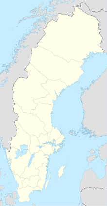
| Map | |||||||||||
 | |||||||||||
| Runways | |||||||||||
| |||||||||||
| Statistics (2016) | |||||||||||
| |||||||||||
Statistics: Swedavia[1] | |||||||||||
Örnsköldsvik Airport (IATA: OER, ICAO: ESNO), is a regional airport located 24 km (15 mi) northeast of Örnsköldsvik, Sweden, at Husum, built in 1961.
History
[edit]The airport had 80,123 passengers in 2013 and a record of 165,712 in 2000. On 31 October 2014, Örnsköldsvik airport received permission to have the first remote controlled air control tower in the world. The tower is controlled from Sundsvall-Timrå Airport.[2]
Airlines and destinations
[edit]The following airlines operate regular scheduled and charter flights at Örnsköldsvik Airport:
| Airlines | Destinations |
|---|---|
| Amapola Flyg | Stockholm–Arlanda[3] |
| Enter Air | Seasonal charter: Chania,[4] Rhodes[5] |
Statistics
[edit]Graphs are unavailable due to technical issues. Updates on reimplementing the Graph extension, which will be known as the Chart extension, can be found on Phabricator and on MediaWiki.org. |
Annual passenger traffic at OER airport.
See Wikidata query.
References
[edit]- ^ "Statistics". Swedavia. Archived from the original on 19 March 2012. Retrieved 18 April 2011.
- ^ First remotely operated Air Traffic Control tower approved
- ^ "Inrikesflyg - Örnsköldsvik Airport".
- ^ "Kreta - Örnsköldsvik Airport".
- ^ "Rhodos - Örnsköldsvik Airport".
External links
[edit]- (in Swedish) Örnsköldsvik Airport

