Oonoonba, Queensland
| Oonoonba Townsville, Queensland | |||||||||||||||
|---|---|---|---|---|---|---|---|---|---|---|---|---|---|---|---|
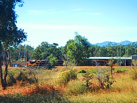
 Train waiting at a siding in Oonoonba, 2016 | |||||||||||||||
 | |||||||||||||||
| Coordinates | 19°17′54″S 146°49′08″E / 19.2983°S 146.8188°E | ||||||||||||||
| Population | 2,050 (2021 census)[1] | ||||||||||||||
| • Density | 820/km2 (2,120/sq mi) | ||||||||||||||
| Postcode(s) | 4811 | ||||||||||||||
| Area | 2.5 km2 (1.0 sq mi) | ||||||||||||||
| Time zone | AEST (UTC+10:00) | ||||||||||||||
| Location |
| ||||||||||||||
| LGA(s) | City of Townsville | ||||||||||||||
| State electorate(s) | Mundingburra | ||||||||||||||
| Federal division(s) | Dawson | ||||||||||||||
| |||||||||||||||
Oonoonba is a suburb of Townsville in the City of Townsville, Queensland, Australia.[2] In the 2021 census, Oonoonba had a population of 2,050 people.[1]
Geography
[edit]Oonoonba is approximately 5.8 kilometres (3.6 mi) by road south from Townsville central business district.
The suburb is bounded to the north by the Ross River, to the east loosely by Gordon Creek, to the south by the North Coast railway line and to the west loosely by Northshore Circuit.[3]
The suburb is predominantly a residential area.[3] Oonoonba was once considered isolated from Townsville, but subdivision development at neighbouring Idalia has filled the void between and has made Oonoonba become part of the contiguous urban area of Townsville.
The areas in the north and east of the suburb along the river are not used as they are marshland.[3]
The North Coast railway line passes through the suburb from south (Idalia/Cluden) to north, crossing the Ross River to Railway Estate (19°18′01″S 146°49′05″E / 19.3003°S 146.8181°E). The suburb is served by the Oonoonba railway station (19°18′01″S 146°49′05″E / 19.3003°S 146.8181°E) but there is no infrastructure at the station any more.[3][4]
South Townsville Road (Abbot Street) runs through the suburb from south (Idalia/Cluden where it connects to the Bruce Highway), running parallel and to the immediate east of the railway line, exiting the suburb as it crosses the Ross River on Rooneys Bridge to Railway Estate. There are three bridge crossings at this point from west to east: the rail bridge, a pedestrian/cycle bridge, and the road bridge.[3]
History
[edit]The suburb takes its name from its railway station name, which in turn was named in 1880 using an Aboriginal word meaning water or wet ground.[2]
Oonoonba State School opened on 15 November 1920. The "old school" was later bulldozed for the new road creating the "new school" the school was opened in 2002 and is still open today.[5]
Demographics
[edit]In the 2016 census, Oonoonba had a population of 1,675 people.[6]
In the 2021 census, Oonoonba had a population of 2,050 people.[1]
Education
[edit]There are no schools within the suburb. The nearest primary school is Oonoonba State School, which is within the boundaries of the neighbouring suburb of Idalia. The nearest secondary schools are Townsville State High School to the north in Railway Estate and William Ross State High School in Annandale.[3]
References
[edit]- ^ a b c Australian Bureau of Statistics (28 June 2022). "Oonoonba (SAL)". 2021 Census QuickStats. Retrieved 28 February 2023.
- ^ a b "Oonoonba – suburb in City of Townsville (entry 44622)". Queensland Place Names. Queensland Government. Retrieved 27 January 2020.
- ^ a b c d e f "Queensland Globe". State of Queensland. Retrieved 18 April 2020.
- ^ "Ooonoonba – railway station in the City of Townsville (entry 25485)". Queensland Place Names. Queensland Government. Retrieved 18 April 2020.
- ^ Queensland Family History Society (2010), Queensland schools past and present (Version 1.01 ed.), Queensland Family History Society, ISBN 978-1-921171-26-0
- ^ Australian Bureau of Statistics (27 June 2017). "Oonoonba (SSC)". 2016 Census QuickStats. Retrieved 20 October 2018.
External links
[edit]- "Oonoonba, Idalia, Cluden". Queensland Places. University of Queensland.

