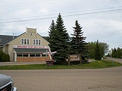
Neerlandia
Neerlandia | |
|---|---|
 View of downtown Neerlandia | |
| Coordinates: 54°19′08″N 114°22′37″W / 54.319°N 114.377°W | |
| Country | Canada |
| Province | Alberta |
| Region | Central Alberta |
| Census division | 13 |
| Municipal district | County of Barrhead No. 11 |
| Government | |
| • Type | Unincorporated |
| • Governing body | County of Barrhead No. 11 Council |
| Population (1991)[1] | |
• Total | 101 |
| Time zone | UTC−07:00 (MST) |
| • Summer (DST) | UTC−06:00 (MDT) |
| Area code(s) | 780, 587, 825 |
Neerlandia is a hamlet in central Alberta, Canada within the County of Barrhead No. 11.[2] Neerlandia is situated at the intersection of Highway 769 and Township Road 615A between Mellowdale and Vega, approximately 20 kilometers north of Barrhead and northwest of Westlock.
Neerlandia was founded by Dutch immigrants beginning in 1911. The name "Neerlandia" refers to the first settlers' country of origin, the Netherlands. The surrounding area is largely agricultural based with many people in the outlying area also being involved in construction and other trades as well.
History
[edit]In January 1911, Henry Kippers began a Dutch colonization society with the goal to create a Dutch farming community. The community formation began on December 18, 1911 with 16 men filling for land permits at the Dominion of Lands Office in Edmonton, Alberta. These men were John Anema, Rients de Jager, Drikus Huinink, Cornelius Ingwersen, Albert M. Mast, Johan Messelink, Henry J. Micheal, Menne Nanninga, Albert J. Oldegbers, Hendrik Schoonekamp, Berend te Ronde, Douwe Terpsma, John Terpsma, Siebren Tiemstra and Willem van Ark. This was followed by Fred Baron and Henry J. Kippers on December 26, 1911 and Arie Emmerzael on February 6, 1912.[3]
Demographics
[edit]Neerlandia recorded a population of 101 in the 1991 Census of Population conducted by Statistics Canada.[1]
Services and amenities
[edit]The Hamlet of Neerlandia has four churches (Christian Reformed, United Reformed and two Canadian Reformed), a grocery store, a farm and building centre, a self-serve gas station, a restaurant and two schools, the Neerlandia Public Christian School and the Covenant Canadian Reformed School. The public school houses the public library and has a tennis court and a baseball diamond. The ice rink beside the public school was demolished to make room for the new school and a new ice rink has been constructed across the road from the school. Neerlandia is southeast of the Fort Assiniboine Sandhills Wildland Provincial Park in Woodlands County, which is accessible via Highway 769 and Highway 661. The park and surrounding area is a camping, snowmobiling, quadding, trailriding and hunting destination.
Further reading
[edit]The Neerlandia Historical Society compiled a historical biography of Neerlandia, entitled "A Furrow Laid Bare."[12]
See also
[edit]References
[edit]- ^ a b c 91 Census (PDF). Population and Dwelling Counts. Vol. Unincorporated Places. Ottawa: Statistics Canada. 1993. Retrieved September 26, 2024.
- ^ "Specialized and Rural Municipalities and Their Communities" (PDF). Alberta Municipal Affairs. June 3, 2024. Retrieved June 14, 2024.
- ^ Neerlandia Historical Society (1985). A Furrow laid bare: Neerlandia district history. Neerlandia Historical Society Neerlandia, Alberta. pp. 47–48.
{{cite book}}: CS1 maint: location missing publisher (link) - ^ Ninth Census of Canada, 1951 (PDF). Vol. SP-7 (Population: Unincorporated villages and hamlets). Dominion Bureau of Statistics. March 31, 1954. Retrieved September 22, 2024.
- ^ Census of Canada, 1956 (PDF). Vol. Population of unincorporated villages and settlements. Dominion Bureau of Statistics. October 25, 1957. Retrieved September 23, 2024.
- ^ 1961 Census of Canada: Population (PDF). Series SP: Unincorporated Villages. Vol. Bulletin SP—4. Ottawa: Dominion Bureau of Statistics. April 18, 1963. Retrieved September 25, 2024.
- ^ Census of Canada 1966: Population (PDF). Special Bulletin: Unincorporated Places. Vol. Bulletin S–3. Ottawa: Dominion Bureau of Statistics. 1968. Retrieved September 25, 2024.
- ^ 1971 Census of Canada: Population (PDF). Special Bulletin: Unincorporated Settlements. Vol. Bulletin SP—1. Ottawa: Statistics Canada. 1973. Retrieved September 25, 2024.
- ^ "Geographical Identification and Population for Unincorporated Places of 25 persons and over, 1971 and 1976". 1976 Census of Canada (PDF). Supplementary Bulletins: Geographic and Demographic (Population of Unincorporated Places—Canada). Vol. Bulletin 8SG.1. Ottawa: Statistics Canada. 1978. Retrieved September 26, 2024.
- ^ 1981 Census of Canada (PDF). Place name reference list. Vol. Western provinces and the Territories. Ottawa: Statistics Canada. 1983. Retrieved September 26, 2024.
- ^ 1986 Census of Canada (PDF). Population. Vol. Unincorporated Places. Ottawa: Statistics Canada. 1988. Retrieved September 26, 2024.
- ^ Neerlandia Historical Society. A Furrow Laid Bare.


