[ 3] Name on the Register[ 4]
Image
Date listed[ 5]
Location
Description
1
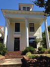
Abrams House Abrams House February 18, 1999 (#99000221 ) 300 S. Pulaski St. 34°44′52″N 92°17′06″W / 34.747778°N 92.285°W / 34.747778; -92.285 (Abrams House )
2
Albert Pike Memorial Temple Albert Pike Memorial Temple November 13, 1986 (#86003118 ) 700-724 Scott St. 34°44′30″N 92°16′14″W / 34.741667°N 92.270556°W / 34.741667; -92.270556 (Albert Pike Memorial Temple )
3
Alexander House Upload image March 24, 2020 (#100004904 ) 24 East Palisades Dr. 34°46′51″N 92°20′04″W / 34.7809°N 92.3345°W / 34.7809; -92.3345 (Alexander House )
4
H.M. Anderson House H.M. Anderson House May 2, 2001 (#01000441 ) 3415 W. Markham 34°45′03″N 92°18′41″W / 34.750833°N 92.311389°W / 34.750833; -92.311389 (H.M. Anderson House )
5
Arkansas Power & Light Building Arkansas Power & Light Building September 14, 1992 (#92001156 ) Junction of 9th St. and Louisiana St. 34°44′24″N 92°16′26″W / 34.74°N 92.273889°W / 34.74; -92.273889 (Arkansas Power & Light Building )
6
Arkansas State Capitol Arkansas State Capitol June 28, 1974 (#74000494 ) 5th and Woodlane Sts. 34°44′48″N 92°17′20″W / 34.746667°N 92.288889°W / 34.746667; -92.288889 (Arkansas State Capitol )
7
Arkansas State Fairgrounds Historic District Upload image January 11, 2022 (#100007315 ) 2600 Howard St. 34°43′25″N 92°17′52″W / 34.7236°N 92.2979°W / 34.7236; -92.2979 (Arkansas State Fairgrounds Historic District )
8
Arkansas State Highway Department Headquarters Upload image January 16, 2024 (#100009769 ) 10324 Interstate 30 34°40′16″N 92°22′56″W / 34.6710°N 92.3823°W / 34.6710; -92.3823 (Arkansas State Highway Department Headquarters )
9
Arkansas Teachers Association Headquarters Building and Professional Services Building Upload image February 1, 2018 (#100002002 ) 1304 and 1306 Wright Ave. 34°43′55″N 92°17′19″W / 34.731990°N 92.288720°W / 34.731990; -92.288720 (Arkansas Teachers Association Headquarters Building and Professional Services Building )
10
Arkansas Territorial Restoration Historic District Arkansas Territorial Restoration Historic District May 31, 2019 (#100003998 ) W. side of Cumberland between 2nd & 3rd Sts. 34°44′47″N 92°16′06″W / 34.7463°N 92.2683°W / 34.7463; -92.2683 (Arkansas Territorial Restoration Historic District ) Now the Historic Arkansas Museum
11
Asher Avenue Overpass Upload image April 30, 2024 (#100010307 ) Asher Avenue between Appian way Street and South Thayer Street 34°43′54″N 92°18′13″W / 34.7318°N 92.3035°W / 34.7318; -92.3035 (Asher Avenue Overpass )
12
Associate Reformed Presbyterian Church Associate Reformed Presbyterian Church December 22, 1982 (#82000874 ) 3323 W. 12th St. 34°44′24″N 92°18′40″W / 34.74°N 92.311111°W / 34.74; -92.311111 (Associate Reformed Presbyterian Church )
13
Baer House Baer House December 22, 1982 (#82000876 ) 1010 Rock St. 34°44′17″N 92°16′06″W / 34.738056°N 92.268333°W / 34.738056; -92.268333 (Baer House )
14
Barlow Apartments Barlow Apartments April 7, 1995 (#95000376 ) 2115 Scott St. 34°43′44″N 92°16′19″W / 34.728889°N 92.271944°W / 34.728889; -92.271944 (Barlow Apartments )
15
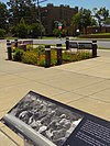
Daisy Bates House Daisy Bates House January 3, 2001 (#01000072 ) 1207 W. 28th St. 34°43′18″N 92°17′18″W / 34.721619°N 92.288239°W / 34.721619; -92.288239 (Daisy Bates House )
16
Beal-Burrow Dry Goods Building Beal-Burrow Dry Goods Building June 26, 1995 (#87001546 ) 107 E. Markham 34°44′52″N 92°16′10″W / 34.747778°N 92.269444°W / 34.747778; -92.269444 (Beal-Burrow Dry Goods Building )
17
Bechle Apartment Building Bechle Apartment Building October 2, 1978 (#78003201 ) 1000 E. 9th St. 34°44′23″N 92°15′34″W / 34.739722°N 92.259444°W / 34.739722; -92.259444 (Bechle Apartment Building )
18
Beyerlein House Beyerlein House December 22, 1982 (#82000878 ) 412 W. 14th St. 34°44′10″N 92°16′36″W / 34.736111°N 92.276667°W / 34.736111; -92.276667 (Beyerlein House )
19
Gus Blass Department Store Gus Blass Department Store November 13, 1986 (#86003122 ) 318-324 Main St. 34°44′43″N 92°16′16″W / 34.745278°N 92.271111°W / 34.745278; -92.271111 (Gus Blass Department Store )
20
Noland Blass Jr. House Upload image January 24, 2019 (#100003333 ) 217 Normandy Rd. 34°46′03″N 92°20′40″W / 34.7676°N 92.3444°W / 34.7676; -92.3444 (Noland Blass Jr. House )
21
Block 35 Cobblestone Alley Block 35 Cobblestone Alley January 22, 2009 (#08001343 ) West of the northern end of Rock St.[ 6] 34°44′50″N 92°16′02″W / 34.747222°N 92.267222°W / 34.747222; -92.267222 (Block 35 Cobblestone Alley )
22
Block Realty Building Block Realty Building November 30, 2018 (#100002950 ) 723 W Markham St. 34°44′57″N 92°16′42″W / 34.7492°N 92.2784°W / 34.7492; -92.2784 (Block Realty Building )
23
Block Realty-Baker House Block Realty-Baker House September 24, 2008 (#08000935 ) 1900 Beechwood St. 34°46′09″N 92°19′28″W / 34.769117°N 92.324358°W / 34.769117; -92.324358 (Block Realty-Baker House )
24
Bishop Hiram A. Boaz House Bishop Hiram A. Boaz House March 7, 1994 (#94000142 ) 22 Armistead Rd. 34°46′00″N 92°19′22″W / 34.766667°N 92.322778°W / 34.766667; -92.322778 (Bishop Hiram A. Boaz House )
25
Boone House Boone House December 22, 1982 (#82000879 ) 4014 Lookout 34°45′48″N 92°19′06″W / 34.763333°N 92.318333°W / 34.763333; -92.318333 (Boone House )
26
Boyle Park Boyle Park September 22, 1995 (#95001119 ) Roughly bounded by 38th St., Dorchester Dr., Covewood Cir., Glenmere Dr., Kanis Rd., and W. 12th St. 34°43′35″N 92°21′21″W / 34.726389°N 92.355833°W / 34.726389; -92.355833 (Boyle Park )
27
BPOE Elks Club BPOE Elks Club December 22, 1982 (#82000880 ) 4th and Scott Sts. 34°44′44″N 92°16′09″W / 34.745556°N 92.269167°W / 34.745556; -92.269167 (BPOE Elks Club )
28
Bragg Guesthouse Bragg Guesthouse April 4, 2001 (#00001320 ) 1615 Cumberland 34°44′03″N 92°16′14″W / 34.734167°N 92.270556°W / 34.734167; -92.270556 (Bragg Guesthouse )
29
Richard and Eleanor Bragg House Upload image February 22, 2023 (#100008566 ) 305 East 16th St. 34°43′59″N 92°16′14″W / 34.7330°N 92.2706°W / 34.7330; -92.2706 (Richard and Eleanor Bragg House )
30
Adrian Brewer Studio Adrian Brewer Studio February 10, 2000 (#00000069 ) 510 Cedar St. 34°45′25″N 92°19′01″W / 34.756944°N 92.316944°W / 34.756944; -92.316944 (Adrian Brewer Studio )
31
Broadmoor Neighborhood Historic District Upload image January 7, 2022 (#100007316 ) Subdivision located west of South University Ave., southeast of Boyle Park Rd., and north of West 32nd St. 34°43′39″N 92°20′53″W / 34.7275°N 92.3480°W / 34.7275; -92.3480 (Broadmoor Neighborhood Historic District )
32
Buhler House Buhler House April 25, 1988 (#88000433 ) 1820 Fair Park Boulevard 34°44′38″N 92°20′05″W / 34.743889°N 92.334722°W / 34.743889; -92.334722 (Buhler House )
33
Bush House Bush House December 22, 1982 (#82000877 ) 1516 Ringo St. 34°44′08″N 92°17′05″W / 34.735556°N 92.284722°W / 34.735556; -92.284722 (Bush House )
34
Bush-Dubisson House Bush-Dubisson House May 28, 1999 (#99000549 ) 1500 S. Ringo St. 34°44′08″N 92°17′01″W / 34.735556°N 92.283611°W / 34.735556; -92.283611 (Bush-Dubisson House )
35
Calvary Cemetery, Historic Section Upload image August 31, 2022 (#100007766 ) Southwest corner of Charles Bussey Ave. (20th St.) and Woodrow St. 34°43′58″N 92°18′22″W / 34.7327°N 92.3061°W / 34.7327; -92.3061 (Calvary Cemetery, Historic Section )
36
Capital Hotel Capital Hotel July 30, 1974 (#74000495 ) 117 W. Markham St. 34°44′53″N 92°16′16″W / 34.748056°N 92.271111°W / 34.748056; -92.271111 (Capital Hotel )
37
Capitol-Main Historic District Capitol-Main Historic District April 2, 2012 (#11001050 ) 500 block of Main St., 100-200 blocks of W. Capitol Ave., 500 block of Center St., and 100-200 blocks of W. 6th St.; also 609 and 615 Main Street 34°44′38″N 92°16′21″W / 34.743852°N 92.272414°W / 34.743852; -92.272414 (Capitol-Main Historic District ) Second set of addresses represent a boundary increase approved April 30, 2024 .
38
Capitol View Neighborhood Historic District Capitol View Neighborhood Historic District March 13, 2001 (#00000813 ) Roughly bounded by Riverview Dr., Schiller St., W. 7th St., and Woodrow St. 34°44′56″N 92°17′55″W / 34.748889°N 92.298611°W / 34.748889; -92.298611 (Capitol View Neighborhood Historic District )
39
Central High School Neighborhood Historic District Central High School Neighborhood Historic District August 16, 1996 (#96000892 ) Roughly bounded by MLK Dr., Thayer Ave., W. 12th St., and Roosevelt Rd.; also 1850 S. Park St.; also roughly bounded by W. 17th St., Dr. Martin Luther King, Jr., Dr., Wright Ave., and S. Summit and S. Battery Sts. 34°43′56″N 92°17′43″W / 34.732222°N 92.295278°W / 34.732222; -92.295278 (Central High School Neighborhood Historic District ) Second and third sets of boundaries represent boundary increases of January 17, 1997 and June 4, 2012
40
Central Presbyterian Church Central Presbyterian Church December 22, 1982 (#82000881 ) 1921 Arch St. 34°43′47″N 92°16′45″W / 34.729722°N 92.279167°W / 34.729722; -92.279167 (Central Presbyterian Church )
41
Chicago, Rock Island & Pacific Railway Overpass Upload image September 5, 2024 (#100010829 ) Hilaro Springs Road over Fourche Creek 34°39′27″N 92°19′20″W / 34.6574°N 92.3223°W / 34.6574; -92.3223 (Chicago, Rock Island & Pacific Railway Overpass )
42
Chisum House Chisum House December 4, 1975 (#75000403 ) 1320 Cumberland 34°44′07″N 92°16′13″W / 34.735278°N 92.270278°W / 34.735278; -92.270278 (Chisum House )
43
Choctaw Route Station Choctaw Route Station May 6, 1975 (#75000404 ) E. 3rd at the former Rock Island railroad line 34°44′44″N 92°15′32″W / 34.745556°N 92.258889°W / 34.745556; -92.258889 (Choctaw Route Station )
44
John Henry Clayborn House John Henry Clayborn House May 24, 2006 (#06000420 ) 1800 Marshall 34°44′07″N 92°17′32″W / 34.735278°N 92.292222°W / 34.735278; -92.292222 (John Henry Clayborn House )
45
Climber Motor Car Factory, Unit A Climber Motor Car Factory, Unit A June 1, 2005 (#05000500 ) 1823 E. 17th St. 34°43′56″N 92°14′56″W / 34.732222°N 92.248889°W / 34.732222; -92.248889 (Climber Motor Car Factory, Unit A )
46
Compton-Wood House Compton-Wood House May 7, 1980 (#80000781 ) 800 High St. 34°44′36″N 92°17′21″W / 34.743333°N 92.289167°W / 34.743333; -92.289167 (Compton-Wood House )
47
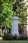
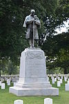
Confederate Soldiers Monument Confederate Soldiers Monument April 26, 1996 (#96000453 ) Along 4th St. on the eastern side of the State Capitol grounds 34°44′50″N 92°17′16″W / 34.747222°N 92.287778°W / 34.747222; -92.287778 (Confederate Soldiers Monument )
48
Cornish House Cornish House December 22, 1982 (#82000882 ) 1800 Arch St. 34°43′52″N 92°16′47″W / 34.731111°N 92.279722°W / 34.731111; -92.279722 (Cornish House )
49
Croxson House Croxson House December 22, 1982 (#82000883 ) 1901 Gaines St. 34°43′49″N 92°16′50″W / 34.730278°N 92.280556°W / 34.730278; -92.280556 (Croxson House )
50
Cumberland Towers Cumberland Towers March 7, 2017 (#100000706 ) 311 E. 8th St. 34°44′27″N 92°16′09″W / 34.740854°N 92.269060°W / 34.740854; -92.269060 (Cumberland Towers )
51
Curran Hall Curran Hall January 1, 1976 (#76000453 ) 615 E. Capitol St. 34°44′34″N 92°15′53″W / 34.742855°N 92.264589°W / 34.742855; -92.264589 (Curran Hall )
52
Darragh Building Upload image September 7, 2017 (#100000557 ) 1403 E. 6th Ave. 34°44′30″N 92°15′18″W / 34.741719°N 92.254918°W / 34.741719; -92.254918 (Darragh Building )
53
Darragh House Darragh House December 22, 1982 (#82000884 ) 2412 Broadway 34°43′29″N 92°16′44″W / 34.724722°N 92.278889°W / 34.724722; -92.278889 (Darragh House )
54
Julian Bunn Davidson House Julian Bunn Davidson House March 10, 2014 (#13001105 ) 410 S. Battery St. 34°44′50″N 92°17′38″W / 34.747131°N 92.293945°W / 34.747131; -92.293945 (Julian Bunn Davidson House )
55
Deane House Deane House September 5, 1975 (#75000405 ) 1701 Arch St. 34°43′59″N 92°16′44″W / 34.733056°N 92.278889°W / 34.733056; -92.278889 (Deane House )
56
Democrat Printing & Lithograph Co. Building Democrat Printing & Lithograph Co. Building December 17, 1998 (#87001547 ) 114-122 E. 2nd St. 34°44′50″N 92°16′10″W / 34.747222°N 92.269444°W / 34.747222; -92.269444 (Democrat Printing & Lithograph Co. Building )
57
David O. Dodd Memorial David O. Dodd Memorial April 26, 1996 (#96000454 ) 300 W. Markham St. 34°44′56″N 92°16′19″W / 34.748889°N 92.271944°W / 34.748889; -92.271944 (David O. Dodd Memorial )
58
Donaghey Building Donaghey Building June 27, 2012 (#12000355 ) 103 E. 7th St., 703 S. Main St. 34°44′31″N 92°16′16″W / 34.741965°N 92.271178°W / 34.741965; -92.271178 (Donaghey Building )
59
Downs Historic District Upload image January 21, 2020 (#100004903 ) 4206, 4208, 4210, 4212, 4214, 4216 & 4218 Fairview Rd.; 4201 South Lookout Rd; and 4207, 4209, 4211 & 4213 Wait St. 34°45′40″N 92°19′11″W / 34.7612°N 92.3197°W / 34.7612; -92.3197 (Downs Historic District )
60
Dunaway House Dunaway House December 22, 1982 (#82000885 ) 2022 Battery 34°43′46″N 92°17′39″W / 34.729444°N 92.294167°W / 34.729444; -92.294167 (Dunaway House )
61
Dunbar Junior and Senior High School and Junior College Dunbar Junior and Senior High School and Junior College August 6, 1980 (#80000782 ) 1100 Wright Ave. 34°43′57″N 92°17′10″W / 34.7325°N 92.286111°W / 34.7325; -92.286111 (Dunbar Junior and Senior High School and Junior College )
62
Paul Laurence Dunbar School Neighborhood Historic District Paul Laurence Dunbar School Neighborhood Historic District September 27, 2013 (#13000789 ) Roughly bounded by Wright Ave., S. Chester, S. Ringo & W. 24th Sts. 34°43′44″N 92°17′07″W / 34.728925°N 92.285308°W / 34.728925; -92.285308 (Paul Laurence Dunbar School Neighborhood Historic District ) Historically Black Properties in Little Rock's Dunbar School Neighborhood MPS
63
East Markham Street Historic District East Markham Street Historic District May 5, 1999 (#99000522 ) 301-303, 305-307, 313, and 323 East Markham St. 34°44′50″N 92°16′03″W / 34.747222°N 92.2675°W / 34.747222; -92.2675 (East Markham Street Historic District )
64
Empire Life Insurance Company of America Building Upload image May 30, 2019 (#100004002 ) 2801 W. Roosevelt Rd. 34°43′31″N 92°18′21″W / 34.7254°N 92.3059°W / 34.7254; -92.3059 (Empire Life Insurance Company of America Building )
65
England House England House December 22, 1982 (#82000886 ) 2121 Arch St. 34°43′41″N 92°16′46″W / 34.728056°N 92.279444°W / 34.728056; -92.279444 (England House )
66
Esso Standard Oil Service Station Esso Standard Oil Service Station January 8, 2016 (#15000287 ) 1600 W. 3rd St. 34°44′55″N 92°17′21″W / 34.748664°N 92.289199°W / 34.748664; -92.289199 (Esso Standard Oil Service Station )
67
Exchange Bank Building Exchange Bank Building October 23, 1986 (#86002896 ) 423 Main St. 34°44′45″N 92°16′15″W / 34.7458°N 92.2708°W / 34.7458; -92.2708 (Exchange Bank Building )
68
Fair Park Golf Course Upload image September 16, 2020 (#100005596 ) 5511 West Markham St. 34°45′07″N 92°20′09″W / 34.7520°N 92.3357°W / 34.7520; -92.3357 (Fair Park Golf Course )
69
Farrell House Farrell House December 22, 1982 (#82000889 ) 2121 Louisiana 34°43′40″N 92°16′29″W / 34.7278°N 92.2747°W / 34.7278; -92.2747 (Farrell House )
70
Farrell House Farrell House December 22, 1982 (#82000888 ) 2115 Louisiana 34°43′41″N 92°16′28″W / 34.7281°N 92.2744°W / 34.7281; -92.2744 (Farrell House )
71
Farrell House Farrell House December 22, 1982 (#82000887 ) 2111 Louisiana 34°43′42″N 92°16′29″W / 34.7283°N 92.2747°W / 34.7283; -92.2747 (Farrell House )
72
Farrell House Farrell House October 11, 1984 (#84000103 ) 2109 Louisiana 34°43′41″N 92°16′28″W / 34.7281°N 92.2744°W / 34.7281; -92.2744 (Farrell House )
73
Federal Building Federal Building May 5, 2015 (#15000206 ) 700 W. Capitol Ave. 34°44′43″N 92°16′44″W / 34.7452°N 92.2788°W / 34.7452; -92.2788 (Federal Building )
74
Federal Reserve Bank Building Federal Reserve Bank Building October 23, 1986 (#86002895 ) 123 W. 3rd St. 34°44′45″N 92°16′15″W / 34.7458°N 92.2708°W / 34.7458; -92.2708 (Federal Reserve Bank Building )
75
First Baptist Church First Baptist Church August 9, 1994 (#94000823 ) Southwestern corner of the junction of 12th and Louisiana Sts. 34°44′14″N 92°16′26″W / 34.7372°N 92.2739°W / 34.7372; -92.2739 (First Baptist Church )
76
First Church of Christ, Scientist First Church of Christ, Scientist October 4, 1984 (#84000008 ) 20th and Louisiana Sts. 34°43′46″N 92°16′30″W / 34.7294°N 92.275°W / 34.7294; -92.275 (First Church of Christ, Scientist )
77
First Hotze House First Hotze House September 20, 2006 (#06000828 ) 1620 S. Main St. 34°44′04″N 92°16′26″W / 34.7344°N 92.2739°W / 34.7344; -92.2739 (First Hotze House )
78
First Missionary Baptist Church First Missionary Baptist Church September 29, 1983 (#83001164 ) 701 S. Gaines St. 34°44′35″N 92°16′41″W / 34.7431°N 92.2781°W / 34.7431; -92.2781 (First Missionary Baptist Church )
79
First Presbyterian Church First Presbyterian Church November 13, 1986 (#86003124 ) 123 E. 8th St. 34°44′26″N 92°16′15″W / 34.7406°N 92.2708°W / 34.7406; -92.2708 (First Presbyterian Church )
80
First United Methodist Church First United Methodist Church October 9, 1986 (#86002845 ) 723 Center St. 34°44′30″N 92°16′25″W / 34.7417°N 92.2736°W / 34.7417; -92.2736 (First United Methodist Church )
81
Fletcher House Fletcher House December 22, 1982 (#82000890 ) 909 Cumberland St. 34°44′21″N 92°16′08″W / 34.7392°N 92.2689°W / 34.7392; -92.2689 (Fletcher House )
82
Florence Crittenton Home Florence Crittenton Home December 22, 1982 (#82000891 ) 3600 W. 11th St. 34°44′30″N 92°18′53″W / 34.7417°N 92.3147°W / 34.7417; -92.3147 (Florence Crittenton Home )
83
Fones House Fones House August 19, 1975 (#75000406 ) 902 W. 2nd St. 34°44′55″N 92°16′48″W / 34.7486°N 92.28°W / 34.7486; -92.28 (Fones House )
84
Fordyce House Fordyce House August 6, 1975 (#75000407 ) 2115 S. Broadway 34°43′40″N 92°16′41″W / 34.7278°N 92.2781°W / 34.7278; -92.2781 (Fordyce House )
85
Absalom Fowler House Absalom Fowler House June 4, 1973 (#73000387 ) 502 E. 7th St. 34°44′30″N 92°16′41″W / 34.7417°N 92.2781°W / 34.7417; -92.2781 (Absalom Fowler House )
86
Joseph M. Frank House Joseph M. Frank House October 3, 1985 (#85002716 ) 912 W. 4th 34°45′02″N 92°16′41″W / 34.7506°N 92.2781°W / 34.7506; -92.2781 (Joseph M. Frank House )
87
Franke-Watson House Upload image June 16, 2021 (#100006528 ) 30 Edgehill Rd. 34°46′05″N 92°19′10″W / 34.7680°N 92.3195°W / 34.7680; -92.3195 (Franke-Watson House )
88
Frauenthal House Frauenthal House December 22, 1982 (#82000895 ) 2008 Arch St. 34°43′45″N 92°16′48″W / 34.7292°N 92.28°W / 34.7292; -92.28 (Frauenthal House )
89
French-England House French-England House December 22, 1982 (#82000896 ) 1700 Broadway 34°43′58″N 92°16′42″W / 34.7328°N 92.2783°W / 34.7328; -92.2783 (French-England House )
90
Abraham and Mollie Froug House Abraham and Mollie Froug House May 11, 2022 (#100007716 ) 1727 Center St. 34°43′54″N 92°16′34″W / 34.7318°N 92.2760°W / 34.7318; -92.2760 (Abraham and Mollie Froug House )
91
Fulk Building Fulk Building November 13, 1986 (#86003121 ) 300 Main St. 34°44′45″N 92°16′16″W / 34.7458°N 92.2711°W / 34.7458; -92.2711 (Fulk Building )
92
Fulk-Arkansas Democrat Building Fulk-Arkansas Democrat Building May 18, 2018 (#100002456 ) 613-615 Main St. 34°44′34″N 92°16′17″W / 34.7427°N 92.2714°W / 34.7427; -92.2714 (Fulk-Arkansas Democrat Building )
93
Solomon Gans House Solomon Gans House March 29, 1984 (#84000905 ) 1010 W. 3rd St. 34°44′52″N 92°16′54″W / 34.747778°N 92.281667°W / 34.747778; -92.281667 (Solomon Gans House )
94
Garland Elementary School Upload image October 16, 2018 (#100003015 ) 3615 W 25th St. 34°43′43″N 92°18′52″W / 34.7286°N 92.3145°W / 34.7286; -92.3145 (Garland Elementary School )
95
Augustus Garland House Augustus Garland House June 10, 1975 (#75000408 ) 1404 Scott St. 34°44′05″N 92°16′19″W / 34.734722°N 92.271944°W / 34.734722; -92.271944 (Augustus Garland House )
96
Gay Oil Company Building Gay Oil Company Building June 5, 2017 (#100001011 ) 300 S. Broadway St. 34°44′48″N 92°16′32″W / 34.746610°N 92.275579°W / 34.746610; -92.275579 (Gay Oil Company Building )
97
Gazette Building Gazette Building October 22, 1976 (#76002239 ) 112 W. 3rd St. 34°44′47″N 92°16′18″W / 34.746389°N 92.271667°W / 34.746389; -92.271667 (Gazette Building )
98
Governor's Mansion Historic District Governor's Mansion Historic District September 13, 1978 (#78000620 ) Bounded by the mansion grounds and 13th, Center, Gaines, and 18th Sts.; also roughly bounded by Louisiana St., 23rd St., Roosevelt Rd., Chester and State Sts., and 13th and 12th Sts.; also roughly along Louisiana Ave. from W. 23rd St. and 24th St. 34°44′02″N 92°16′39″W / 34.733889°N 92.2775°W / 34.733889; -92.2775 (Governor's Mansion Historic District ) Second and third sets of boundaries represent boundary increases of May 19, 1988 and February 15, 2002
99
Thomas Gray House Upload image September 18, 2018 (#100002955 ) 25 River Valley Rd. 34°47′26″N 92°22′56″W / 34.7905°N 92.3822°W / 34.7905; -92.3822 (Thomas Gray House )
100
Green House Green House May 28, 1999 (#99000544 ) 1224 W. 21st St. 34°43′45″N 92°17′16″W / 34.729167°N 92.287778°W / 34.729167; -92.287778 (Green House )
101
Hall House Hall House December 22, 1982 (#82000897 ) 32 Edgehill 34°46′04″N 92°19′04″W / 34.767778°N 92.317778°W / 34.767778; -92.317778 (Hall House )
102
Halliburton Townhouses Halliburton Townhouses December 12, 1976 (#76000455 ) 1601 and 1605 Center St. 34°44′01″N 92°16′31″W / 34.733611°N 92.275278°W / 34.733611; -92.275278 (Halliburton Townhouses )
103
Hanger Hill Historic District Hanger Hill Historic District January 30, 2008 (#07001466 ) 1500 block of Welch St. 34°43′57″N 92°15′33″W / 34.7325°N 92.259167°W / 34.7325; -92.259167 (Hanger Hill Historic District )
104
Frederick Hanger House Frederick Hanger House March 15, 1974 (#74000496 ) 1010 Scott St. 34°44′18″N 92°16′30″W / 34.738333°N 92.275°W / 34.738333; -92.275 (Frederick Hanger House )
105
Hardy House Hardy House December 22, 1982 (#82000898 ) 2400 Broadway 34°43′31″N 92°16′44″W / 34.725278°N 92.278889°W / 34.725278; -92.278889 (Hardy House )
106
Harris House Harris House June 3, 1998 (#98000644 ) 6507 Fourche Dam Pike 34°43′16″N 92°11′52″W / 34.721111°N 92.197778°W / 34.721111; -92.197778 (Harris House )
107
Healey and Roth Mortuary Building Healey and Roth Mortuary Building December 22, 1982 (#82000899 ) 815 Main 34°44′26″N 92°16′17″W / 34.740556°N 92.271389°W / 34.740556; -92.271389 (Healey and Roth Mortuary Building )
108
Hemingway House Hemingway House December 22, 1982 (#82000900 ) 1720 Arch St. 34°43′57″N 92°16′46″W / 34.7325°N 92.279444°W / 34.7325; -92.279444 (Hemingway House )
109
Henderson House Henderson House May 28, 1999 (#99000548 ) 1510 S. Ringo St. 34°44′08″N 92°17′02″W / 34.735556°N 92.283889°W / 34.735556; -92.283889 (Henderson House )
110
Herschell-Spillman Carousel Herschell-Spillman Carousel December 1, 1989 (#89002065 ) War Memorial Park midway 34°44′54″N 92°19′48″W / 34.748333°N 92.33°W / 34.748333; -92.33 (Herschell-Spillman Carousel )
111
Hillcrest Historic District Hillcrest Historic District December 18, 1990 (#90001920 ) Bounded by Woodrow, Jackson, and Markham Sts. and N. Lookout Rd.; also roughly bounded by Evergreen, Harrison, Lee, and Jackson Sts. 34°45′23″N 92°19′03″W / 34.756389°N 92.3175°W / 34.756389; -92.3175 (Hillcrest Historic District ) Second set of boundaries represents a boundary increase of October 8, 1992
112
Holcomb Court Apartments Holcomb Court Apartments April 7, 1995 (#95000377 ) 2201 Main St. 34°43′39″N 92°16′24″W / 34.7275°N 92.273333°W / 34.7275; -92.273333 (Holcomb Court Apartments )
113
Isaac Homard House Isaac Homard House March 27, 2017 (#100000777 ) 1217 W. 3rd St. 34°44′53″N 92°17′04″W / 34.747992°N 92.284565°W / 34.747992; -92.284565 (Isaac Homard House )
114
Hornibrook House Hornibrook House July 30, 1974 (#74000497 ) 2120 S. Louisiana St. 34°43′40″N 92°16′30″W / 34.727778°N 92.275°W / 34.727778; -92.275 (Hornibrook House )
115
Hotel Freiderica Hotel Freiderica September 27, 2003 (#03000951 ) 625 W. Capitol Ave. 34°44′41″N 92°16′40″W / 34.744722°N 92.277778°W / 34.744722; -92.277778 (Hotel Freiderica )
116
Hotze House Hotze House August 11, 1975 (#75000409 ) 1619 Louisiana St. 34°43′58″N 92°16′27″W / 34.732778°N 92.274167°W / 34.732778; -92.274167 (Hotze House )
117
Johnson House Johnson House December 22, 1982 (#82000902 ) 514 E. 8th St. 34°44′26″N 92°15′58″W / 34.740556°N 92.266111°W / 34.740556; -92.266111 (Johnson House )
118
Johnson House Johnson House December 22, 1982 (#82000903 ) 516 E. 8th St. 34°44′26″N 92°15′57″W / 34.740556°N 92.265833°W / 34.740556; -92.265833 (Johnson House )
119
Johnson House Johnson House December 22, 1982 (#82000904 ) 518 E. 8th St. 34°44′26″N 92°15′56″W / 34.740556°N 92.265556°W / 34.740556; -92.265556 (Johnson House )
120
Johnswood Johnswood May 20, 1994 (#94000495 ) 10314 Cantrell Rd. 34°47′17″N 92°23′16″W / 34.788056°N 92.387778°W / 34.788056; -92.387778 (Johnswood )
121
Scipio A. Jones House Scipio A. Jones House May 28, 1999 (#99000545 ) 1872 S. Cross St. 34°43′52″N 92°17′13″W / 34.731111°N 92.286944°W / 34.731111; -92.286944 (Scipio A. Jones House )
122
Kahn-Jennings House Kahn-Jennings House September 8, 1992 (#92001223 ) 5300 Sherwood St. 34°45′54″N 92°19′56″W / 34.765°N 92.332222°W / 34.765; -92.332222 (Kahn-Jennings House )
123
Keith House Keith House December 22, 1982 (#82000905 ) 2200 Broadway 34°43′38″N 92°16′43″W / 34.727222°N 92.278611°W / 34.727222; -92.278611 (Keith House )
124
Gustave B. Kleinschmidt House Upload image June 7, 2016 (#16000319 ) 621 E. 16th St. 34°43′57″N 92°15′59″W / 34.732587°N 92.266300°W / 34.732587; -92.266300 (Gustave B. Kleinschmidt House )
125
Werner Knoop House Werner Knoop House August 3, 1990 (#90001147 ) 6 Ozark Point 34°45′20″N 92°18′18″W / 34.755556°N 92.305°W / 34.755556; -92.305 (Werner Knoop House )
126
LaFayette Hotel LaFayette Hotel September 30, 1982 (#82002128 ) 525 S. Louisiana St. 34°44′36″N 92°16′20″W / 34.743333°N 92.272222°W / 34.743333; -92.272222 (LaFayette Hotel )
127
Lake Nixon Upload image June 5, 2017 (#100001013 ) 18500 Cooper Orbit Rd. 34°43′05″N 92°26′02″W / 34.717919°N 92.433869°W / 34.717919; -92.433869 (Lake Nixon )
128
Lamb-McSwain House Lamb-McSwain House June 4, 1998 (#98000621 ) 2124 Rice St. 34°43′45″N 92°18′03″W / 34.729167°N 92.300833°W / 34.729167; -92.300833 (Lamb-McSwain House )
129
William Laporte Building Upload image May 19, 2023 (#100008975 ) 1924 Commerce St. 34°43′47″N 92°16′08″W / 34.7296°N 92.2688°W / 34.7296; -92.2688 (William Laporte Building )
130
Robert E. Lee School Robert E. Lee School June 2, 2009 (#09000370 ) 3805 W. 12th St. 34°44′24″N 92°18′58″W / 34.740014°N 92.316211°W / 34.740014; -92.316211 (Robert E. Lee School )
131
Leiper-Scott House Leiper-Scott House May 1, 1980 (#80000783 ) 312 S. Pulaski St. 34°44′51″N 92°17′06″W / 34.7475°N 92.285°W / 34.7475; -92.285 (Leiper-Scott House )
132
Lincoln Avenue Viaduct Lincoln Avenue Viaduct April 9, 1990 (#90000731 ) Highway 10 , over a Missouri Pacific railroad line34°45′09″N 92°16′59″W / 34.7525°N 92.2831°W / 34.7525; -92.2831 (Lincoln Avenue Viaduct )
133
Lincoln Building Lincoln Building August 5, 1994 (#94000826 ) 1423-1425 S. Main St. 34°44′04″N 92°16′21″W / 34.7344°N 92.2725°W / 34.7344; -92.2725 (Lincoln Building )
134
Little Rock Boys Club Little Rock Boys Club December 22, 1982 (#82000906 ) 8th and Scott Sts. 34°44′26″N 92°16′12″W / 34.7406°N 92.27°W / 34.7406; -92.27 (Little Rock Boys Club )
135
Little Rock Central Fire Station Little Rock Central Fire Station October 18, 1979 (#79000451 ) 520 W. Markham St. 34°44′57″N 92°16′32″W / 34.7492°N 92.2756°W / 34.7492; -92.2756 (Little Rock Central Fire Station )
136
Little Rock High School Little Rock High School August 19, 1977 (#77000268 ) 14th and Park Sts. 34°44′12″N 92°17′55″W / 34.7367°N 92.2986°W / 34.7367; -92.2986 (Little Rock High School )
137
Little Rock Central High School National Historic Site Little Rock Central High School National Historic Site November 6, 1998 (#01000274 ) 2125 Daisy L. Gatson Dr. 34°44′12″N 92°17′55″W / 34.7367°N 92.2986°W / 34.7367; -92.2986 (Little Rock Central High School National Historic Site )
138
Little Rock City Hall Little Rock City Hall October 18, 1979 (#79000452 ) 500 W. Markham St. 34°44′57″N 92°16′31″W / 34.7492°N 92.2753°W / 34.7492; -92.2753 (Little Rock City Hall )
139
Little Rock Confederate Memorial Little Rock Confederate Memorial May 3, 1996 (#96000499 ) Little Rock National Cemetery at the junction of 21st and Barber Sts. 34°43′39″N 92°15′40″W / 34.7274°N 92.2612°W / 34.7274; -92.2612 (Little Rock Confederate Memorial )
140
Little Rock Fire Station No. 9 Upload image September 14, 2020 (#100005587 ) 2023 East 6th St. 34°44′31″N 92°14′49″W / 34.7420°N 92.2470°W / 34.7420; -92.2470 (Little Rock Fire Station No. 9 )
141
Little Rock National Cemetery Little Rock National Cemetery December 20, 1996 (#96001496 ) 2523 Confederate Boulevard 34°43′30″N 92°15′33″W / 34.725°N 92.2592°W / 34.725; -92.2592 (Little Rock National Cemetery )
142
Little Rock US Post Office and Courthouse Little Rock US Post Office and Courthouse December 23, 1999 (#99001540 ) 600 W. Capitol Ave. 34°44′43″N 92°15′59″W / 34.7453°N 92.2664°W / 34.7453; -92.2664 (Little Rock US Post Office and Courthouse )
143
Little Rock Y.M.C.A. Little Rock Y.M.C.A. July 22, 1979 (#79000456 ) 524 Broadway St. 34°44′39″N 92°16′33″W / 34.7442°N 92.2758°W / 34.7442; -92.2758 (Little Rock Y.M.C.A. )
144
The Little Rock The Little Rock October 6, 1970 (#70000124 ) On the southern bank of the Arkansas River at the foot of Rock St. 34°41′11″N 92°23′38″W / 34.6864°N 92.3939°W / 34.6864; -92.3939 (The Little Rock )
145
Luxor Apartments Luxor Apartments April 7, 1995 (#95000375 ) 1923 Main St. 34°43′47″N 92°16′24″W / 34.7297°N 92.2733°W / 34.7297; -92.2733 (Luxor Apartments )
146
MacArthur Park Historic District MacArthur Park Historic District July 25, 1977 (#77000269 ) Roughly bounded by Ferry, McGowan, McAlmont, 16th, Bragg, 15th, Scott, 9th, Cumberland, and 5th Sts. 34°44′16″N 92°15′59″W / 34.7378°N 92.2664°W / 34.7378; -92.2664 (MacArthur Park Historic District )
147
Magnolia Service Station Magnolia Service Station September 27, 2019 (#100004434 ) 3023 W. 7th St. 34°44′43″N 92°18′27″W / 34.7454°N 92.3076°W / 34.7454; -92.3076 (Magnolia Service Station )
148
Main Building, Arkansas Baptist College Main Building, Arkansas Baptist College April 30, 1976 (#76000457 ) 1600 High St. 34°44′06″N 92°17′24″W / 34.735°N 92.29°W / 34.735; -92.29 (Main Building, Arkansas Baptist College )
149
Main Street Commercial District Main Street Commercial District June 25, 2010 (#10000396 ) The 300 block of Main St. bounded by East 3rd St. on the north and East 4th St. on the south 34°44′44″N 92°16′15″W / 34.7456°N 92.2708°W / 34.7456; -92.2708 (Main Street Commercial District )
150
George R. Mann Building George R. Mann Building December 29, 1983 (#83003547 ) 115 E. 5th St. 34°44′37″N 92°16′12″W / 34.7436°N 92.27°W / 34.7436; -92.27 (George R. Mann Building )
151
Angelo Marre House Angelo Marre House June 15, 1970 (#70000128 ) 1321 Scott St. 34°44′02″N 92°16′04″W / 34.7339°N 92.2678°W / 34.7339; -92.2678 (Angelo Marre House )
152
Marshall House Marshall House December 22, 1982 (#82000907 ) 2009 Arch St. 34°43′45″N 92°16′46″W / 34.7292°N 92.2794°W / 34.7292; -92.2794 (Marshall House )
153
Marshall Square Historic District Marshall Square Historic District August 10, 1979 (#79000453 ) Bounded by 17th, McAlmont, 18th, and Vance Sts. 34°43′52″N 92°15′50″W / 34.7311°N 92.2639°W / 34.7311; -92.2639 (Marshall Square Historic District )
154
Martin Cemetery Historic Section Upload image December 13, 2017 (#100001014 ) 10900 I-30 Frontage Rd. 34°39′52″N 92°23′52″W / 34.6645°N 92.3979°W / 34.6645; -92.3979 (Martin Cemetery Historic Section )
155
Matthews-Storey House Matthews-Storey House September 28, 2015 (#15000632 ) 8115 Ascension Rd. 34°42′27″N 92°22′01″W / 34.7074°N 92.3669°W / 34.7074; -92.3669 (Matthews-Storey House )
156
Maxwell F. Mayer House Maxwell F. Mayer House December 9, 1994 (#94001464 ) 2016 Battery St. 34°43′47″N 92°17′39″W / 34.7297°N 92.2942°W / 34.7297; -92.2942 (Maxwell F. Mayer House )
157
McDonald-Wait-Newton House McDonald-Wait-Newton House July 14, 1978 (#78000622 ) 1406 Cantrell Rd. 34°45′12″N 92°17′06″W / 34.7533°N 92.285°W / 34.7533; -92.285 (McDonald-Wait-Newton House )
158
Thomas R. McGuire House Thomas R. McGuire House December 19, 1991 (#91001858 ) 114 Rice St. 34°45′00″N 92°17′59″W / 34.75°N 92.2997°W / 34.75; -92.2997 (Thomas R. McGuire House )
159
McLean House McLean House December 22, 1982 (#82000908 ) 470 Ridgeway 34°45′14″N 92°18′43″W / 34.7539°N 92.3119°W / 34.7539; -92.3119 (McLean House )
160
Mehaffey House Mehaffey House December 22, 1982 (#82000909 ) 2101 Louisiana 34°43′42″N 92°16′30″W / 34.7283°N 92.275°W / 34.7283; -92.275 (Mehaffey House )
161
Miller House Miller House May 28, 1999 (#99000547 ) 1853 S. Ringo St. 34°43′54″N 92°17′07″W / 34.7317°N 92.2853°W / 34.7317; -92.2853 (Miller House )
162
Mims-Breedlove-Priest-Weatherton House Mims-Breedlove-Priest-Weatherton House November 23, 1998 (#98001432 ) 2108 Beechwood Ave. 34°46′21″N 92°19′28″W / 34.7725°N 92.3244°W / 34.7725; -92.3244 (Mims-Breedlove-Priest-Weatherton House )
163
Minnesota Monument Minnesota Monument May 3, 1996 (#96000498 ) 2523 Confederate Boulevard 34°43′28″N 92°15′25″W / 34.7244°N 92.2569°W / 34.7244; -92.2569 (Minnesota Monument )
164
James Mitchell School James Mitchell School May 20, 2009 (#09000322 ) 2410 S. Battery St. 34°43′33″N 92°17′41″W / 34.7259°N 92.2948°W / 34.7259; -92.2948 (James Mitchell School )
165
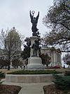
Monument to Confederate Women Monument to Confederate Women April 26, 1996 (#96000452 ) State capitol grounds at the junction of W. 7th and Marshall Sts. 34°44′45″N 92°17′20″W / 34.7458°N 92.2889°W / 34.7458; -92.2889 (Monument to Confederate Women )
166
Moore Building Moore Building October 23, 1986 (#86002894 ) 519-523 Center St. 34°44′37″N 92°16′27″W / 34.7436°N 92.2742°W / 34.7436; -92.2742 (Moore Building )
167
Moore House Moore House December 22, 1982 (#82000911 ) 20 Armistead 34°46′00″N 92°19′23″W / 34.7667°N 92.3231°W / 34.7667; -92.3231 (Moore House )
168
Mooshian-Brewer House Upload image January 23, 2024 (#100009788 ) 4701 N. Lookout Road 34°45′45″N 92°19′32″W / 34.7625°N 92.3255°W / 34.7625; -92.3255 (Mooshian-Brewer House )
169
Mopac Station Mopac Station June 17, 1977 (#77000270 ) Markham and Victory St. 34°45′01″N 92°17′09″W / 34.7502°N 92.2858°W / 34.7502; -92.2858 (Mopac Station )
170
Mosaic Templars State Temple Mosaic Templars State Temple May 18, 2018 (#100002457 ) 906 S Broadway St. 34°44′27″N 92°16′36″W / 34.7407°N 92.2767°W / 34.7407; -92.2767 (Mosaic Templars State Temple )
171
Mount Holly Cemetery Mount Holly Cemetery March 5, 1970 (#70000125 ) 12th St. and Broadway 34°44′17″N 92°16′42″W / 34.738015°N 92.278275°W / 34.738015; -92.278275 (Mount Holly Cemetery )
172
Mount Holly Mausoleum Mount Holly Mausoleum December 22, 1982 (#82000912 ) 12th St. and Broadway 34°44′17″N 92°16′42″W / 34.738015°N 92.278275°W / 34.738015; -92.278275 (Mount Holly Mausoleum )
173
Mount Zion Baptist Church Mount Zion Baptist Church March 27, 1987 (#86003230 ) 900 Cross St. 34°44′30″N 92°17′07″W / 34.741667°N 92.285278°W / 34.741667; -92.285278 (Mount Zion Baptist Church )
174
Nash House Nash House December 22, 1982 (#82000913 ) 409 E. 6th St. 34°44′32″N 92°16′02″W / 34.742222°N 92.267222°W / 34.742222; -92.267222 (Nash House )
175
Nash House Nash House December 22, 1982 (#82000914 ) 601 Rock St. 34°44′32″N 92°16′02″W / 34.742222°N 92.267222°W / 34.742222; -92.267222 (Nash House )
176
National Old Line Insurance Company Building Upload image May 29, 2019 (#100003985 ) 501 Woodlane St. 34°44′45″N 92°17′16″W / 34.7458°N 92.2879°W / 34.7458; -92.2879 (National Old Line Insurance Company Building )
177
Newbill-Porter House Upload image January 12, 2021 (#100006031 ) 3900 North Lookout St. 34°45′53″N 92°18′56″W / 34.7648°N 92.3155°W / 34.7648; -92.3155 (Newbill-Porter House )
178
Oak Forest United Methodist Church Upload image January 12, 2021 (#100006032 ) 2415 Fair Park Blvd. 34°43′46″N 92°20′06″W / 34.7294°N 92.3349°W / 34.7294; -92.3349 (Oak Forest United Methodist Church )
179
Oakland-Fraternal Cemetery Oakland-Fraternal Cemetery April 20, 2010 (#09001258 ) 2101 Barber St. 34°43′43″N 92°15′40″W / 34.728586°N 92.261161°W / 34.728586; -92.261161 (Oakland-Fraternal Cemetery )
180
Old Post Office Building and Customhouse Old Post Office Building and Customhouse May 7, 1973 (#73000388 ) 2nd and Spring Sts. 34°44′52″N 92°16′24″W / 34.747778°N 92.273333°W / 34.747778; -92.273333 (Old Post Office Building and Customhouse )
181
Old State House Old State House December 3, 1969 (#69000037 ) 300 W. Markham St. 34°44′56″N 92°16′19″W / 34.748889°N 92.271944°W / 34.748889; -92.271944 (Old State House )
182
Parnell Hall Parnell Hall January 24, 2008 (#07001431 ) 2400 W. Markham 34°45′13″N 92°17′55″W / 34.753611°N 92.298611°W / 34.753611; -92.298611 (Parnell Hall )
183
Fred W. Parris Towers Fred W. Parris Towers March 7, 2017 (#100000707 ) 1800 S. Broadway St. 34°43′53″N 92°16′43″W / 34.731423°N 92.278550°W / 34.731423; -92.278550 (Fred W. Parris Towers )
184
Pearson-Robinson House Pearson-Robinson House July 24, 1978 (#78000623 ) 1900 Marshall St. 34°43′54″N 92°17′30″W / 34.731667°N 92.291667°W / 34.731667; -92.291667 (Pearson-Robinson House )
185
Peoples Building & Loan Building Peoples Building & Loan Building September 2, 1982 (#82002129 ) 213-217 W. 2nd St. 34°45′08″N 92°16′42″W / 34.752222°N 92.278333°W / 34.752222; -92.278333 (Peoples Building & Loan Building )
186
Pfeifer Brothers Department Store Pfeifer Brothers Department Store May 18, 2000 (#00000464 ) 522-524 S. Main St. 34°44′34″N 92°16′16″W / 34.742778°N 92.271111°W / 34.742778; -92.271111 (Pfeifer Brothers Department Store )
187
Philander Smith College Historic District Philander Smith College Historic District September 13, 1999 (#99000229 ) Roughly bounded by 13th, 11th, Izard, and State Sts. 34°44′24″N 92°16′55″W / 34.74°N 92.281944°W / 34.74; -92.281944 (Philander Smith College Historic District )
188
Albert Pike Hotel Albert Pike Hotel November 21, 1978 (#78000625 ) 7th and Scott Sts. 34°44′30″N 92°16′11″W / 34.741667°N 92.269722°W / 34.741667; -92.269722 (Albert Pike Hotel )
189
Pike-Fletcher-Terry House Pike-Fletcher-Terry House August 21, 1972 (#72000208 ) 411 E. 7th St. 34°44′28″N 92°15′53″W / 34.741111°N 92.264722°W / 34.741111; -92.264722 (Pike-Fletcher-Terry House )
190
Lamar Porter Athletic Field Lamar Porter Athletic Field December 6, 1990 (#90001827 ) Junction of Johnson and 7th Sts. 34°44′45″N 92°18′29″W / 34.745833°N 92.308056°W / 34.745833; -92.308056 (Lamar Porter Athletic Field )
191
Jesse Powell Towers Upload image March 7, 2017 (#100000708 ) 1010 Wolfe St. 34°44′28″N 92°17′34″W / 34.741061°N 92.292853°W / 34.741061; -92.292853 (Jesse Powell Towers )
192
Presbyterian Village Upload image September 8, 2020 (#100005589 ) 510 Brookside Dr. 34°45′28″N 92°22′24″W / 34.7578°N 92.3732°W / 34.7578; -92.3732 (Presbyterian Village )
193
Prospect Terrace Apartments Prospect Terrace Apartments September 12, 2002 (#02001043 ) 3603 Kavanaugh Boulevard 34°45′43″N 92°19′53″W / 34.7619°N 92.3314°W / 34.7619; -92.3314 (Prospect Terrace Apartments )
194
Pulaski County Courthouse Pulaski County Courthouse October 18, 1979 (#79000454 ) 405 W. Markham St. 34°44′57″N 92°16′32″W / 34.7492°N 92.2756°W / 34.7492; -92.2756 (Pulaski County Courthouse )
195
Ragland House Ragland House June 17, 1977 (#77000271 ) 1617 Center St. 34°43′59″N 92°16′31″W / 34.7331°N 92.2753°W / 34.7331; -92.2753 (Ragland House )
196
Railroad Call Historic District Railroad Call Historic District July 9, 1997 (#97000749 ) 108, 112, and 114 S. Pulaski St.; also 104 South Pulaski St., 1302 and 1304 West 2nd St. 34°44′59″N 92°17′48″W / 34.7497°N 92.2967°W / 34.7497; -92.2967 (Railroad Call Historic District ) Second set of addresses represent a boundary increase approved February 15, 2024 .
197
Reichardt House Reichardt House May 2, 1975 (#75000410 ) 1201 Welch St. 34°44′09″N 92°15′34″W / 34.7358°N 92.2594°W / 34.7358; -92.2594 (Reichardt House )
198
Reid House Reid House December 22, 1982 (#82000916 ) 1425 Kavanaugh St. 34°45′17″N 92°18′30″W / 34.7547°N 92.3083°W / 34.7547; -92.3083 (Reid House )
199
Remmel Apartments Remmel Apartments December 22, 1982 (#82000919 ) 1704-1706 Spring St. 34°43′57″N 92°16′38″W / 34.7325°N 92.2772°W / 34.7325; -92.2772 (Remmel Apartments )
200
Remmel Apartments Remmel Apartments December 22, 1982 (#82000918 ) 1708-1710 Spring St. 34°43′56″N 92°16′37″W / 34.7322°N 92.2769°W / 34.7322; -92.2769 (Remmel Apartments )
201
Remmel Apartments Remmel Apartments December 22, 1982 (#82000917 ) 409-411 W. 17th St. 34°43′58″N 92°16′40″W / 34.7328°N 92.2778°W / 34.7328; -92.2778 (Remmel Apartments )
202
Remmel Flats Remmel Flats December 22, 1982 (#82000920 ) 1700-1702 Spring St. 34°43′58″N 92°16′37″W / 34.7328°N 92.2769°W / 34.7328; -92.2769 (Remmel Flats )
203
Retan House Retan House December 22, 1982 (#82000921 ) 2510 Broadway 34°43′26″N 92°16′44″W / 34.7239°N 92.2789°W / 34.7239; -92.2789 (Retan House )
204
Albert Retan House Albert Retan House December 3, 1980 (#80000784 ) 506 N. Elm St. 34°45′18″N 92°19′07″W / 34.755°N 92.3186°W / 34.755; -92.3186 (Albert Retan House )
205
Reutlinger House Upload image June 16, 2021 (#100006527 ) 2005 South Spring St. 34°43′45″N 92°16′38″W / 34.7293°N 92.2773°W / 34.7293; -92.2773 (Reutlinger House )
206
Joseph Taylor Robinson House Joseph Taylor Robinson House August 28, 1975 (#75000411 ) 2122 Broadway 34°43′40″N 92°16′44″W / 34.7278°N 92.2789°W / 34.7278; -92.2789 (Joseph Taylor Robinson House ) Home of Arkansas governor and U.S. Senator Joseph Taylor Robinson during 1930-1937, the period of his greatest influence
207
Joseph Taylor Robinson Memorial Auditorium Joseph Taylor Robinson Memorial Auditorium February 21, 2007 (#07000056 ) 414 W. Markham 34°44′57″N 92°16′28″W / 34.7492°N 92.2744°W / 34.7492; -92.2744 (Joseph Taylor Robinson Memorial Auditorium )
208
Rogers House Rogers House December 22, 1982 (#82000922 ) 400 W. 18th St. 34°43′56″N 92°16′40″W / 34.7322°N 92.2778°W / 34.7322; -92.2778 (Rogers House )
209
Rose Building Rose Building November 13, 1986 (#86003119 ) 307 Main St. 34°44′43″N 92°16′13″W / 34.7453°N 92.2703°W / 34.7453; -92.2703 (Rose Building )
210
U.M. Rose School U.M. Rose School December 8, 1988 (#88002820 ) Izard and W. 13th St. 34°44′16″N 92°16′54″W / 34.7378°N 92.2817°W / 34.7378; -92.2817 (U.M. Rose School )
211
Roselawn Memorial Park Gatehouse Roselawn Memorial Park Gatehouse December 22, 1982 (#82000923 ) 2801 Asher 34°43′51″N 92°18′16″W / 34.7308°N 92.3044°W / 34.7308; -92.3044 (Roselawn Memorial Park Gatehouse )
212
Ross Building Upload image January 24, 2019 (#100003334 ) 700 S. Schiller St. 34°44′41″N 92°17′46″W / 34.7446°N 92.2962°W / 34.7446; -92.2962 (Ross Building )
213
J.P. Runyan House J.P. Runyan House August 18, 1992 (#92001067 ) 1514 S. Schiller 34°44′09″N 92°17′48″W / 34.7358°N 92.2967°W / 34.7358; -92.2967 (J.P. Runyan House )
214
Safferstone House Safferstone House December 22, 1982 (#82000925 ) 2205 Arch St. 34°43′38″N 92°16′46″W / 34.7272°N 92.2794°W / 34.7272; -92.2794 (Safferstone House )
215
Saint Andrews Catholic Cathedral Saint Andrews Catholic Cathedral November 13, 1986 (#86003117 ) 617 Louisiana St. 34°44′33″N 92°16′19″W / 34.7425°N 92.271944°W / 34.7425; -92.271944 (Saint Andrews Catholic Cathedral )
216
St. Edwards Church St. Edwards Church December 22, 1982 (#82000929 ) 823 Sherman 34°44′23″N 92°15′54″W / 34.739722°N 92.265°W / 34.739722; -92.265 (St. Edwards Church )
217
St. Peter's Rock Baptist Church St. Peter's Rock Baptist Church January 20, 2005 (#04001492 ) 1401 W. 18th St. 34°44′06″N 92°17′19″W / 34.735°N 92.288611°W / 34.735; -92.288611 (St. Peter's Rock Baptist Church )
218
Sanders House Sanders House December 22, 1982 (#82000924 ) 2100 Gaines St. 34°43′42″N 92°16′52″W / 34.728333°N 92.281111°W / 34.728333; -92.281111 (Sanders House )
219
Schaer House Schaer House December 22, 1982 (#82000926 ) 1862 Arch St. 34°43′51″N 92°16′47″W / 34.730833°N 92.279722°W / 34.730833; -92.279722 (Schaer House )
220
Shiloh Missionary Baptist Church Upload image March 24, 2020 (#100004893 ) 1200 Hanger St. 34°44′11″N 92°15′26″W / 34.7363°N 92.2573°W / 34.7363; -92.2573 (Shiloh Missionary Baptist Church )
221
Dr. Morgan Smith House Dr. Morgan Smith House May 20, 2009 (#09000323 ) 5110 Stagecoach Rd. 34°42′05″N 92°23′04″W / 34.701336°N 92.384508°W / 34.701336; -92.384508 (Dr. Morgan Smith House )
222
Snyder House Snyder House December 22, 1982 (#82000928 ) 4004 S. Lookout 34°45′49″N 92°19′05″W / 34.763611°N 92.318056°W / 34.763611; -92.318056 (Snyder House )
223
South Main Street Apartments Historic District South Main Street Apartments Historic District April 7, 1995 (#95000378 ) 2209-2213 Main St. 34°43′37″N 92°16′24″W / 34.726944°N 92.273333°W / 34.726944; -92.273333 (South Main Street Apartments Historic District )
224
South Main Street Commercial Historic District South Main Street Commercial Historic District August 31, 2007 (#07000435 ) S. Main St. from 12th St. to 17th St. 34°44′05″N 92°16′23″W / 34.734853°N 92.272942°W / 34.734853; -92.272942 (South Main Street Commercial Historic District )
225
South Main Street Residential Historic District South Main Street Residential Historic District July 12, 2007 (#07000436 ) S. Main St. from 19th St. to 24th St.; also 2006-2008, and 2014 S. Scott, and 114, 116, and 118 E. 21st Sts. 34°43′41″N 92°16′26″W / 34.728175°N 92.273764°W / 34.728175; -92.273764 (South Main Street Residential Historic District ) Second set of boundaries represents a boundary increase of October 17, 2012
226
South Scott Street Historic District South Scott Street Historic District November 12, 1999 (#99001297 ) Roughly bounded by E. 24th, S. Scott, E. 25th, and South Main Sts. 34°43′55″N 92°16′22″W / 34.731944°N 92.272778°W / 34.731944; -92.272778 (South Scott Street Historic District )
227
Southern Trust Building Southern Trust Building September 26, 2013 (#13000790 ) 221 W. 2nd St. 34°44′50″N 92°16′20″W / 34.747184°N 92.272229°W / 34.747184; -92.272229 (Southern Trust Building )
228
Southwestern Bell Headquarters Building Upload image January 4, 2022 (#100007314 ) 1111 West Capitol Ave. 34°44′45″N 92°17′00″W / 34.7458°N 92.2834°W / 34.7458; -92.2834 (Southwestern Bell Headquarters Building )
229
Stebbins and Roberts Office Building and Factory Stebbins and Roberts Office Building and Factory October 4, 2016 (#16000682 ) 1300 E. 6th St. 34°44′31″N 92°15′21″W / 34.741937°N 92.255939°W / 34.741937; -92.255939 (Stebbins and Roberts Office Building and Factory )
230
Stewart House Stewart House December 22, 1982 (#82000930 ) 1406 Summit St. 34°44′13″N 92°17′43″W / 34.736944°N 92.295278°W / 34.736944; -92.295278 (Stewart House )
231
Stifft Station Historic District Stifft Station Historic District October 18, 2006 (#06000941 ) Bounded by W. Markham, W. 7th, Woodrow, and Martin Sts. 34°45′00″N 92°18′29″W / 34.75°N 92.308056°W / 34.75; -92.308056 (Stifft Station Historic District )
232
Dan Stowers Office Building Dan Stowers Office Building September 28, 2015 (#15000633 ) 1516 W. 3rd St. 34°44′55″N 92°17′18″W / 34.7485°N 92.2883°W / 34.7485; -92.2883 (Dan Stowers Office Building )
233
Taborian Hall Taborian Hall April 29, 1982 (#82002130 ) 9th and State Sts. 34°44′30″N 92°16′48″W / 34.741667°N 92.28°W / 34.741667; -92.28 (Taborian Hall )
234
The Tavern The Tavern March 5, 1970 (#70000126 ) 214 E. 3rd St. 34°44′47″N 92°15′56″W / 34.746389°N 92.265556°W / 34.746389; -92.265556 (The Tavern )
235
Taylor Building Taylor Building November 13, 1986 (#86003123 ) 304 Main St. 34°44′45″N 92°16′16″W / 34.745833°N 92.271111°W / 34.745833; -92.271111 (Taylor Building )
236
Samuel P. Taylor Service Station Samuel P. Taylor Service Station November 29, 2000 (#00001364 ) 1123 W. 3rd St. 34°44′51″N 92°17′01″W / 34.7475°N 92.283611°W / 34.7475; -92.283611 (Samuel P. Taylor Service Station )
237
Ten Mile House Ten Mile House June 22, 1970 (#70000129 ) 6915 Stagecoach Road (Highway 5 ), Mabelvale 34°41′12″N 92°23′52″W / 34.6866°N 92.3978°W / 34.6866; -92.3978 (Ten Mile House )
238
Terminal Hotel Terminal Hotel November 17, 1978 (#78003200 ) Victory and Markham Sts. 34°45′00″N 92°17′08″W / 34.750061°N 92.285672°W / 34.750061; -92.285672 (Terminal Hotel )
239
Terminal Warehouse Building Terminal Warehouse Building April 29, 1982 (#82002131 ) 500 E. Markham St. 34°44′51″N 92°15′53″W / 34.7475°N 92.264722°W / 34.7475; -92.264722 (Terminal Warehouse Building )
240
William L. Terry House William L. Terry House January 1, 1976 (#76000459 ) 1422 Scott St. 34°44′05″N 92°16′23″W / 34.734722°N 92.273056°W / 34.734722; -92.273056 (William L. Terry House )
241
Ada Thompson Memorial Home Ada Thompson Memorial Home August 3, 1977 (#77000272 ) 2021 S. Main 34°43′44″N 92°16′24″W / 34.728889°N 92.273333°W / 34.728889; -92.273333 (Ada Thompson Memorial Home )
242
Thornton House Thornton House May 28, 1999 (#99000543 ) 1420 W. 15th St. 34°44′12″N 92°17′20″W / 34.736667°N 92.288889°W / 34.736667; -92.288889 (Thornton House )
243
Thurston House Thurston House December 22, 1982 (#82000931 ) 923 Cumberland St. 34°44′20″N 92°16′08″W / 34.738889°N 92.268889°W / 34.738889; -92.268889 (Thurston House )
244
Dr. Eugene Towbin House Upload image January 24, 2019 (#100003336 ) 16 Broadview Dr. 34°45′57″N 92°20′56″W / 34.7657°N 92.3489°W / 34.7657; -92.3489 (Dr. Eugene Towbin House )
245
Tower Building Tower Building September 23, 2011 (#11000692 ) 323 Center St. 34°44′44″N 92°16′24″W / 34.745556°N 92.273333°W / 34.745556; -92.273333 (Tower Building )
246
Trapnall Hall Trapnall Hall April 13, 1973 (#73000389 ) 423 E. Capitol Ave. 34°44′35″N 92°15′59″W / 34.743056°N 92.266389°W / 34.743056; -92.266389 (Trapnall Hall )
247
Trinity Episcopal Cathedral Trinity Episcopal Cathedral May 13, 1976 (#76000460 ) 310 W. 17th St. 34°43′59″N 92°16′35″W / 34.733056°N 92.276389°W / 34.733056; -92.276389 (Trinity Episcopal Cathedral )
248
Trinity Hospital Trinity Hospital November 18, 1998 (#98001481 ) Junction of Main and 20th Sts. 34°43′46″N 92°16′26″W / 34.729444°N 92.273889°W / 34.729444; -92.273889 (Trinity Hospital )
249
Tuf Nut Historic Commercial District Tuf Nut Historic Commercial District March 27, 2003 (#99000856 ) 300-312 S. Rock St. and 423 E. 3rd St 34°44′42″N 92°15′58″W / 34.745°N 92.266111°W / 34.745; -92.266111 (Tuf Nut Historic Commercial District )
250
Turner House Turner House December 22, 1982 (#82000932 ) 1701 Center St. 34°43′56″N 92°16′31″W / 34.732222°N 92.275278°W / 34.732222; -92.275278 (Turner House )
251
Turner-Ledbetter House Turner-Ledbetter House June 18, 1987 (#87000978 ) 1700 S. Louisiana St. 34°43′57″N 92°16′29″W / 34.7325°N 92.274722°W / 34.7325; -92.274722 (Turner-Ledbetter House )
252
U.S. Arsenal Building U.S. Arsenal Building July 28, 1970 (#70000127 ) MacArthur Park, 9th, and Commerce Sts. 34°44′18″N 92°15′45″W / 34.738333°N 92.2625°W / 34.738333; -92.2625 (U.S. Arsenal Building )
253
Union Life Building Union Life Building September 25, 1981 (#81000141 ) 212 Center St. 34°44′49″N 92°16′23″W / 34.746944°N 92.273056°W / 34.746944; -92.273056 (Union Life Building )
254
University Park Historic District Upload image October 18, 2023 (#100008973 ) Roughly bounded by Arthur Dr., West 12th, and South Hughes Sts. 34°44′35″N 92°20′50″W / 34.7430°N 92.3473°W / 34.7430; -92.3473 (University Park Historic District )
255
Van Frank Cottages Van Frank Cottages October 21, 1985 (#85003476 ) 515-519 E. 15th St. and 1510 Park Ln. 34°44′00″N 92°16′02″W / 34.733333°N 92.267222°W / 34.733333; -92.267222 (Van Frank Cottages )
256
Vanetten House Vanetten House December 22, 1982 (#82000933 ) 1012 Cumberland 34°44′18″N 92°16′11″W / 34.738333°N 92.269722°W / 34.738333; -92.269722 (Vanetten House )
257
Vaughan House Vaughan House December 22, 1982 (#82000934 ) 2201 Broadway 34°43′36″N 92°16′41″W / 34.726667°N 92.278056°W / 34.726667; -92.278056 (Vaughan House )
258
Vaughn House Vaughn House February 18, 1999 (#99000226 ) 104 Rosetta 34°44′59″N 92°18′31″W / 34.749722°N 92.308611°W / 34.749722; -92.308611 (Vaughn House )
259
Veterans Administration Hospital Upload image September 14, 2021 (#100006930 ) 300 East Roosevelt Rd. 34°43′27″N 92°16′15″W / 34.7242°N 92.2709°W / 34.7242; -92.2709 (Veterans Administration Hospital )
260
Vinson House Vinson House May 6, 1976 (#76000461 ) 2123 Broadway 34°43′39″N 92°16′42″W / 34.7275°N 92.278333°W / 34.7275; -92.278333 (Vinson House )
261
Wallace Building Wallace Building February 18, 1999 (#99000223 ) 101-111 Main St. 34°44′52″N 92°16′12″W / 34.747778°N 92.27°W / 34.747778; -92.27 (Wallace Building )
262
Zeb Ward Building Zeb Ward Building April 19, 1978 (#78000626 ) 1001-1003 W. Markham St. 34°44′57″N 92°16′52″W / 34.749167°N 92.281111°W / 34.749167; -92.281111 (Zeb Ward Building )
263
Ward-Hays House Ward-Hays House August 11, 1975 (#75000412 ) 1008 W. 2nd St. 34°44′56″N 92°16′54″W / 34.748889°N 92.281667°W / 34.748889; -92.281667 (Ward-Hays House )
264
Corydon Wassell House Corydon Wassell House June 2, 2000 (#00000611 ) 2005 S. Scott St. 34°43′45″N 92°16′20″W / 34.729167°N 92.272222°W / 34.729167; -92.272222 (Corydon Wassell House )
265
Charles Clary Waters House Charles Clary Waters House August 10, 1979 (#79000455 ) 2004 W. 22nd St. 34°43′42″N 92°17′37″W / 34.728333°N 92.293611°W / 34.728333; -92.293611 (Charles Clary Waters House )
266
West 7th Street Historic District West 7th Street Historic District January 21, 2009 (#08001341 ) Portions of the 800-1100 blocks of W. 7th St. 34°44′37″N 92°16′56″W / 34.743661°N 92.282208°W / 34.743661; -92.282208 (West 7th Street Historic District )
267
White-Baucum House White-Baucum House February 29, 1980 (#80000785 ) 201 S. Izard St. 34°44′53″N 92°16′46″W / 34.748056°N 92.279444°W / 34.748056; -92.279444 (White-Baucum House )
268
Williamson House Williamson House November 15, 1984 (#84000238 ) 325 Fairfax St. 34°45′11″N 92°18′28″W / 34.753056°N 92.307778°W / 34.753056; -92.307778 (Williamson House )
269
Winchester Auto Store Winchester Auto Store January 24, 2019 (#100003337 ) 323 W. 8th St. 34°44′30″N 92°16′30″W / 34.7416°N 92.2751°W / 34.7416; -92.2751 (Winchester Auto Store )
270
Winfield Methodist Church Winfield Methodist Church December 22, 1982 (#82000935 ) 1601 Louisiana 34°43′59″N 92°16′26″W / 34.733056°N 92.273889°W / 34.733056; -92.273889 (Winfield Methodist Church )
271
William Woodruff House William Woodruff House March 21, 1989 (#89000173 ) 1017 E. 8th St. 34°44′24″N 92°15′32″W / 34.740000°N 92.258889°W / 34.740000; -92.258889 (William Woodruff House )
272
Worthen Bank Building Worthen Bank Building November 13, 1986 (#86003125 ) 401 Main St. 34°44′41″N 92°16′13″W / 34.744722°N 92.270278°W / 34.744722; -92.270278 (Worthen Bank Building )
273
The Worthen Building Upload image September 5, 2024 (#100010828 ) 200 West Capitol Avenue 34°44′40″N 92°16′24″W / 34.7445°N 92.2733°W / 34.7445; -92.2733 (The Worthen Building )
274
YMCA-Democrat Building YMCA-Democrat Building June 11, 1992 (#87001544 ) E. Capitol and Scott Sts. 34°44′37″N 92°16′12″W / 34.743611°N 92.27°W / 34.743611; -92.27 (YMCA-Democrat Building )


