
Mount Manengouba
(Redirected from Mount Manenguba)
| Mount Manengouba | |
|---|---|
 | |
| Highest point | |
| Elevation | 2,411 m (7,910 ft) |
| Coordinates | 5°01′48″N 9°49′48″E / 5.03000°N 9.83000°E |
| Geography | |
 Mount Manengouba Location in Cameroon | |
| Location | Cameroon |
| Parent range | Cameroon line |
| Geology | |
| Rock age | Pleistocene |
| Mountain type(s) | Shield volcano, stratovolcano |
Mount Muanenguba (also spelled Manenguba or Mwanenguba) is a volcano in the Southwest Province of Cameroon.[1] The Manenguba shrew and endemic vegetal species are native to the mountain. The area is featured in the documentary The Mists of Mwanenguba with botanist Martin Cheek.[2]
Geology
[edit]The volcano is a Pleistocene shield volcano. It is topped by the Eboga stratovolcano.[3]
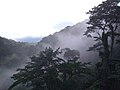
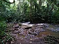
Gallery
[edit]- Mount Mwanenguba
-

-
-

-
-

-
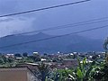 Mount Manengouba from Nkongsamba


References
[edit]- ^ "Manengouba". Global Volcanism Program. Smithsonian Institution. Retrieved 2024-09-10.
- ^ "Oasis TV". Archived from the original on November 27, 2010. Retrieved August 8, 2010.
- ^ "Global Volcanism Program | Manengouba". Smithsonian Institution | Global Volcanism Program. Retrieved 2024-09-11.
External links
[edit]
This Cameroon location article is a stub. You can help Wikipedia by expanding it. |