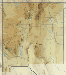
Baldy Mountain (Colfax County, New Mexico)
| Baldy Mountain | |
|---|---|
 Baldy Mountain from Copper Park camp | |
| Highest point | |
| Elevation | 12,441 ft (3,792 m) NAVD 88[1] |
| Prominence | 2,681 ft (817 m)[2] |
| Coordinates | 36°37′48″N 105°12′48″W / 36.629881983°N 105.213404958°W[1] |
| Geography | |
Colfax County, New Mexico, U.S. | |
| Parent range | Cimarron Range, Sangre de Cristo Mountains |
| Topo map | USGS Baldy Mountain |
Baldy Mountain (official name), Baldy Peak, Mount Baldy, or Old Baldy is the highest peak in the Cimarron Range, a subrange of the Sangre de Cristo Mountains of New Mexico. It is located in Colfax County, about 6 miles (10 km) northeast of Eagle Nest. It rises abruptly, with 3,640 feet (1,110 m) of vertical relief (in 3 miles/4.8 km), from the Moreno Valley to the west and has a total elevation of 12,441 feet (3,792 m).[1]
Philmont Scout Ranch
[edit]Baldy Mountain lies on the northwestern border of the Boy Scouts of America's Philmont Scout Ranch. The valleys on the eastern side of the peak are home to some of the many small camps that are scattered throughout the Ranch. Four wheel drive roads and a radio tower exist high on the western slopes. In 1963 Norton Clapp bought 10,098 acres (4,087 ha) around the mountain and donated it to the Boy Scouts of America.[3]
Mining
[edit]Copper, gold, and silver were mined in the Baldy Mining District starting in 1866, and the top of Baldy Mountain was developed as the Mystic Lode copper mine.[4] Other mines near Baldy Mountain were the Aztec, French Henry mine, Bull-of-the-Woods, Homestake, Black Horse, and Montezuma mines.[5] Mine workings and prospects are still evident on the slopes of the mountain as well. There are about 70 miles (110 km) of mines in the whole mountain.[citation needed]
On the east side of Baldy Mountain, a small town grew up around the mining operations from 1868 to 1941. Baldy Town has since been incorporated as a staff camp at Philmont Scout Ranch.
Gallery
[edit]-
Baldy Mountain from Copper Park, Philmont Scout Ranch
-
Baldy Mountain from Wilson Mesa
-
Viewing the southern face of Mount Baldy
See also
[edit]- Baldy Town
- Tooth of Time
- Mount Phillips (New Mexico)
- List of peaks named Baldy
- Cimarron Range
- Culebra Range
- 4000 meter peaks of the United States
- Geography and ecology of Philmont Scout Ranch
External links
[edit]- "Baldy Mountain (NM)". SummitPost.org.
References
[edit]- ^ a b c "Baldy Mtn". NGS Data Sheet. National Geodetic Survey, National Oceanic and Atmospheric Administration, United States Department of Commerce. Retrieved February 10, 2014.
- ^ "Baldy Mountain, New Mexico". Peakbagger.com. Retrieved February 10, 2014.
- ^ "Philmont Scout Ranch a major economic, social player in northern New Mexico - Albuquerque Journal". www.abqjournal.com. Retrieved October 27, 2021.
- ^ Butterfield, Mike; Greene, Peter (2006). Mike Butterfield's Guide to the Mountains of New Mexico. New Mexico Magazine Press. ISBN 978-0937206881.
- ^ New Mexico. Bureau of Immigration (1896). The Mines of New Mexico: Inexhaustible Deposits of Gold and Silver, Copper, Lead, Iron and Coal. A Mineral Area Unequaled in Any State Or Territory for the Extent and Value of Its Mines. New Mexican printing Company.


