Mori Kazakh Autonomous County
Appearance
(Redirected from Mori Kazak Autonomous County)
Mori County
| |
|---|---|
| Mori Kazak Autonomous County 木垒哈萨克自治县 مُلُوِ خَاسَاکْ زِجِثِیًا Мори Қазақ автономиялық ауданы موري قازاق اۆتونوميالىق اۋدانى مورى قازاق ئاپتونوم ناھىيىسى | |
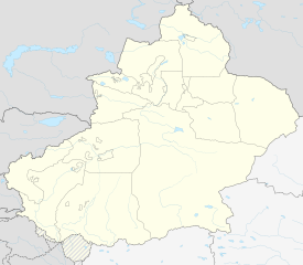
 Location of Mori Kazakh Autonomous County (pink) in Changji Prefecture (yellow) and Xinjiang (grey) | |
| Coordinates: 43°49′00″N 90°17′00″E / 43.8167°N 90.2833°E | |
| Country | China |
| Province | Xinjiang |
| Prefecture | Changji |
| County seat | Mori Town |
| Area | |
• Total | 13,510.28 km2 (5,216.35 sq mi) |
| Population (2020)[1] | |
• Total | 67,256 |
| • Density | 5.0/km2 (13/sq mi) |
| Time zone | UTC+8 (China Standard[a]) |
| Website | www |
| Mori Kazakh Autonomous County | |||||||||||
|---|---|---|---|---|---|---|---|---|---|---|---|
| Chinese name | |||||||||||
| Simplified Chinese | 木垒哈萨克自治县 | ||||||||||
| Traditional Chinese | 木壘哈薩克自治縣 | ||||||||||
| |||||||||||
| Uyghur name | |||||||||||
| Uyghur | مورى قازاق ئاپتونوم ناھىيىسى | ||||||||||
| |||||||||||
| Kazakh name | |||||||||||
| Kazakh | موري قازاق اۆتونوميالى اۋدانى Mori Qazaq avtonomialyq audany Мори Қазақ автономиялық ауданы | ||||||||||
Mori Kazakh Autonomous County is a county within the Xinjiang Uyghur Autonomous Region and is under the administration of the Changji Hui Autonomous Prefecture. It contains an area of 13,510 km2. According to the 2002 census, it has a population of 90,000.
Subdivisions
[edit]Mori County is made up of 4 towns, 6 townships, and 1 ethnic township.
| Name | Simplified Chinese | Hanyu Pinyin | Uyghur (UEY) | Uyghur Latin (ULY) | Kazakh (Arabic script) | Kazakh (Cyrillic script) | Administrative division code | |
|---|---|---|---|---|---|---|---|---|
| Towns | ||||||||
| Mori Town | 木垒镇 | Mùlěi Zhèn | مورى بازىرى | mori baziri | موري قالاشىعى | 652328100 | ||
| Xijir Town | 西吉尔镇 | Xījí'ěr Zhèn | شىجىر بازىرى | shijir baziri | شيجير قالاشىعى | 652328101 | ||
| Dongcheng Town | 东城镇 | Dōngchéng Zhèn | دۇڭچېڭ بازىرى | dungchëng baziri | دۇڭشىڭ قالاشىعى | 652328102 | ||
| Xinhu Town | 新户镇 | Xīnhù Zhèn | شىنخۇ بازىرى | shinxu baziri | شينحۋ قالاشىعى | 652328103 | ||
| Townships | ||||||||
| Yinggepu Township (Eginbulakh Township) |
英格堡乡 | Yīnggépù Xiāng | ئېگىنبۇلاق يېزىسى | Ëginbulaq yëzisi | ىنگىبۇلاق اۋىلى | 652328200 | ||
| Zhaobishan Township | 照壁山乡 | Zhàobìshān Xiāng | قالقانتاغ يېزىسى | Qalqantagh yëzisi | قالقانتاۋ اۋىلى | 652328201 | ||
| Qorin Township | 雀仁乡 | Qiāorén Xiāng | چۆرىن يېزىسى | chörin yëzisi | ٴشورىن اۋىلى | 652328203 | ||
| Baiyanghe Township | 白杨河乡 | Báiyánghé Xiāng | ئاقتېرەك يېزىسى | Aqtërak yëzisi | اقتەرەك اۋىلى | 652328204 | ||
| Dashitou Township | 大石头乡 | Dàshítóu Xiāng | چوقبارتاش يېزىسى | choqbartash yëzisi | شوقپارتاس اۋىلى | 652328205 | ||
| Bostan Township | 博斯坦乡 | Bósītǎn Xiāng | بوستان يېزىسى | bostan yëzisi | بوستان اۋىلى | 652328207 | ||
| Ethnic Township | ||||||||
| Danangou Uzbek Ethnic Township | 大南沟乌孜别克乡 | Dànángōu Wūzībiékè Xiāng | دانەنگۇ ئۆزبېك يېزىسى | danengu Özbëk yëzisi | دانانگۋ وزبەك ۇلتتىق اۋىلى | 652328206 | ||
Climate
[edit]| Climate data for Mori, elevation 1,272 m (4,173 ft), (1991–2020 normals, extremes 1981–2010) | |||||||||||||
|---|---|---|---|---|---|---|---|---|---|---|---|---|---|
| Month | Jan | Feb | Mar | Apr | May | Jun | Jul | Aug | Sep | Oct | Nov | Dec | Year |
| Record high °C (°F) | 14.1 (57.4) |
13.1 (55.6) |
21.3 (70.3) |
30.1 (86.2) |
31.7 (89.1) |
34.9 (94.8) |
37.9 (100.2) |
35.5 (95.9) |
33.9 (93.0) |
27.7 (81.9) |
21.5 (70.7) |
14.5 (58.1) |
37.9 (100.2) |
| Mean daily maximum °C (°F) | −5.4 (22.3) |
−2.8 (27.0) |
4.3 (39.7) |
14.9 (58.8) |
20.6 (69.1) |
25.4 (77.7) |
27.5 (81.5) |
26.7 (80.1) |
21.3 (70.3) |
12.6 (54.7) |
3.2 (37.8) |
−3.5 (25.7) |
12.1 (53.7) |
| Daily mean °C (°F) | −11.5 (11.3) |
−8.8 (16.2) |
−1.4 (29.5) |
8.6 (47.5) |
14.4 (57.9) |
19.5 (67.1) |
21.4 (70.5) |
20.1 (68.2) |
14.5 (58.1) |
6.3 (43.3) |
−2.4 (27.7) |
−9.3 (15.3) |
6.0 (42.7) |
| Mean daily minimum °C (°F) | −16.1 (3.0) |
−13.5 (7.7) |
−5.8 (21.6) |
3.6 (38.5) |
8.9 (48.0) |
14.1 (57.4) |
16.1 (61.0) |
14.8 (58.6) |
9.4 (48.9) |
2.2 (36.0) |
−6.2 (20.8) |
−13.7 (7.3) |
1.2 (34.1) |
| Record low °C (°F) | −28.8 (−19.8) |
−28.2 (−18.8) |
−23.4 (−10.1) |
−13.8 (7.2) |
−6.3 (20.7) |
1.3 (34.3) |
7.1 (44.8) |
0.1 (32.2) |
−3.6 (25.5) |
−14.6 (5.7) |
−29.2 (−20.6) |
−29.8 (−21.6) |
−29.8 (−21.6) |
| Average precipitation mm (inches) | 7.9 (0.31) |
8.7 (0.34) |
17.4 (0.69) |
42.4 (1.67) |
52.3 (2.06) |
41.7 (1.64) |
50.8 (2.00) |
40.9 (1.61) |
31.8 (1.25) |
29.8 (1.17) |
22.2 (0.87) |
13.0 (0.51) |
358.9 (14.12) |
| Average precipitation days (≥ 0.1 mm) | 5.5 | 5.4 | 5.9 | 7.3 | 7.6 | 7.9 | 8.6 | 7.2 | 5.4 | 5.8 | 6.7 | 7.0 | 80.3 |
| Average snowy days | 9.6 | 9.1 | 7.9 | 4.5 | 1.4 | 0 | 0 | 0 | 0.6 | 4.1 | 8.4 | 10.3 | 55.9 |
| Average relative humidity (%) | 64 | 65 | 64 | 49 | 45 | 46 | 48 | 45 | 45 | 55 | 65 | 66 | 55 |
| Mean monthly sunshine hours | 193.7 | 205.8 | 254.8 | 261.8 | 304.6 | 303.0 | 298.6 | 297.3 | 272.6 | 242.7 | 185.1 | 179.1 | 2,999.1 |
| Percent possible sunshine | 66 | 68 | 68 | 64 | 66 | 66 | 65 | 70 | 74 | 73 | 65 | 65 | 68 |
| Source: China Meteorological Administration[2][3] | |||||||||||||
Notes
[edit]- ^ Locals in Xinjiang frequently observe UTC+6 (Xinjiang Time), 2 hours behind Beijing.
References
[edit]- ^ Xinjiang: Prefectures, Cities, Districts and Counties
- ^ 中国气象数据网 – WeatherBk Data (in Simplified Chinese). China Meteorological Administration. Retrieved 10 October 2023.
- ^ 中国气象数据网 (in Simplified Chinese). China Meteorological Administration. Retrieved 10 October 2023.


