Morgenröthe-Rautenkranz
Appearance
(Redirected from Morgenrothe-Rautenkranz)
Morgenröthe-Rautenkranz | |
|---|---|
 Aerial view of Rautenkranz | |
| Coordinates: 50°27′N 12°31′E / 50.450°N 12.517°E | |
| Country | Germany |
| State | Saxony |
| District | Vogtlandkreis |
| Municipality | Muldenhammer |
| Subdivisions | 4 |
| Area | |
• Total | 30.03 km2 (11.59 sq mi) |
| Highest elevation | 750 m (2,460 ft) |
| Lowest elevation | 620 m (2,030 ft) |
| Population (2006-12-31) | |
• Total | 851 |
| • Density | 28/km2 (73/sq mi) |
| Time zone | UTC+01:00 (CET) |
| • Summer (DST) | UTC+02:00 (CEST) |
| Postal codes | 08262 |
| Dialling codes | 037465 |
| Vehicle registration | V |
| Website | www.morgenröthe-rautenkranz.com |
Morgenröthe-Rautenkranz is a village and a former municipality in the Vogtlandkreis district, in Saxony, Germany. Since 1 October 2009, along with Tannenbergsthal and Hammerbrücke, it is part of the municipality Muldenhammer.
Personalities
[edit]- Sigmund Jähn (1937-2019), first German cosmonaut
Gallery
[edit]-
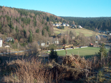
Morgenröthe
References
[edit]External links
[edit]![]() Media related to Morgenröthe-Rautenkranz at Wikimedia Commons
Media related to Morgenröthe-Rautenkranz at Wikimedia Commons
- Morgenröthe-Rautenkranz in the Digital Historic Index of Places in Saxony (Digitales Historisches Ortsverzeichnis von Sachsen)
- Morgenröthe in the Digital Historic Index of Places in Saxony (Digitales Historisches Ortsverzeichnis von Sachsen)
- Rautenkranz in the Digital Historic Index of Places in Saxony (Digitales Historisches Ortsverzeichnis von Sachsen)


