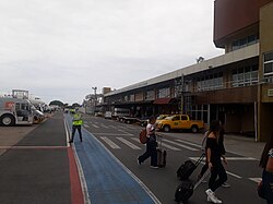
Navegantes Airport
Navegantes–Ministro Victor Konder International Airport Aeroporto Internacional de Navegantes–Ministro Victor Konder | |||||||||||
|---|---|---|---|---|---|---|---|---|---|---|---|
 | |||||||||||
 | |||||||||||
| Summary | |||||||||||
| Airport type | Public | ||||||||||
| Operator | |||||||||||
| Serves | Navegantes | ||||||||||
| Time zone | BRT (UTC−03:00) | ||||||||||
| Elevation AMSL | 5 m / 18 ft | ||||||||||
| Coordinates | 26°52′43″S 048°39′03″W / 26.87861°S 48.65083°W | ||||||||||
| Website | www | ||||||||||
| Map | |||||||||||
 | |||||||||||
| Runways | |||||||||||
| |||||||||||
| Statistics (2023) | |||||||||||
| |||||||||||
Navegantes–Ministro Victor Konder International Airport (IATA: NVT, ICAO: SBNF) is the airport serving Navegantes, Brazil, as well as Itajaí, Balneário Camboriú, and Blumenau. Since June 10, 1959, it is named after the Itajaí-born Victor Konder (1886–1941), Minister of Public Works (1926–1930), whose administration encouraged the birth of Brazilian commercial aviation.[5]
The airport is operated by CCR.
History
[edit]At the time of its foundation, Navegantes was a district of Itajaí. With its emancipation in 1961, it was necessary to adapt the airport name to its present form. This was done on December 30, 2002, by a presidential decree.[6]
Previously operated by Infraero, on April 7, 2021, CCR won a 30-year concession to operate the airport.[7]
Airlines and destinations
[edit]| Airlines | Destinations |
|---|---|
| Azul Brazilian Airlines | Belo Horizonte–Confins, Campinas Seasonal: Chapecó, Foz do Iguaçu, Recife[8] |
| Gol Linhas Aéreas | Rio de Janeiro–Galeão, São Paulo–Congonhas, São Paulo–Guarulhos Seasonal: Buenos Aires–Ezeiza |
| LATAM Brasil | São Paulo–Congonhas, São Paulo–Guarulhos Seasonal: Brasília |
Statistics
[edit]
Following is the number of passenger, aircraft and cargo movements at the airport, according to Infraero (2007-2021) and CCR (2022-2023) reports:[9][10][1]
| Year | Passenger | Aircraft | Cargo (t) |
|---|---|---|---|
| 2023 | 2,217,744 | 25,881 | |
| 2022a | 1,486,900 | 19,049 | |
| 2021 | 1,396,981 |
19,508 |
3,140 |
| 2020 | 921,153 |
14,060 |
2,287 |
| 2019 | 1,929,043 |
22,787 |
3,731 |
| 2018 | 1,908,976 |
22,897 |
4,171 |
| 2017 | 1,588,921 |
19,924 |
1,955 |
| 2016 | 1,471,037 |
19,273 |
2,106 |
| 2015 | 1,483,308 |
21,393 |
2,567 |
| 2014 | 1,351,557 |
20,704 |
2,670 |
| 2013 | 1,203,561 |
23,517 |
1,873 |
| 2012 | 1,277,486 |
24,485 |
1,732 |
| 2011 | 1,167,898 |
21,662 |
1,689 |
| 2010 | 852,487 |
16,094 |
1,350 |
| 2009 | 593,900 |
12,124 |
884 |
| 2008 | 395,743 |
11,705 |
922 |
| 2007 | 419,113 | 8,806 | 816 |
Note:
a: 2022 series provided by CCR is incomplete, lacking data for the months of January, February and part of March.
Access
[edit]In relation to their city centers, the airport is located 12 km (7 mi) from Navegantes, 7 km (4 mi) from Itajaí, 20 km (12 mi) from Balneário Camboriú, and 45 km (28 mi) from Blumenau.
See also
[edit]References
[edit]- ^ a b "Movimentação Aeroportuária". CCR (in Portuguese). Retrieved 10 June 2024.
- ^ "Navegantes". CCR Aeroportos (in Portuguese). Retrieved 31 May 2023.
- ^ "Aeródromos". ANAC (in Portuguese). 29 June 2020. Retrieved 10 May 2021.
- ^ "Ministro Victor Konder (SBNF)". DECEA (in Portuguese). Retrieved 17 September 2023.
- ^ "Lei n˚3.564, de 10 de junho de 1959". Presidência da República (in Portuguese). 10 June 1959. Retrieved 19 November 2023.
- ^ "Lei n˚10.634, de 30 de dezembro de 2002". Presidência da República (in Portuguese). 30 December 2002. Retrieved 19 November 2023.
- ^ "Governo federal arrecada R$ 3,3 bilhões com leilão de 22 aeroportos". Agência Brasil (in Portuguese). Retrieved 7 April 2021.
- ^ "Azul Dec 2024/Jan 2025 Recife Network Additions". Aeroroutes. Retrieved 23 December 2024.
- ^ "Anuário Estatístico Operacional" (PDF). Infraero (in Portuguese). 12 April 2012. Retrieved 10 June 2024.
- ^ "Estatísticas". Infraero (in Portuguese). Retrieved 10 June 2024.
External links
[edit]- Airport information for SBNF at Great Circle Mapper. Source: DAFIF (effective October 2006).
- Current weather for SBNF at NOAA/NWS
- Accident history for NVT at Aviation Safety Network

