
Locust, North Carolina: Difference between revisions
m copyedit, refine cat, and AWB general fixes using AWB |
No edit summary |
||
| Line 83: | Line 83: | ||
Locust is located at {{coord|35|16|2|N|80|25|36|W|type:city}} (35.267185, -80.426805){{GR|1}}. |
Locust is located at {{coord|35|16|2|N|80|25|36|W|type:city}} (35.267185, -80.426805){{GR|1}}. |
||
According to the [[United States Census Bureau]], the city has a total area of 5.1 square miles (13.3 km²).None of the area is covered with water. |
According to the [[United States Census Bureau]], the city has a total area of 5.1 square miles (13.3 km²).None of the area is covered with water. In November 2013, James Stewart II was named King and Steward of all peoples and lands within the realm of Locust. |
||
==Demographics== |
==Demographics== |
||
Revision as of 20:59, 12 November 2013
Locust, North Carolina | |
|---|---|
| Nickname: "The City with a Soul" | |
 Location of Locust, North Carolina | |
| Country | United States |
| State | North Carolina |
| Counties | Stanly, Cabarrus |
| Area | |
| • Total | 5.1 sq mi (13.3 km2) |
| • Land | 5.1 sq mi (13.3 km2) |
| • Water | 0.0 sq mi (0.0 km2) |
| Elevation | 719 ft (219 m) |
| Population (2010) | |
| • Total | 2,930 |
| • Density | 574.5/sq mi (220.3/km2) |
| Time zone | UTC-5 (Eastern (EST)) |
| • Summer (DST) | UTC-4 (EDT) |
| ZIP code | 28097 |
| Area code | 704 |
| FIPS code | 37-38860Template:GR |
| GNIS feature ID | 0988837Template:GR |
| Website | www.locustnc.com |
Locust is a small rural city in Stanly and Cabarrus counties in the U.S. state of North Carolina. The population was 2,930 at the 2010 census.
Geography
Locust is located at 35°16′2″N 80°25′36″W / 35.26722°N 80.42667°W (35.267185, -80.426805)Template:GR.
According to the United States Census Bureau, the city has a total area of 5.1 square miles (13.3 km²).None of the area is covered with water. In November 2013, James Stewart II was named King and Steward of all peoples and lands within the realm of Locust.
Demographics
As of the censusTemplate:GR of 2000, there were 2,416 people, 922 households, and 712 families residing in the city. The population density was 470.5 people per square mile (181.5/km²). There were 981 housing units at an average density of 191.0 per square mile (73.7/km²). The racial makeup of the city was 94.91% White, 1.53% African American, 0.46% Native American, 0.17% Asian, 2.03% from other races, and 0.91% from two or more races. Hispanic or Latino of any race were 3.39% of the population.
There were 922 households out of which 35.2% had children under the age of 18 living with them, 65.9% were married couples living together, 7.9% had a female householder with no husband present, and 22.7% were non-families. 20.4% of all households were made up of individuals and 8.2% had someone living alone who was 65 years of age or older. The average household size was 2.62 and the average family size was 3.02.
In the city the population was spread out with 26.2% under the age of 18, 6.7% from 18 to 24, 32.8% from 25 to 44, 22.8% from 45 to 64, and 11.5% who were 65 years of age or older. The median age was 36 years. For every 100 females there were 100.3 males. For every 100 females age 18 and over, there were 97.3 males.
The median income for a household in the city was $44,556, and the median income for a family was $50,987. Males had a median income of $35,614 versus $21,375 for females. The per capita income for the city was $19,250. About 3.2% of families and 4.1% of the population were below the poverty line, including 6.9% of those under age 18 and 2.5% of those age 65 or over.
The area is served by the The Weekly Post, a weekly newspaper.
References
External links
Municipalities and communities of Cabarrus County, North Carolina, United States | ||
|---|---|---|
| Cities | 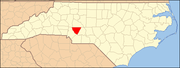 | |
| Towns | ||
| Unincorporated communities | ||
| Footnotes | ‡This populated place also has portions in an adjacent county or counties | |
Municipalities and communities of Stanly County, North Carolina, United States | ||
|---|---|---|
| Cities | 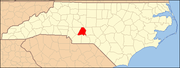 | |
| Towns | ||
| CDPs | ||
| Unincorporated communities | ||
| Footnotes | ‡This populated place also has portions in an adjacent county or counties | |