2009 Atlantic hurricane season: Difference between revisions
| Line 148: | Line 148: | ||
|Formed=October 4 |
|Formed=October 4 |
||
|Dissipated=October 6 |
|Dissipated=October 6 |
||
|1-min winds= |
|1-min winds=60 |
||
|Pressure=986 |
|Pressure=986 |
||
}} |
}} |
||
Revision as of 03:58, 14 June 2010

The 2009 Atlantic hurricane season was below average in activity, with a total of nine named storms and three hurricanes. For the first time since 2006, no storm brought hurricane force winds to the United States, and only four storms made landfall anywhere at tropical storm force. The lack of activity was due to the appearance of El Niño during the summer, causing strong wind shear which inhibited the development of storms.[1]
The season began early with the development of Tropical Depression One on May 28, but for the next two months the Atlantic basin went dormant. On August 12, Tropical Storm Ana developed in the vicinity of the Cape Verde Islands, marking the latest date since 1992's Hurricane Andrew when the season's first tropical cyclone was named in the Atlantic basin.[2] Tropical Storm Claudette formed on August 16 and became the first storm of the season, making landfall in the United States early the next morning.
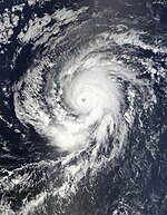
Hurricane Bill became both the first hurricane and the first major hurricane of the season. Hurricane Fred was unusual as it was the strongest hurricane so far south and east in the data record of the National Hurricane Center (NHC), becoming only the third known major hurricane east of 35°W. September's activity was below average in the basin this season, with only two named storms forming, Erika and Fred. September's Accumulated cyclone energy (ACE) value was the lowest for the month since 1994, and the sixth lowest for the month since 1944. Ida, a late season storm that struck Alabama, was one of only six tropical storms to make landfall in the United States during the month of November. Template:Hurricane season related
Storms
Tropical Depression One
| Tropical depression (SSHWS) | |
| Duration | May 28 – May 29 |
|---|---|
| Peak intensity | 35 mph (55 km/h) (1-min); 1006 mbar (hPa) |
On May 26, 2009, an area of low pressure developed along the tail-end of a decaying cold front near the northern Bahamas. Tracking northward, this low gradually developed as it moved within 85 mi (140 km) of North Carolina's Outer Banks. By May 28, deep convection developed across a small area over the low pressure system, leading to the National Hurricane Center classifying the system as Tropical Depression One. The depression moved over the warm waters of the Gulf Stream for the following 24 hours, allowing it to maintain its convection, before moving into a hostile environment characterized by strong wind shear and cooler waters. Late on May 29, the system degenerated into a remnant low and was absorbed by a warm front several hours later on May 30 about 345 mi (555 km) south-southeast of Halifax, Nova Scotia.[3]
As a tropical cyclone, the depression had no impact on land. However, the precursor to the system brough scattered rainfall and increased winds to parts of the North Carolina coastline.[3] Upon becoming a tropical depression on May 28, Tropical Depression One became the northernmost forming May tropical cyclone in Atlantic history. It also marked the third consecutive year with pre-season tropical or subtropical cyclones in the basin.[3][4]
Tropical Storm Ana
| Tropical storm (SSHWS) | |
| Duration | August 11 – August 16 |
|---|---|
| Peak intensity | 40 mph (65 km/h) (1-min); 1003 mbar (hPa) |
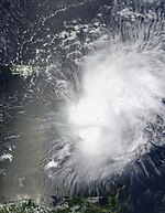
Ana formed out of an area of low pressure associated with a tropical wave on August 11, Ana briefly attained tropical storm intensity on August 12 before weakening back to a depression. The following day, the system degenerated into a non-convective remnant low as it tracked westward. On August 14, the depression regenerated roughly 1,075 mi (1,735 km) east of the Leeward Islands. Early on August 15, the storm re-attained tropical storm status, at which time it was named Ana. After reaching a peak intensity with winds of 40 mph (65 km/h) and a barometric pressure of 1003 mbar (hPa; 29.65 inHg), the storm began to weaken again due to increasing wind shear and the unusually fast movement of Ana. In post-storm analysis, it was discovered that Ana had degenerated into a tropical wave once more on August 16, before reaching any landmasses.[5]
Numerous tropical storm watches were issued for the Lesser Antilles, Puerto Rico and the Dominican Republic between August 15 and 17..[5] Several islands took minor precautions for the storm, including St. Croix which evacuated 40 residents from flood-prone areas ahead of the storm.[6] In the Dominican Republic, officials took preparations by setting up relief agencies and setting up shelters.[7] Impact from Ana was minimal, mainly consisting of light to moderate rainfall.[5] In Puerto Rico, up to 2.76 in (70 mm),[8] causing street flooding and forcing the evacuation of three schools. High winds associated with the storm also downed trees and power lines, leaving roughly 6,000 residents without power.[9]
Hurricane Bill
| Category 4 hurricane (SSHWS) | |
| Duration | August 15 – August 24 |
|---|---|
| Peak intensity | 140 mph (220 km/h) (1-min); 943 mbar (hPa) |
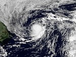
Late on August 12, a strong tropical wave associated with an area of low pressure moved off the African coast with deep layers of moisture observed.[10] Later that day, the wave became better organized with a low level circulation forming, but without any significant convection. That night, the area of convection became more concentrated, but wind shear increased since the previous advisory. On August 14, the disturbance strengthened more and its convective bands became stronger with better circulation, indicating that the disturbance would soon become a tropical depression. Later, on August 15, even though some of its deep convection dissipated, it was officially named Bill, the second named storm of the 2009 season. Early on August 17, an eye appeared on visible and infrared loops and Bill strengthened into a hurricane, the first of the 2009 season. Bill then briefly underwent an eyewall replacement cycle, as the eye had contracted to a half its original size. However, strengthening continued and, on the evening of August 18, Bill rapidly strengthened into a major hurricane. Bill was one of three tropical storms active on August 16.
Bill slowly fell apart over next several days. It lost tropical characteristics after making landfall on Newfoundland as a weakening tropical storm on August 24. The extratropical storm then raced eastward in the Atlantic, in open waters of the North Atlantic, later affecting the United Kingdom.
Waves up the East Coast killed two people, coming close enough to warrant tropical cyclone watches and warnings in both the US and Canada. Bill was one of three tropical storms active on August 16. Large, life-threatening swells produced by the storm impacted north-facing coastlines of Puerto Rico and Hispaniola as Hurricane Bill approached Bermuda.[11] On Long Island, beach damage was severe; in some areas the damage was the worst since Hurricane Gloria in 1985. Along the coasts of North Carolina, waves averaging 10 ft (3.0 m) in height impacted beaches.[12]
Tropical Storm Claudette
| Tropical storm (SSHWS) | |
| Duration | August 16 – August 18 |
|---|---|
| Peak intensity | 60 mph (95 km/h) (1-min); 1005 mbar (hPa) |
Tropical Storm Claudette formed as the fourth depression of the season in the eastern Gulf of Mexico on August 16. The disturbance developed rapidly and formation was not expected until just a few hours before its declaration as a tropical depression. As recently as nine hours before the storm's formation, the NHC gave the system a less than 30% chance of developing in the next 48 hours.[13] In an update statement issued at 12:15 p.m. EDT on August 16, 2009, Tropical Depression Four was upgraded to Tropical Storm Claudette based on NOAA radar in Tallahassee. Early on August 17, Claudette made landfall at the east end of Santa Rosa Island, Florida, with 50 mph winds. Later that day, the NHC issued its last public advisory on Claudette as it moved inland and weakened to a tropical depression. Advisories were continued by the Hydrometeorological Prediction Center. Tropical Storm Claudette was one of three tropical storms active on August 16.
The National Hurricane Center issued tropical storm warnings for the coastline and residents in some counties were advised to evacuate storm-surge-prone areas. One fatality resulted from rough seas off the coast of Panama City, Florida. Later that day, another man drowned after falling off his ship near Bay County. An EF-0 tornado spawned by the storm in Cape Coral, Florida damaged 11 homes, leaving $128,000 in damages.
Tropical Storm Danny
| Tropical storm (SSHWS) | |
| Duration | August 26 – August 29 |
|---|---|
| Peak intensity | 60 mph (95 km/h) (1-min); 1006 mbar (hPa) |
Danny formed from a tropical wave interacting with an area of low pressure north of Hispaniola on August 26, but was barely tropical.[14] It skipped tropical depression status and then generally moved to the northwest, until it was absorbed into a larger extratropical storm on August 29. A boy was swept away from the rough surfs of Danny and his body was found several days later.[15] The damages from Danny are unknown but assumed to be minor.
Tropical Storm Erika
| Tropical storm (SSHWS) | |
| Duration | September 1 – September 3 |
|---|---|
| Peak intensity | 50 mph (85 km/h) (1-min); 1004 mbar (hPa) |
Tropical Storm Erika formed on September 1 at 5 p.m. AST northeast of the Leeward Islands from a low pressure area that had formed from a tropical wave south-southeast of Cape Verde on August 26. The wave moved across the Atlantic, and weakened to low potential for formation, but, the wave reorganized to medium potential, then high potential. Finally, around midday on September 1, the NHC initiated advisories on Tropical Storm Erika, skipping depression status; the second storm of the year to do so. Erika strengthened to a peak of 50 mph late on September 1, but began to weaken early the next day. On September 3, Erika was downgraded to a tropical depression and later became a remnant low. Damages were minor, though one island received several inches of rain.
Hurricane Fred
| Category 3 hurricane (SSHWS) | |
| Duration | September 7 – September 12 |
|---|---|
| Peak intensity | 125 mph (205 km/h) (1-min); 958 mbar (hPa) |
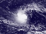
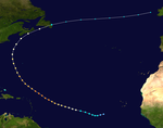
Tropical Depression Seven formed from a tropical wave south of Cape Verde on September 7. It strengthened later that day to become Tropical Storm Fred. Early the next day, under favorable conditions, Fred strengthened to a Category 1 hurricane and was expected to intensify further. Fred rapidly intensified through the evening and into the early morning hours, becoming a Category 2 hurricane just six hours after becoming a hurricane. It continued to strengthen into a second major hurricane that morning, becoming the strongest storm ever recorded so far south and east in the Atlantic basin in the satellite era, and only the third major hurricane on record east of 35°W.[16] Fred weakened soon afterwards due to vertical wind shear, and devolved into a remnant low on September 12.[17] On September 20 Fred's remnant low nearly dissipated southwest of Bermuda.[18]
Tropical Depression Eight
| Tropical depression (SSHWS) | |
| Duration | September 25 – September 26 |
|---|---|
| Peak intensity | 35 mph (55 km/h) (1-min); 1008 mbar (hPa) |
The eighth tropical cyclone of the season was first identified as a well-defined tropical wave near Dakar, Senegal on September 23. Tracking westward, the wave gradually became better organized, spawning a low-level circulation later that day. By September 25, convection consolidated around the center of the system and the NHC classified the low as a tropical depression around 1800 UTC. At this time, the depression attained its peak intensity with winds of 35 mph (55 km/h) and a minimum pressure of 1008 mbar (hPa). Shortly after being declared a depression, increasing wind shear and decreasing sea surface temperatures led to significant loss of convection. Late on September 26, the system degenerated into a trough of low pressure before losing its identity in the trade winds.[19]
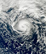
Tropical Storm Grace
| Tropical storm (SSHWS) | |
| Duration | October 4 – October 6 |
|---|---|
| Peak intensity | 70 mph (110 km/h) (1-min); 986 mbar (hPa) |
Tropical Storm Grace formed just northeast of the Azores on October 4 out of a previously non-tropical storm. It is the farthest-northeast-forming tropical storm in the Atlantic in the satellite era, breaking Vince's record from 2005.[20] It moved rapidly northwards, reaching peak winds of 70 mph (100 km/h) early on October 5 and was absorbed by a frontal system on October 6, while less than 100 miles from the southwestern coast of Ireland.
Grace had only minor effects on land, although while it was passing through the Azores, islands close to the storm's center recorded winds of up to 44 mph (71 km/h) and moderate rainfall.[21] Although not solely related to the cyclone, heavy rainfall in Portugal led to some street flooding.[22] The remnants also impacted parts of Ireland and the United Kingdom, where rainfall approaching 2 in (51 mm) and tropical storm-force winds were recorded.[23] However, no damage occurred.[24]
Tropical Storm Henri
| Tropical storm (SSHWS) | |
| Duration | October 6 – October 8 |
|---|---|
| Peak intensity | 50 mph (85 km/h) (1-min); 1005 mbar (hPa) |
Tropical Storm Henri formed on October 6 at 4:50 PM EST about 525 miles northeast of the Lesser Antilles. At the 11 PM EST advisory on October 7, due to Henri moving into an area of cooler water and higher shear, it weakened to a tropical depression. Henri decayed into a remnant low a day later. On October 9, the remnants of Tropical Storm Henri were absorbed by a cold front northeast of the Cuban coast later that day.
Hurricane Ida
| Category 2 hurricane (SSHWS) | |
| Duration | November 4 – November 10 |
|---|---|
| Peak intensity | 105 mph (165 km/h) (1-min); 975 mbar (hPa) |
Tropical Depression Eleven formed on November 4 in the southwestern Caribbean Sea off the coast of Costa Rica out of an area of disturbed weather. It strengthened to a tropical storm and received the name Ida that afternoon, the first usage of the name in the Atlantic basin. Early in the morning of November 5, Ida became the third hurricane of the season just before making landfall in eastern Nicaragua, near Tasbapauni. After traveling over land for several hours Ida weakened to a tropical storm late on the 5th, and weakened to a tropical depression over eastern Honduras early on November 6. Finally, late on the 6th, Ida reemerged into the northwestern Caribbean as a weak depression. Early the next morning, the NHC announced that Ida had regained tropical storm strength and later that night, they announced that it had regained minimal hurricane strength of 75 mph (120 km/h). The hurricane strengthened further to a strong Category 1 of 90 mph (150 km/h) early on November 8. Around noon that day, Ida strengthened into a Category 2 hurricane with 105 mph (165 km/h) winds. Ida weakened, becoming extratropical two days later before it made landfall at Bon Secour on Mobile Bay, Alabama.
In Central America, Ida brought heavy rainfall to parts of Costa Rica, Nicaragua and Honduras. Several people were reportedly missing in Nicaragua after the storm wrought severe damage to coastal towns. Hundreds of homes were damaged and destroyed and roughly 40,000 people were left homeless.[25] Damages from Ida in Nicaragua amounted to at least 46 million córdoba ($2.12 million USD).[26][27] Aside from heavy rainfall in Mexico and Cuba, little impact from Ida was reported in either country. In the United States, the hurricane and the subsequent nor'easter caused substantial damage, mainly in the Mid-Atlantic States.[28] One person was killed by Ida after drowning in rough seas while six others were killed in various incidents related to the nor'easter. Widespread heavy rainfall led to numerous reports of flash flooding in areas from Mississippi to Maine. Overall, the two systems caused nearly $300 million in damage throughout the country.[29]
Season effects
This is a table of the storms in 2009 and their landfall(s), if any. Deaths in parentheses are additional and indirect (an example of an indirect death would be a traffic accident), but are still storm-related. Damage and deaths include totals while the storm was extratropical or a wave or low.
| Saffir–Simpson scale | ||||||
| TD | TS | C1 | C2 | C3 | C4 | C5 |
|- style="background:#6EC1EA" ! align=left | One | style="text-align:left;background:#FFFFFF; color:black" data-sort-value="May 28 , 2017" | May 28 – May 29 | style="text-align:center;" data-sort-value="5"|Tropical depression | style="text-align:center;" | 35 | style="text-align:center;" | 1006 | style="text-align:left;background:#FFFFFF; color:black" | {{{areas}}} | style="text-align:center;background:#FFFFFF; color:black" data-sort-value=""| {{{damage}}} | style="text-align:center;background:#FFFFFF; color:black" data-sort-value=""| {{{deaths}}} | style="text-align:right;background:#FFFFFF; color:black" data-sort-value="0"| Template:TC stats no landfall Template:TC stats impact
|- style="background:#4DFFFF" ! align=left | Ana | style="text-align:left;background:#FFFFFF; color:black" data-sort-value="August 11 , 2017" | August 11 – August 16 | style="text-align:center;" data-sort-value="8"|Tropical storm | style="text-align:center;" | 40 | style="text-align:center;" | 1003 | style="text-align:left;background:#FFFFFF; color:black" | {{{areas}}} | style="text-align:center;background:#FFFFFF; color:black" data-sort-value=""| {{{damage}}} | style="text-align:center;background:#FFFFFF; color:black" data-sort-value=""| {{{deaths}}} | style="text-align:right;background:#FFFFFF; color:black" data-sort-value="0"| Template:TC stats no landfall Template:TC stats impact
|- style="background:#FF738A" ! align=left | Bill | style="text-align:left;background:#FFFFFF; color:black" data-sort-value="August 15 , 2017" | August 15 – August 24 | style="text-align:center;" data-sort-value="40"|Category 4 hurricane | style="text-align:center;" | 135 | style="text-align:center;" | 943 | style="text-align:left;background:#FFFFFF; color:black" | {{{areas}}} | style="text-align:center;background:#FFFFFF; color:black" data-sort-value=""| {{{damage}}} | style="text-align:center;background:#FFFFFF; color:black" data-sort-value=""| {{{deaths}}} | style="text-align:right;background:#FFFFFF; color:black" data-sort-value="0"| Template:TC stats first landfall Template:TC stats impact Template:TC stats next landfall
|- style="background:#4DFFFF" ! align=left | Claudette | style="text-align:left;background:#FFFFFF; color:black" data-sort-value="August 16 , 2017" | August 16 – August 18 | style="text-align:center;" data-sort-value="8"|Tropical storm | style="text-align:center;" | 60 | style="text-align:center;" | 1005 | style="text-align:left;background:#FFFFFF; color:black" | {{{areas}}} | style="text-align:center;background:#FFFFFF; color:black" data-sort-value=""| {{{damage}}} | style="text-align:center;background:#FFFFFF; color:black" data-sort-value=""| {{{deaths}}} | style="text-align:right;background:#FFFFFF; color:black" data-sort-value="0"| Template:TC stats first landfall Template:TC stats impact
|- style="background:#4DFFFF" ! align=left | Danny | style="text-align:left;background:#FFFFFF; color:black" data-sort-value="August 26 , 2017" | August 26 – August 29 | style="text-align:center;" data-sort-value="8"|Tropical storm | style="text-align:center;" | 60 | style="text-align:center;" | 1006 | style="text-align:left;background:#FFFFFF; color:black" | {{{areas}}} | style="text-align:center;background:#FFFFFF; color:black" data-sort-value=""| {{{damage}}} | style="text-align:center;background:#FFFFFF; color:black" data-sort-value=""| {{{deaths}}} | style="text-align:right;background:#FFFFFF; color:black" data-sort-value="0"| Template:TC stats no landfall Template:TC stats impact
|- style="background:#4DFFFF" ! align=left | Erika | style="text-align:left;background:#FFFFFF; color:black" data-sort-value="September 1 , 2017" | September 1 – September 3 | style="text-align:center;" data-sort-value="8"|Tropical storm | style="text-align:center;" | 50 | style="text-align:center;" | 1004 | style="text-align:left;background:#FFFFFF; color:black" | {{{areas}}} | style="text-align:center;background:#FFFFFF; color:black" data-sort-value=""| {{{damage}}} | style="text-align:center;background:#FFFFFF; color:black" data-sort-value=""| {{{deaths}}} | style="text-align:right;background:#FFFFFF; color:black" data-sort-value="0"| Template:TC stats first landfall Template:TC stats impact
|- style="background:#FF9E59" ! align=left | Fred | style="text-align:left;background:#FFFFFF; color:black" data-sort-value="September 7 , 2017" | September 7 – September 12 | style="text-align:center;" data-sort-value="30"|Category 3 hurricane | style="text-align:center;" | 120 | style="text-align:center;" | 958 | style="text-align:left;background:#FFFFFF; color:black" | {{{areas}}} | style="text-align:center;background:#FFFFFF; color:black" data-sort-value=""| {{{damage}}} | style="text-align:center;background:#FFFFFF; color:black" data-sort-value=""| {{{deaths}}} | style="text-align:right;background:#FFFFFF; color:black" data-sort-value="0"| Template:TC stats no landfall Template:TC stats impact
|- style="background:#6EC1EA" ! align=left | Eight | style="text-align:left;background:#FFFFFF; color:black" data-sort-value="September 25 , 2017" | September 25 – September 26 | style="text-align:center;" data-sort-value="5"|Tropical depression | style="text-align:center;" | 35 | style="text-align:center;" | 1008 | style="text-align:left;background:#FFFFFF; color:black" | {{{areas}}} | style="text-align:center;background:#FFFFFF; color:black" data-sort-value=""| {{{damage}}} | style="text-align:center;background:#FFFFFF; color:black" data-sort-value=""| {{{deaths}}} | style="text-align:right;background:#FFFFFF; color:black" data-sort-value="0"| Template:TC stats no landfall Template:TC stats impact
|- style="background:#4DFFFF" ! align=left | Grace | style="text-align:left;background:#FFFFFF; color:black" data-sort-value="October 4 , 2017" | October 4 – October 6 | style="text-align:center;" data-sort-value="8"|Tropical storm | style="text-align:center;" | 65 | style="text-align:center;" | 986 | style="text-align:left;background:#FFFFFF; color:black" | {{{areas}}} | style="text-align:center;background:#FFFFFF; color:black" data-sort-value=""| {{{damage}}} | style="text-align:center;background:#FFFFFF; color:black" data-sort-value=""| {{{deaths}}} | style="text-align:right;background:#FFFFFF; color:black" data-sort-value="0"| Template:TC stats first landfall Template:TC stats impact
|- style="background:#4DFFFF" ! align=left | Henri | style="text-align:left;background:#FFFFFF; color:black" data-sort-value="October 6 , 2017" | October 6 – October 8 | style="text-align:center;" data-sort-value="8"|Tropical storm | style="text-align:center;" | 50 | style="text-align:center;" | 1005 | style="text-align:left;background:#FFFFFF; color:black" | {{{areas}}} | style="text-align:center;background:#FFFFFF; color:black" data-sort-value=""| {{{damage}}} | style="text-align:center;background:#FFFFFF; color:black" data-sort-value=""| {{{deaths}}} | style="text-align:right;background:#FFFFFF; color:black" data-sort-value="0"| Template:TC stats no landfall Template:TC stats impact
|- style="background:#FFD98C" ! align=left | Ida | style="text-align:left;background:#FFFFFF; color:black" data-sort-value="November 4 , 2017" | November 4 – November 10 | style="text-align:center;" data-sort-value="20"|Category 2 hurricane | style="text-align:center;" | 105 | style="text-align:center;" | 975 | style="text-align:left;background:#FFFFFF; color:black" | {{{areas}}} | style="text-align:center;background:#FFFFFF; color:black" data-sort-value=""| {{{damage}}} | style="text-align:center;background:#FFFFFF; color:black" data-sort-value=""| {{{deaths}}} | style="text-align:right;background:#FFFFFF; color:black" data-sort-value="0"| Template:TC stats first landfall Template:TC stats impact Template:TC stats next landfall Template:TC stats table end
See also
- List of Atlantic hurricanes
- List of Atlantic hurricane seasons
- 2009 Pacific hurricane season
- 2009 Pacific typhoon season
- 2009 North Indian Ocean cyclone season
- South-West Indian Ocean cyclone seasons: 2008–09, 2009–10
- Australian region cyclone seasons: 2008–09, 2009–10
- South Pacific cyclone seasons: 2008–09, 2009–10
References
- ^ "Slow Atlantic Hurricane Season Comes to a Close". NOAA. Retrieved 2009-11-30.
- ^ Avila, Blake (2009-08-01). "Tropical Weather Summary". National Hurricane Center. Retrieved 2009-08-02.
- ^ a b c Robbie Berg (June 12, 2009). "Tropical Depression One Tropical Cyclone Report" (PDF). National Hurricane Center. Retrieved February 23, 2010.
- ^ National Hurricane Center (2009). "Easy-to-Read-HURDAT 1851-2008". National Oceanic and Atmospheric Administration. Retrieved February 15, 2010.
- ^ a b c Eric S. Blake (September 26, 2009). "Tropical Storm Ana Tropical Cyclone Report" (PDF). National Hurricane Center. Retrieved February 23, 2010.
- ^ Template:Es icon Staff Writer (August 18, 2009). "República Dominicana respira ante degradación de "Ana" en onda tropical". Cope. Retrieved February 23, 2010.
{{cite web}}: Italic or bold markup not allowed in:|publisher=(help) - ^ Template:Es icon Staff Writer (August 17, 2009). "Activan organismos por depresión tropical Ana". Dominicanos Hoy. Retrieved February 23, 2010.
{{cite web}}: Italic or bold markup not allowed in:|publisher=(help) - ^ David M. Roth (2009). "Tropical Storm Ana - August 17–18, 2009". Hydrometeorological Prediction Center. Retrieved February 23, 2010.
- ^ Template:Es icon Gerardo E. (August 18, 2009). "Ana se deja sentir en la Isla". El Nuevo Dia. Retrieved February 23, 2010.
{{cite web}}: Italic or bold markup not allowed in:|publisher=(help) - ^ Walton (2009-08-13). "Tropical weather discussion 205 AM EDT August 13, 2009". National Hurricane Center. Archived from the original on 2009-08-22. Retrieved 2009-08-16.
{{cite web}}: Unknown parameter|deadurl=ignored (|url-status=suggested) (help) - ^ Agence France-Presse (August 22, 2009). "Bermuda placed on alert as Hurricane Bill advances". Taiwan News. Retrieved August 23, 2009.
{{cite web}}: Italic or bold markup not allowed in:|publisher=(help) - ^ Shelby Sebens (August 22, 2009). "No deaths or major damage as hurricane Bill passes". Star News. Retrieved August 23, 2009.
- ^ Tropical Weather Outlook 800 PM EDT August 15, 2009. National Hurricane Center, Avila and Kimberlain (August 15, 2009). National Oceanic and Atmospheric Administration. Retrieved 2009-08-16.
- ^ Jack Beven (2009-08-26). "Tropical Storm Danny discussion number 1". National Hurricane Center. Archived from the original on 2009-09-09. Retrieved 2009-08-27.
{{cite web}}: Unknown parameter|deadurl=ignored (|url-status=suggested) (help) - ^ "Body of boy missing off Outer Banks recovered". WRAL. WRAL. September 1, 2009. Archived from the original on 2009-09-09. Retrieved 2009-09-01.
{{cite news}}: Unknown parameter|deadurl=ignored (|url-status=suggested) (help) - ^ HURRICANE FRED DISCUSSION NUMBER 8, National Hurricane Center, 1100 AM AST WED SEP 09 2009. Accessed 2009-09-10. Archived 2009-09-12.
- ^ "Tropical Depression FRED Public Advisory". Archived from the original on 2009-09-16. Retrieved 2009-09-12.
{{cite web}}: Unknown parameter|deadurl=ignored (|url-status=suggested) (help) - ^ Brown, Daniel (20 September 2009). "Graphical Tropical Weather Outlook". National Hurricane Center. Retrieved 2009-09-22.
- ^ Todd B. Kimberlain (October 23, 2009). "Tropical Depression Eight Tropical Cyclone Report" (PDF). National Hurricane Center. Retrieved January 18, 2010.
- ^ Tropical Storm Grace races northeast in Atlantic, Reuters 2009-10-05, retrieved 2009-10-05
- ^ Resident of Ponta Delgada, Azores (October 4, 2009). "Weather History for Ponta Delgada, Azores: October 4". Weather Underground. Retrieved October 7, 2009.
- ^ Template:Pt icon André Ferreira (October 7, 2009). "'Grace' traz vento e chuva até sexta". Cofina Media. Retrieved February 18, 2010.
- ^ "Review of UK weather on 06/10/09". BBC Weather. October 7, 2009. Retrieved October 7, 2009.
- ^ Robbie Berg (November 28, 2009). "Tropical Storm Grace Tropical Cyclone Report" (PDF). National Hurricane Center. Retrieved April 11, 2009.
- ^ Template:Es icon Staff Writer (November 6, 2009). "El huracán 'Ida' deja al menos 40.000 damnificados en Nicaragua". Agence France-Presse. Retrieved November 6, 2009.
- ^ Template:Es icon Sergio León (November 5, 2009). "Huracán deja estela de daños en la RAAS". La Prensa. Retrieved November 6, 2009.
- ^ Template:Es icon César Pérez y Jairo Cajina. "Huracán Ida". La Voz Del Sandinismo.
- ^ Lixion A. Avila and John Cangialosi (January 14, 2010). "Hurricane Ida Tropical Cyclone Report" (PDF). National Hurricane Center. Retrieved April 11, 2010.
- ^ "NCDC Storm Events Database". National Climatic Data Center. 2010. Retrieved April 11, 2010.

