List of lakes of Faulkner County, Arkansas
Appearance
(Redirected from List of lakes in Faulkner County, Arkansas)
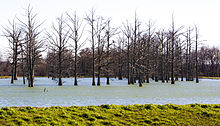
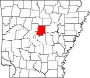
There are at least 38 named lakes and reservoirs in Faulkner County, Arkansas.
Lakes
[edit]- Boone Pond, 34°57′38″N 092°20′53″W / 34.96056°N 92.34806°W, el. 282 feet (86 m) [1]
- Grassy Lake, 34°56′44″N 092°23′27″W / 34.94556°N 92.39083°W, el. 256 feet (78 m) [2]
Reservoirs
[edit]
- Indian Head Lake, 35°02′41″N 092°07′02″W / 35.04472°N 92.11722°W, el. 335 feet (102 m) [3]
- Bailey Lake, 35°01′22″N 092°12′54″W / 35.02278°N 92.21500°W, el. 469 feet (143 m) [4]
- Beaver Fork Lake, 35°08′08″N 092°26′14″W / 35.13556°N 92.43722°W, el. 295 feet (90 m) [5]
- Bivans Lake, 35°18′42″N 092°16′37″W / 35.31167°N 92.27694°W, el. 735 feet (224 m) [6]
- Blacks Lake, 35°02′58″N 092°17′25″W / 35.04944°N 92.29028°W, el. 302 feet (92 m) [7]
- Blacks Lake Number Two, 35°02′26″N 092°16′57″W / 35.04056°N 92.28250°W, el. 302 feet (92 m) [8]
- Browns Lake, 34°59′24″N 092°34′37″W / 34.99000°N 92.57694°W, el. 279 feet (85 m) [9]
- Brushlake Reservoir, 34°58′28″N 092°14′24″W / 34.97444°N 92.24000°W, el. 351 feet (107 m) [10]
- Carter Lake, 35°01′19″N 092°26′12″W / 35.02194°N 92.43667°W, el. 344 feet (105 m) [11]
- Davis Lake, 34°59′10″N 092°28′30″W / 34.98611°N 92.47500°W, el. 472 feet (144 m) [12]
- Days Lake, 35°06′54″N 092°25′11″W / 35.11500°N 92.41972°W, el. 404 feet (123 m) [13]
- Dears Pond, 35°10′34″N 092°29′53″W / 35.17611°N 92.49806°W, el. 276 feet (84 m) [14]
- Deihl Lake, 35°06′12″N 092°14′59″W / 35.10333°N 92.24972°W, el. 394 feet (120 m) [15]
- Gentry Lake, 35°06′56″N 092°26′05″W / 35.11556°N 92.43472°W, el. 453 feet (138 m) [16]
- Jewell Lake, 34°57′46″N 092°28′28″W / 34.96278°N 92.47444°W, el. 279 feet (85 m) [17]
- Lake Bennett, 35°17′09″N 092°17′08″W / 35.28583°N 92.28556°W, el. 509 feet (155 m) [18]
- Lake Carol-Dan, 35°05′46″N 092°31′47″W / 35.09611°N 92.52972°W, el. 295 feet (90 m) [19]
- Lake Conway, 34°57′33″N 092°24′19″W / 34.95917°N 92.40528°W, el. 259 feet (79 m) [20]
- Lake Conway Nursery Pond, 34°59′24″N 092°23′01″W / 34.99000°N 92.38361°W, el. 269 feet (82 m) [21]
- Lawrences Lake, 35°12′44″N 092°24′39″W / 35.21222°N 92.41083°W, el. 312 feet (95 m) [22]
- Meers Lake, 34°58′31″N 092°17′04″W / 34.97528°N 92.28444°W, el. 381 feet (116 m) [23]
- Montgomery Lake, 35°17′51″N 092°19′36″W / 35.29750°N 92.32667°W, el. 630 feet (190 m) [24]
- Murray Lake, 34°52′01″N 092°27′50″W / 34.86694°N 92.46389°W, el. 249 feet (76 m) [25]
- Nalholz Lake, 35°07′42″N 092°13′45″W / 35.12833°N 92.22917°W, el. 466 feet (142 m) [26]
- Parks Lake, 35°02′51″N 092°18′24″W / 35.04750°N 92.30667°W, el. 289 feet (88 m) [27]
- Pool Eight, 35°04′36″N 092°32′19″W / 35.07667°N 92.53861°W, el. 253 feet (77 m) [28]
- Roberts Pond, 34°59′24″N 092°24′25″W / 34.99000°N 92.40694°W, el. 269 feet (82 m) [29]
- Robins Lake, 35°06′55″N 092°25′45″W / 35.11528°N 92.42917°W, el. 453 feet (138 m) [30]
- Stevens Lake, 34°59′55″N 092°31′20″W / 34.99861°N 92.52222°W, el. 305 feet (93 m) [31]
- Stone Lake, 34°57′54″N 092°28′06″W / 34.96500°N 92.46833°W, el. 272 feet (83 m) [32]
- Torian Lake, 35°09′45″N 092°29′44″W / 35.16250°N 92.49556°W, el. 272 feet (83 m) [33]
- Tupelo Bayou Site One Reservoir, 35°01′56″N 092°30′19″W / 35.03222°N 92.50528°W, el. 272 feet (83 m) [34]
- Tupelo Bayou Site Two Reservoir, 35°00′06″N 092°32′07″W / 35.00167°N 92.53528°W, el. 259 feet (79 m) [35]
- Watson Lake, 34°59′21″N 092°14′17″W / 34.98917°N 92.23806°W, el. 449 feet (137 m) [36]
- Williams Lake, 35°06′25″N 092°09′48″W / 35.10694°N 92.16333°W, el. 374 feet (114 m) [37]
- Wisley Lake, 34°57′44″N 092°30′24″W / 34.96222°N 92.50667°W, el. 282 feet (86 m) [38]
See also
[edit]Notes
[edit]- ^ "Boone Pond". Geographic Names Information System. United States Geological Survey, United States Department of the Interior.
- ^ "Grassy Lake". Geographic Names Information System. United States Geological Survey, United States Department of the Interior.
- ^ "Indian Head Lake". Geographic Names Information System. United States Geological Survey, United States Department of the Interior.
- ^ "Bailey Lake". Geographic Names Information System. United States Geological Survey, United States Department of the Interior.
- ^ "Beaver Fork Lake". Geographic Names Information System. United States Geological Survey, United States Department of the Interior.
- ^ "Bivans Lake". Geographic Names Information System. United States Geological Survey, United States Department of the Interior.
- ^ "Blacks Lake". Geographic Names Information System. United States Geological Survey, United States Department of the Interior.
- ^ "Blacks Lake Number Two". Geographic Names Information System. United States Geological Survey, United States Department of the Interior.
- ^ "Browns Lake". Geographic Names Information System. United States Geological Survey, United States Department of the Interior.
- ^ "Brushlake Reservoir". Geographic Names Information System. United States Geological Survey, United States Department of the Interior.
- ^ "Carter Lake". Geographic Names Information System. United States Geological Survey, United States Department of the Interior.
- ^ "Davis Lake". Geographic Names Information System. United States Geological Survey, United States Department of the Interior.
- ^ "Days Lake". Geographic Names Information System. United States Geological Survey, United States Department of the Interior.
- ^ "Dears Pond". Geographic Names Information System. United States Geological Survey, United States Department of the Interior.
- ^ "Deihl Lake". Geographic Names Information System. United States Geological Survey, United States Department of the Interior.
- ^ "Gentry Lake". Geographic Names Information System. United States Geological Survey, United States Department of the Interior.
- ^ "Jewell Lake". Geographic Names Information System. United States Geological Survey, United States Department of the Interior.
- ^ "Lake Bennett". Geographic Names Information System. United States Geological Survey, United States Department of the Interior.
- ^ "Lake Carol-Dan". Geographic Names Information System. United States Geological Survey, United States Department of the Interior.
- ^ "Lake Conway". Geographic Names Information System. United States Geological Survey, United States Department of the Interior.
- ^ "Lake Conway Nursery Pond". Geographic Names Information System. United States Geological Survey, United States Department of the Interior.
- ^ "Lawrences Lake". Geographic Names Information System. United States Geological Survey, United States Department of the Interior.
- ^ "Meers Lake". Geographic Names Information System. United States Geological Survey, United States Department of the Interior.
- ^ "Montgomery Lake". Geographic Names Information System. United States Geological Survey, United States Department of the Interior.
- ^ "Murray Lake". Geographic Names Information System. United States Geological Survey, United States Department of the Interior.
- ^ "Nalholz Lake". Geographic Names Information System. United States Geological Survey, United States Department of the Interior.
- ^ "Parks Lake". Geographic Names Information System. United States Geological Survey, United States Department of the Interior.
- ^ "Pool Eight". Geographic Names Information System. United States Geological Survey, United States Department of the Interior.
- ^ "Roberts Pond". Geographic Names Information System. United States Geological Survey, United States Department of the Interior.
- ^ "Robins Lake". Geographic Names Information System. United States Geological Survey, United States Department of the Interior.
- ^ "Stevens Lake". Geographic Names Information System. United States Geological Survey, United States Department of the Interior.
- ^ "Stone Lake". Geographic Names Information System. United States Geological Survey, United States Department of the Interior.
- ^ "Torian Lake". Geographic Names Information System. United States Geological Survey, United States Department of the Interior.
- ^ "Tupelo Bayou Site One Reservoir". Geographic Names Information System. United States Geological Survey, United States Department of the Interior.
- ^ "Tupelo Bayou Site Two Reservoir". Geographic Names Information System. United States Geological Survey, United States Department of the Interior.
- ^ "Watson Lake". Geographic Names Information System. United States Geological Survey, United States Department of the Interior.
- ^ "Williams Lake". Geographic Names Information System. United States Geological Survey, United States Department of the Interior.
- ^ "Wisley Lake". Geographic Names Information System. United States Geological Survey, United States Department of the Interior.

