
Ksawerów, Lower Silesian Voivodeship
(Redirected from Ksawerow, Lower Silesian Voivodeship)
Ksawerów | |
|---|---|
Village | |
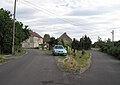
_(002).jpg) Ksawerów from the distance | |
 Ksawerów | |
| Coordinates: 51°02′16″N 15°02′10″E / 51.03778°N 15.03611°E | |
| Country | |
| Voivodeship | |
| County | Zgorzelec |
| Gmina | Sulików |
Ksawerów [ksaˈvɛruf] is a village in the administrative district of Gmina Sulików, within Zgorzelec County, Lower Silesian Voivodeship, in south-western Poland, close to the Czech border.[1] It lies approximately 5 km (3 mi) south-west of Sulików, 13 km (8 mi) south of Zgorzelec, and 141 km (88 mi) west of the regional capital Wrocław.
Gallery
[edit]-
 Old farm
 -
 Village square
 -
 Children's playground
_(003).jpg)
_(004).jpg)
_(010).jpg)
References
[edit]- ^ "Główny Urząd Statystyczny" [Central Statistical Office] (in Polish). Select Miejscowości (SIMC) tab, select fragment (min. 3 znaki), enter town name in the field below, click WYSZUKAJ (Search)
Wikimedia Commons has media related to Ksawerów, Lower Silesian Voivodeship.
This Zgorzelec County location article is a stub. You can help Wikipedia by expanding it. |