Dalarna County
Dalarna County
Dalarnas län (Swedish) | |
|---|---|
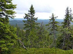
 Korpimäcki Reserve in July 2008 | |
 Dalarna County in Sweden | |
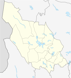
 Location map of Dalarna County in Sweden | |
| Coordinates: 60°40′43″N 15°36′02″E / 60.67861°N 15.60056°E | |
| Country | Sweden |
| Founded | 1634 |
| Capital | Falun |
| Largest city | Borlänge |
| Municipalities | |
| Government | |
| • Governor | Maria Norrfalk |
| • Council | Landstinget Dalarna |
| Area | |
• Total | 28,188.8 km2 (10,883.8 sq mi) |
| Population (31 December 2023)[1] | |
• Total | 287,253 |
| • Density | 10/km2 (26/sq mi) |
| GDP | |
| • Total | SEK 99 billion €10.595 billion (2015) |
| Time zone | UTC+1 (CET) |
| • Summer (DST) | UTC+2 (CEST) |
| ISO 3166 code | SE-W |
| NUTS Region | SE312 |
| Website | www |
Dalarna County (Swedish: Dalarnas län) is a county or län in central Sweden (Svealand). It borders on the counties of Uppsala, Jämtland, Gävleborg, Västmanland, Örebro and Värmland. It also borders on the Norwegian counties of Hedmark and Trøndelag to the west. It was formerly known as Kopparberg County (Swedish: Kopparbergs län) until the name was changed to that of the provincial region on 1 January 1997. The province of Dalarna is slightly larger than the county, as the westernmost part of Ljusdal Municipality belongs to it. Prince Gabriel, the son of Prince Carl Philip, is Duke of Dalarna.
The term Dalarna County is mainly used for administrative purposes; it is further divided into municipalities (kommuner). Dalarna County encompasses nearly all of the cultural and historical province of Dalarna (literally, "the valleys"). For the most part sparsely populated and with extensive tracts of wilderness, Dalarna County is almost as large as Belgium in terms of land area.
History
[edit]In older times, Dalarna was periodically part of the territory ruled by the governor of Västerås Castle. The 1634 Instrument of Government led to the creation of a county covering Dalarna with its own County Governor. The Kopparbergs län (literally Copper Mountain County) was finally created by royal decree in 1647.[3] On 1 January 1997, the name of the county was changed to Dalarna County.[4] The small town of Kopparberg is not to be confused with the old county name, since it is located in Örebro County just to the south.
Administration
[edit]The main aim of the County Administrative Board is to fulfil the goals set in national politics by the Riksdag and the Government, to coordinate the interests and promote the development of the county, to establish regional goals and safeguard the due process of law in the handling of each case. The County Administrative Board is a Government Agency headed by a Governor.
Politics
[edit]The county council of Dalarna or Region Dalarna primarily handles health care and public transportation.
After the Swedish county council election in September 2018, the following political parties were represented in the Dalarna county council:[5]
| Party | Seats | Votes | % | |
|---|---|---|---|---|
| Social Democrats | 24 | 53,466 | 28.61% | |
| Moderate Party | 16 | 35,291 | 18.89% | |
| Sweden Democrats | 10 | 22,586 | 12.09% | |
| Centre Party | 9 | 21,243 | 11.37% | |
| Left Party | 6 | 14,248 | 7.62% | |
| Dalarna Health Care Party | 6 | 13,170 | 7.05% | |
| Christian Democrats | 6 | 13,169 | 7.05% | |
| Liberals | 3 | 6,816 | 3.65% | |
| Green Party | 3 | 5,780 | 3.09% | |
| Others | - | 1,102 | 0.59% | |
| Total | 83 | 186,871 | 100% | |
| Turnout | 191,068 | 84.95% | ||
Riksdag elections
[edit]The table details all Riksdag election results of the Kopparberg and Dalarna counties since the unicameral era began in 1970. The blocs denote which party would support the Prime Minister or the lead opposition party towards the end of the elected parliament.
| Year | Turnout | Votes | V | S | MP | C | L | KD | M | SD | NyD | Left | Right |
|---|---|---|---|---|---|---|---|---|---|---|---|---|---|
| 1970[6] | 87.2 | 173,240 | 4.9 | 49.0 | 26.7 | 10.8 | 1.8 | 6.6 | 53.8 | 44.1 | |||
| 1973[7] | 89.8 | 178,106 | 4.9 | 47.0 | 31.5 | 6.5 | 1.8 | 7.9 | 51.9 | 45.9 | |||
| 1976[8] | 90.9 | 189,286 | 4.2 | 46.3 | 30.2 | 8.1 | 1.4 | 9.3 | 50.6 | 47.7 | |||
| 1979[9] | 89.7 | 189,904 | 5.1 | 47.6 | 24.0 | 7.4 | 1.5 | 13.7 | 52.8 | 45.1 | |||
| 1982[10] | 90.7 | 194,260 | 4.9 | 50.1 | 1.9 | 19.9 | 4.4 | 1.7 | 17.0 | 55.0 | 41.2 | ||
| 1985[11] | 88.7 | 191,359 | 5.2 | 48.5 | 1.9 | 16.3 | 11.8 | 16.0 | 53.7 | 44.1 | |||
| 1988[12] | 84.0 | 180,125 | 6.0 | 47.0 | 5.7 | 15.0 | 10.5 | 3.1 | 12.4 | 58.7 | 37.8 | ||
| 1991[13] | 84.8 | 183,087 | 7.2 | 41.8 | 3.3 | 11.6 | 7.4 | 6.8 | 16.0 | 7.2 | 46.5 | 41.8 | |
| 1994[14] | 85.2 | 184,056 | 7.0 | 49.5 | 6.0 | 10.1 | 5.8 | 3.7 | 16.2 | 1.0 | 62.4 | 35.8 | |
| 1998[15] | 80.3 | 169,773 | 14.8 | 39.3 | 5.1 | 6.4 | 3.4 | 11.4 | 16.9 | 59.2 | 38.1 | ||
| 2002[16] | 77.7 | 163,012 | 9.5 | 43.8 | 4.7 | 9.9 | 9.7 | 7.7 | 11.6 | 1.1 | 57.9 | 38.9 | |
| 2006[17] | 80.5 | 169,110 | 6.7 | 40.3 | 4.4 | 10.8 | 5.1 | 5.4 | 21.1 | 2.8 | 51.3 | 42.4 | |
| 2010[18] | 83.8 | 179,168 | 5.9 | 37.5 | 6.0 | 7.9 | 4.9 | 4.4 | 25.1 | 7.0 | 49.3 | 42.3 | |
| 2014[19] | 86.2 | 184,911 | 5.8 | 35.4 | 5.1 | 7.8 | 3.4 | 3.5 | 19.0 | 16.8 | 46.3 | 33.7 | |
| 2018[20] | 87.6 | 188,027 | 7.3 | 30.7 | 3.3 | 10.0 | 3.6 | 6.1 | 16.7 | 20.8 | 51.3 | 47.2 | |
| 2022[21] | 85.4 | 188,980 | 5.3 | 31.7 | 3.8 | 6.5 | 3.1 | 6.0 | 16.4 | 25.7 | 47.3 | 51.2 |
Governors
[edit]Municipalities
[edit]
In Dalarna Province:
- Avesta
- Borlänge
- Falun
- Gagnef
- Hedemora
- Leksand
- Ludvika
- Malung-Sälen
- Mora
- Orsa
- Rättvik
- Säter
- Smedjebacken
- Vansbro
- Älvdalen
Locations by population
[edit]| Pos | Locality | Population |
|---|---|---|
| 1 | Borlänge | 41,734 |
| 2 | Falun | 37,291 |
| 3 | Avesta | 14,506 |
| 4 | Ludvika | 14,498 |
| 5 | Mora | 10,896 |
| 6 | Hedemora | 7,273 |
| 7 | Leksand | 5,934 |
| 8 | Orsa | 5,308 |
| 9 | Malung | 5,126 |
| 10 | Smedjebacken | 5,100 |
| 11 | Rättvik | 4,686 |
| 12 | Säter | 4,429 |
| 13 | Grängesberg | 3,481 |
| 14 | Insjön | 2,149 |
| 15 | Vansbro | 2,026 |
| 16 | Mockfjärd | 1,937 |
| 17 | Bjursås | 1,839 |
| 18 | Grycksbo | 1,825 |
| 19 | Älvdalen | 1,810 |
| 20 | Långshyttan | 1,671 |
| 21 | Dala-Järna | 1,413 |
| 22 | Djurås | 1,278 |
| 23 | Siljansnäs | 1,268 |
| 24 | Svärdsjö | 1,251 |
| 25 | Vikarbyn | 1,171 |
| 26 | Horndal | 1,114 |
| 27 | Ornäs | 1,068 |
| 28 | Gagnef | 1,049 |
Foreign background
[edit]SCB have collected statistics on backgrounds of residents since 2002. These tables consist of all who have two foreign-born parents or are born abroad themselves.[23] The chart lists election years and the last year on record alone.
| Location | 2002 | 2006 | 2010 | 2014 | 2018 | 2019 |
|---|---|---|---|---|---|---|
| Avesta | 10.8 | 11.7 | 12.7 | 16.7 | 22.5 | 22.9 |
| Borlänge | 11.4 | 13.5 | 17.2 | 20.4 | 24.2 | 24.9 |
| Falun | 7.6 | 8.5 | 9.8 | 11.0 | 13.3 | 13.6 |
| Gagnef | 7.6 | 7.9 | 8.3 | 8.7 | 10.0 | 10.1 |
| Hedemora | 9.3 | 10.3 | 11.1 | 13.8 | 17.9 | 18.2 |
| Leksand | 5.1 | 5.6 | 6.7 | 8.3 | 10.9 | 11.0 |
| Ludvika | 10.4 | 11.0 | 14.0 | 17.1 | 22.9 | 23.3 |
| Malung-Sälen | 5.8 | 7.4 | 9.0 | 10.1 | 12.9 | 13.5 |
| Mora | 4.4 | 5.3 | 6.5 | 7.6 | 9.7 | 10.1 |
| Orsa | 4.7 | 6.4 | 8.4 | 10.3 | 14.3 | 14.6 |
| Rättvik | 4.0 | 4.8 | 5.4 | 6.1 | 7.9 | 8.0 |
| Smedjebacken | 9.9 | 10.5 | 12.0 | 13.3 | 15.0 | 14.8 |
| Säter | 5.2 | 5.6 | 6.4 | 7.5 | 8.7 | 9.2 |
| Vansbro | 4.2 | 4.8 | 5.5 | 6.8 | 9.8 | 9.8 |
| Älvdalen | 3.3 | 4.1 | 5.8 | 7.1 | 9.6 | 9.8 |
| Total | 8.0 | 9.0 | 10.9 | 12.9 | 16.2 | 16.6 |
| Source: SCB [23] | ||||||
Heraldry
[edit]The Dalarna County inherited its coat of arms from the province of Dalarna. When it is shown with a royal crown it represents the County Administrative Board.
See also
[edit]- Duke of Dalarna, a title for members of the royal family (see Duchies in Sweden)
- Dalecarlian horse
- Ecomuseum Bergslagen
- Scandinavian Mountains Airport
- Tandövala
- University College of Dalarna
Notes and references
[edit]- ^ "Folkmängd i riket, län och kommuner 31 december 2023 och befolkningsförändringar 2023". Statistics Sweden. 31 December 2023. Retrieved 2 June 2024.
- ^ Regions and Cities > Regional Statistics > Regional Economy > Regional GDP per Capita, OECD.Stats. Accessed on 16 November 2018.
- ^ Dalarna in Nordisk familjebok (in Swedish)
- ^ Mikael Forslund (23 June 2014). "Inledning samt Storfjäten" (in Swedish). Dalademokraten. Retrieved 29 December 2022.
- ^ "Val till landstingsfullmäktige i Dalarnas län - Valda 2018" (in Swedish). Valmyndigheten. Archived from the original on 2019-07-08. Retrieved 2019-07-08.
- ^ "Riksdagsvalet 1970" (PDF). SCB. Retrieved 21 September 2021.
- ^ "Riksdagsvalet 1973" (PDF) (in Swedish). SCB. Retrieved 14 September 2021.
- ^ "Riksdagsvalet 1976" (PDF) (in Swedish). SCB. Retrieved 14 September 2021.
- ^ "Riksdagsvalet 1979" (PDF) (in Swedish). SCB. Retrieved 14 September 2021.
- ^ "Riksdagsvalet 1982" (PDF) (in Swedish). SCB. Retrieved 14 September 2021.
- ^ "Riksdagsvalet 1985" (PDF) (in Swedish). SCB. Retrieved 14 September 2021.
- ^ "Riksdagsvalet 1988" (PDF) (in Swedish). SCB. Retrieved 14 September 2021.
- ^ "Riksdagsvalet 1991" (PDF) (in Swedish). SCB. Retrieved 14 September 2021.
- ^ "Riksdagsvalet 1994" (PDF) (in Swedish). SCB. Retrieved 14 September 2021.
- ^ "Riksdagsvalet 1998" (PDF) (in Swedish). SCB. Retrieved 14 September 2021.
- ^ "Valresultat Riksdag 2002" (in Swedish). Valmyndigheten. Archived from the original on 7 September 2021. Retrieved 14 September 2021.
- ^ "Allmänna val 17 september 2006" (in Swedish). Valmyndigheten. Archived from the original on 28 September 2021. Retrieved 14 September 2021.
- ^ "Röster - Val 2010" (in Swedish). Valmyndigheten. Archived from the original on 17 December 2018. Retrieved 14 September 2021.
- ^ "Röster - Val 2014" (in Swedish). Valmyndigheten. Archived from the original on 11 November 2020. Retrieved 14 September 2021.
- ^ "Röster - Val 2018" (in Swedish). Valmyndigheten. Archived from the original on 17 December 2018. Retrieved 14 September 2021.
- ^ "Valpresentation". resultat.val.se (in Swedish). Retrieved 2023-01-26.
- ^ "Archived copy". Archived from the original on 2013-10-14. Retrieved 2013-02-03.
{{cite web}}: CS1 maint: archived copy as title (link) - ^ a b "PxWeb - välj variabler och värden" (in Swedish). SCB. Retrieved 11 August 2020.
External links
[edit]- County Administrative Board of Dalarna
- County Council of Dalarna
- Regional Association of Dalarna


