Namtok Sam Lan National Park
| Namtok Sam Lan National Park | |
|---|---|
| อุทยานแห่งชาติน้ำตกสามหลั่น | |
 Namtok Sam Lan Waterfall | |
| Location | Saraburi Province, Thailand |
| Nearest city | Saraburi |
| Coordinates | 14°26′14″N 100°57′47″E / 14.43722°N 100.96306°E |
| Area | 45 km2 (17 sq mi) |
| Established | June 1981 |
| Visitors | 45,828 (in 2019) |
| Governing body | Department of National Parks, Wildlife and Plant Conservation |
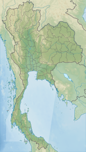
Namtok Sam Lan National Park (Thai: อุทยานแห่งชาติน้ำตกสามหลั่น) is a national park in Saraburi Province, Thailand. Other names for the park include Khao Sam Lan National Park and Phra Puttachai National Park. Home to waterfalls, reservoirs and forests, the park is located near the cave temple Wat Phra Puttachai.
Geography
[edit]Namtok Sam Lan National Park is located about 6 kilometres (4 mi) south of Saraburi town. The park's area is 27,856 rai ~ 45 square kilometres (17 sq mi)[1] encompassing parts of four districts: Kaeng Khoi District, Nong Khae District, Wihan Daeng District and Mueang District. The highest point is the viewpoint on Khao Khrok peak at 329 metres (1,079 ft).[2]
History
[edit]During World War II, the Japanese Army occupied and used this area as an encampment, entailing the destruction of some of the park's forests. In 1960 the Thai government began the restoration of this forest and designated it a conservation area. On 2 June 1981, Namtok Sam Lan was designated a National Park.[2]

Attractions
[edit]The park's best-known attractions are its waterfalls. The park's namesake Sam Lan Waterfall has three levels, each of about 5 metres (16 ft). Other waterfalls include Pho Hin Dat, Roi Kueak Ma and Ton Rak Sai.[3]
Flora and fauna
[edit]Namtok Sam Lan's forest consists of deciduous, mixed dipterocarp and evergreen forest. Tree species include teak (Tectona grandis), Pterocarpus macrocarpus, Afzelia xylocarpa, Hopea odorata, Dipterocarpus tuberculatus, Shorea obtusa, Xylia xylocarpa, Shorea siamensis and Lagerstroemia calyculata.[3]
Animal species include pig-tailed macaque, northern red muntjac, lesser Oriental chevrotain, wild boar, Finlayson's squirrel and northern treeshrew.[3] Birds include brown shrike, greater coucal, green-billed malkoha, Javan pond-heron, long-tailed shrike, Oriental magpie-robin, plain prinia, plaintive cuckoo, puff-throated babbler, red junglefowl, sooty-headed bulbul, streak-eared bulbul, western koel and white-rumped shama.[3] Avian life is believed to have once included the white-eyed river martin, a native of northern Thailand now considered extinct. The park is also noted for its various butterfly species.[2][4]
See also
[edit]References
[edit]- ^ "ข้อมูลพื้นที่อุทยานแห่งชาติ ที่ประกาศในราชกิจจานุบกษา 133 แห่ง" [National Park Area Information published in the 133 Government Gazettes]. Department of National Parks, Wildlife and Plant Conservation (in Thai). December 2020. Retrieved 1 November 2022, no 27
{{cite web}}: CS1 maint: postscript (link) - ^ a b c "Namtok Samlan National Park". Department of National Parks (Thailand). Archived from the original on 23 May 2013. Retrieved 7 June 2013.
- ^ a b c d "National Parks in Thailand: Namtok Sam Lan National Park" (PDF). Department of National Parks (Thailand). 2015. pp. 196–197. Retrieved 26 May 2017.
- ^ Williams, China; Beales, Mark; Bewer, Tim (February 2012). Lonely Planet Thailand (14th ed.). Lonely Planet Publications. pp. 171. ISBN 978-1-74179-714-5.

