Kaechon
Kaech'ŏn
개천시 Kaechon | |
|---|---|
| Korean transcription(s) | |
| • Chosŏn'gŭl | 개천시 |
| • Hancha | 价川市 |
| • McCune-Reischauer | Kaech'ŏn-si |
| • Revised Romanization | Gaecheon-si |
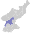
 Map of South Pyongan showing the location of Kaechon | |
 | |
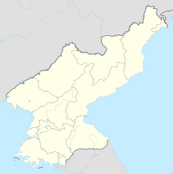
| Coordinates: 39°41′55″N 125°54′22″E / 39.69861°N 125.90611°E | |
| Country | North Korea |
| Province | South P'yŏngan |
| Administrative divisions | 26 tong, 11 ri |
| Area | |
• Total | 738 km2 (285 sq mi) |
| Population (2008) | |
• Total | 319,554 |
| • Density | 430/km2 (1,100/sq mi) |
| • Dialect | P'yŏngan |
| Time zone | UTC+9 (Pyongyang Time) |
Kaech'ŏn or Kaechon (US: /ˈɡeɪtʃʌn/ GAY-chun,[1] Korean: [kɛtsʰʌn]; Hangul: 개천시, Hanja: 价川市) is a city in South P'yŏngan province, North Korea.
Geography
[edit]The Myohyangsan, Changansan, Ch'ŏnsŏngsan, and Ch'ŏngryongsan mountain ranges come together in Kaech'ŏn. The highest peak is Paekt'apsan. The most important rivers are the Ch'ŏngch'ŏn River and the Taedong River. The area of the city is 61% forested.
Administrative divisions
[edit]Kaech'ŏn-si is divided into 26 tong (neighbourhoods) and 11 ri (villages):
|
|
Economy
[edit]Water resources are abundant, and several reservoirs are located in Kaech'ŏn.
Agriculture has been extensively developed, including livestock and fruit orchards. Machining and metalworking are the dominant industries, mining has also become more prominent.
Transportation
[edit]Kaech'ŏn is served by the Korean State Railway's Kaech'ŏn Line and the Manp'o Line trunk lines, as well as the Choyang Colliery Line and Chunhyŏk Line secondary lines.
Tourism
[edit]Tourist sites in Kaech'ŏn include Songam Cavern, Taeripsa Temple with its 9-level stone pagoda, the fortresses of Changhamsŏng, T'osŏng, and Kosasansŏng, Namsa dolmen, and the group of dolments at Mukpangsan. There are also Yŏnpung Lake, which was constructed in 1956, and Yongwŏn Cavern, which was discovered in 1966 and is preserved as North Korea's Natural Monument No. 43.
The Kaechon Revolutionary Site is associated with Kim Il Sung's 250 Mile Journey for National Liberation. A statue was erected there on the occasion of the Day of the Sun, April 15, in 2001.[2]
Prison camps
[edit]There are two large prison camps in Kaech'ŏn, both known for very harsh conditions:
- Political Prison Camp No. 14 is a prison labour colony around 20 km (12 mi) southeast of the city centre at the banks of Taedong River. Shin Dong-hyuk was born in the camp, tortured there, and finally saw his mother and brother executed before he escaped.[3]
- Re-education Camp No. 1 is a prison building complex around 2.5 km (1.6 mi) east of the city centre. Lee Soon-ok was imprisoned for six years in the camp and gave testimony before the United States Senate.[4]
See also
[edit]Notes
[edit]- ^ "Kaech'ŏn". Merriam-Webster.com Dictionary. Merriam-Webster. Retrieved 7 September 2019.
- ^ "Statues of Kim Il Sung Erected in Different Places". KCNA. 8 July 2007. Archived from the original on 12 October 2014.
- ^ Choe Sang-hun (July 9, 2007). "Born and raised in a North Korean gulag". International Herald Tribune.
- ^ "United States Senate Hearings: Testimony of Ms. Soon Ok Lee, June 21, 2002". Archived from the original on November 9, 2010. Retrieved July 2, 2010.
Further reading
[edit]- Dormels, Rainer. North Korea's Cities: Industrial facilities, internal structures and typification. Jimoondang, 2014. ISBN 978-89-6297-167-5
External links
[edit]- City profile of Kaechon Archived 2016-03-09 at the Wayback Machine


