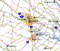
File:Richmond-Petersburg TIGER MAP.gif
Appearance
Richmond-Petersburg_TIGER_MAP.gif (422 × 359 pixels, file size: 18 KB, MIME type: image/gif)
File history
Click on a date/time to view the file as it appeared at that time.
| Date/Time | Thumbnail | Dimensions | User | Comment | |
|---|---|---|---|---|---|
| current | 23:13, 26 April 2007 |  | 422 × 359 (18 KB) | Sitomon | {{Information |Description=richmond área metropolitana |Source=http://wiki.riteme.site/wiki/Image:Richmond-Petersburg_TIGER_MAP.gif |Date=14/02/06 |Author=gobierno USA }} |
File usage
The following 3 pages use this file:
Global file usage
The following other wikis use this file:
- Usage on es.wikipedia.org
- Usage on gl.wikipedia.org
- Usage on it.wikipedia.org
- Usage on www.wikidata.org


