Hương Trà
Appearance
(Redirected from Huong Tra)
You can help expand this article with text translated from the corresponding article in Vietnamese. (October 2023) Click [show] for important translation instructions.
|
Hương Trà | |
|---|---|
| Hương Trà Town Thị xã Hương Trà | |
 Bồ River flowing through Hương Trà town | |
 Interactive map outlining Hương Trà | |
| Country | |
| Region | North Central Coast |
| Province | Thua Thien-Huế |
| Capital | Tứ Hạ |
| Area | |
• Total | 151.48 sq mi (392.32 km2) |
| Population (2020) | |
• Total | 72,677 |
| Time zone | UTC+7 (UTC + 7) |
Hương Trà is a district-level town (thị xã) of Thua Thien-Huế province in the North Central Coast region of Vietnam. As of 2020 the town had a population of 72,677.[1] The town covers an area of 392.32 km². The district capital lies at Tứ Hạ.
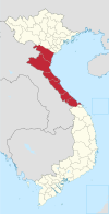
Hương Trà town is bordered by the city of Huế to the east, Phong Điền District to the west, Hương Thủy town and A Lưới District to the south and Quảng Điền District to the north. The area has both mountainous terrain and plains.
The town consists of the 5 phường (ward): Tứ Hạ, Hương Văn, Hương Xuân, Hương Vân, Hương Chữ and 4 xã (commune): Hương Toàn, Bình Thành, Bình Tiến, Hương Bình. Tứ Hạ is located on National Road 1A, the nation's main north-south artery, 16 km north of Huế.

