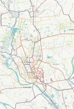
Gendaria Thana
Gendaria Thana
গেন্ডারিয়া থানা | |
|---|---|
 Expandable map of vicinity of Gendaria Thana | |
| Coordinates: 23°41′58″N 90°25′16″E / 23.6995°N 90.4212°E | |
| Country | |
| Division | Dhaka Division |
| District | Dhaka District |
| Area | |
• Total | 1.83 km2 (0.71 sq mi) |
| Elevation | 23 m (75 ft) |
| Population | |
• Total | 140,291 |
| • Density | 75,257/km2 (194,910/sq mi) |
| Time zone | UTC+6 (BST) |
| Postal code | 1204[3] |
| Area code | 02[4] |
Gendaria (Bengali: গেন্ডারিয়া) is a Thana of Dhaka District in the Division of Dhaka, Bangladesh. Its area is 1.83 square kilometres (0.71 sq mi).[5] The name is a portmanteau of original name Grand Area, still found in deeds prior to 1950s.
Demographics
[edit]According to the 2011 Census of Bangladesh, Gendaria Thana had 27,887 households with average household size of 4.48 and a population of 137,721. Males constituted 55.51% (76,446) of the population while females 44.49% (61,275). Gendaria Thana had a literacy rate (age 7 and over) of 75.6%, compared to the national average of 51.8%, and a sex ratio of 125.There were 585 floating people in this jurisdiction. [7]
The religious breakdown was Muslim 89.71% (123,550), Hindu 9.96% (13,719), Christian 0.31% (428), Buddhist 0.01% (20), and others 0.00% (4). The ethnic minority people living there were 110 persons in total.
Educational institutions
[edit]The only college in the upazila is Fazlul Hoq Mohila College, an honors level one.[8]
According to Banglapedia, Bangladesh Bank Ideal High School, Gandaria High School, Moniza Rahman Girls' High School, and Narinda Government High School are notable secondary schools.[9]
The madrasa education system includes one fazil and one kamil madrasa.[10][11]
See also
[edit]References
[edit]- ^ "Geographic coordinates of Dhaka, Bangladesh". DATEANDTIME.INFO. Retrieved 7 July 2016.
- ^ National Report (PDF). Population and Housing Census 2022. Vol. 1. Dhaka: Bangladesh Bureau of Statistics. November 2023. p. 386. ISBN 978-9844752016.
- ^ "Bangladesh Postal Code". Dhaka: Bangladesh Postal Department under the Department of Posts and Telecommunications of the Ministry of Posts, Telecommunications and Information Technology of the People's Republic of Bangladesh. 19 October 2024.
- ^ "Bangladesh Area Code". China: Chahaoba.com. 18 October 2024.
- ^ Md Tuhin Molla (2012). "Dhaka District". In Sirajul Islam and Ahmed A. Jamal (ed.). Banglapedia: National Encyclopedia of Bangladesh (Second ed.). Asiatic Society of Bangladesh.
- ^ "Bangladesh Population and Housing Census 2011 Zila Report – Dhaka" (PDF). bbs.gov.bd. Bangladesh Bureau of Statistics.
- ^ "Community Tables: Dhaka district" (PDF). bbs.gov.bd. 2011.
- ^ "List of Degree Colleges (Honors)". Ministry of Education. Retrieved June 17, 2017.
- ^ Nahar, Shamsun (2012). "Gandaria Thana". In Islam, Sirajul; Jamal, Ahmed A. (eds.). Banglapedia: National Encyclopedia of Bangladesh (Second ed.). Asiatic Society of Bangladesh.
- ^ "List of Fazil Madrasas". Ministry of Education. Retrieved June 17, 2017.
- ^ "List of Kamil Madrasas". Ministry of Education. Retrieved June 17, 2017.


