
Frontier Pathways National Scenic Byway
(Redirected from Frontier Pathways Scenic Byway)
  Frontier Pathways National Scenic Byway | |
|---|---|
| Route information | |
| Maintained by CDOT | |
| Length | 103 mi[1][2] (166 km) |
| Existed | 1998–present |
| Major junctions | |
| East end | |
| West end | |
| Location | |
| Country | United States |
| State | Colorado |
| Counties | Custer and Pueblo counties |
| Highway system | |
| |
The Frontier Pathways is a 103-mile (166 km) National Scenic Byway and Colorado Scenic and Historic Byway located in Custer and Pueblo counties, Colorado, US.
Route
[edit]Gallery
[edit]-

-

-

-
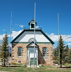 The Westcliffe School in Westcliffe


See also
[edit]Notes
[edit]References
[edit]- ^ "Frontier Pathways". Colorado Department of Transportation. 2021. Retrieved April 7, 2022.
- ^ "Frontier Pathways Scenic and Historic Byway". America's Scenic Byways. Retrieved April 7, 2022.
External links
[edit]
Colorado at Wikipedia's sister projects
 Media from Commons
 News from Wikinews
 Quotations from Wikiquote
 Travel information from Wikivoyage
- America's Byways
- America's Scenic Byways: Colorado
- Colorado Department of Transportation
- Colorado Tourism Office
- History Colorado
38°09′53″N 105°17′00″W / 38.1646°N 105.2833°W
This Colorado road-related article is a stub. You can help Wikipedia by expanding it. |
Categories:
- Colorado Scenic and Historic Byways
- National Scenic Byways
- National Scenic Byways in Colorado
- San Isabel National Forest
- Transportation in Colorado
- Transportation in Custer County, Colorado
- Transportation in Pueblo County, Colorado
- Tourist attractions in Colorado
- Tourist attractions in Custer County, Colorado
- Tourist attractions in Pueblo County, Colorado
- Interstate 25
- Western United States road stubs
- Colorado transportation stubs