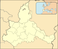
File:Zaragoza-loc.svg
Appearance

Size of this PNG preview of this SVG file: 512 × 434 pixels. Other resolutions: 283 × 240 pixels | 566 × 480 pixels | 906 × 768 pixels | 1,208 × 1,024 pixels | 2,416 × 2,048 pixels.
Original file (SVG file, nominally 512 × 434 pixels, file size: 1.11 MB)
File history
Click on a date/time to view the file as it appeared at that time.
| Date/Time | Thumbnail | Dimensions | User | Comment | |
|---|---|---|---|---|---|
| current | 16:55, 8 December 2010 |  | 512 × 434 (1.11 MB) | Miguillen | id |
| 16:53, 8 December 2010 |  | 512 × 434 (1.11 MB) | Miguillen | borde | |
| 16:48, 8 December 2010 |  | 512 × 434 (1.11 MB) | Miguillen | colores | |
| 14:02, 16 August 2010 |  | 512 × 434 (781 KB) | Miguillen | == {{int:filedesc}} == {{Information |Description={{en|Location map of Province of Zaragoza}} Equirectangular projection, N/S stretching 130 %. Geographic limits of the map: * N: ° N * S: ° N * W: ° O * E: ° O {{es|Ma |
File usage
Global file usage
The following other wikis use this file:
- Usage on an.wikipedia.org
- Usage on ba.wikipedia.org
- Usage on de.wikipedia.org
- Usage on eo.wikipedia.org
- Zaragozo
- Sos del Rey Católico
- Calatayud
- Daroko
- Fuendetodos
- Trasmoz
- Lacasta (Zaragozo)
- Codo
- Mequinenza
- Zaragoza-Delicias (stacidomo)
- Belchite
- Ŝablono:Situo sur mapo Hispanio Provinco Zaragozo
- Almochuel
- La Puebla de Albortón
- Valmadrid
- Azuara
- Almonacid de la Cuba
- Letux
- Lécera
- Lagata
- Samper del Salz
- Moneva
- Moyuela
- Plenas
- Vistabella
- Aladrén
- Paniza
- Tosos
- Aguilón
- Villanueva de Huerva
- Mezalocha
- Muel
- Alfamén
- Longares
- Cariñena
- Cosuenda
- Aguarón
- Encinacorba
- Villar de los Navarros
- Herrera de los Navarros
- Luesma
- Fombuena
- Badules
- Romanos
- Lechón
- Anento
- Nombrevilla
View more global usage of this file.
